MyTopo
Ollie Iowa US Topo Map
Couldn't load pickup availability
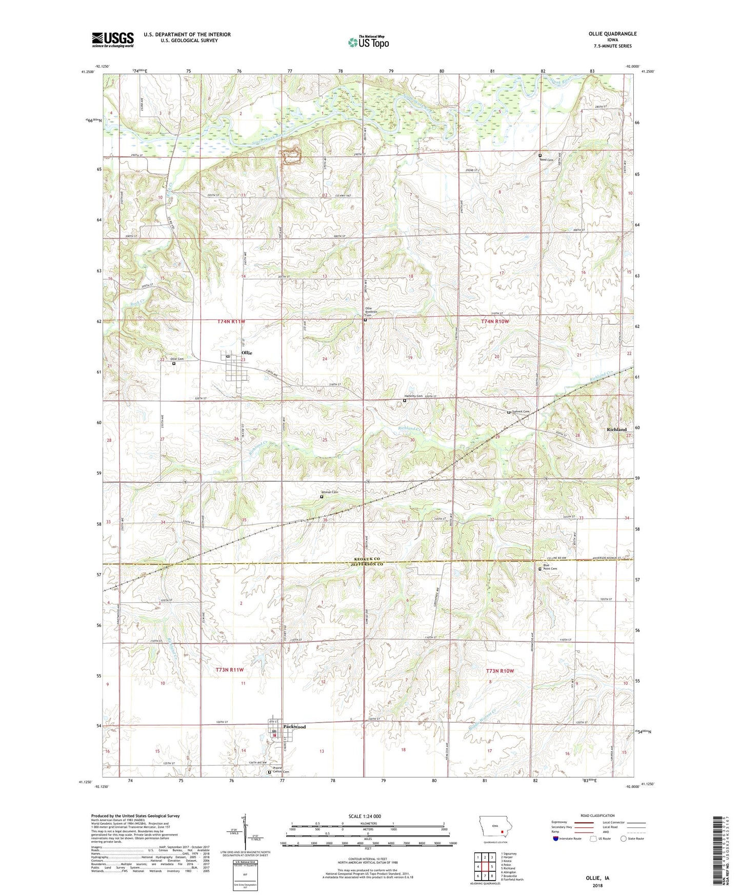
2022 topographic map quadrangle Ollie in the state of Iowa. Scale: 1:24000. Based on the newly updated USGS 7.5' US Topo map series, this map is in the following counties: Keokuk, Jefferson. The map contains contour data, water features, and other items you are used to seeing on USGS maps, but also has updated roads and other features. This is the next generation of topographic maps. Printed on high-quality waterproof paper with UV fade-resistant inks.
Quads adjacent to this one:
West: Pekin
Northwest: Sigourney
North: Harper
Northeast: Keota
East: Richland
Southeast: Fairfield North
South: Brookville
Southwest: Abingdon
This map covers the same area as the classic USGS quad with code o41092b1.
Contains the following named places: Altman Cemetery, Belleville Post Office, Bellville, Blue Point Cemetery, City of Ollie, City of Packwood, First Christian Church, Friendship Park, Grace Family Church, Halferty Cemetery, Manhatten Bridge County Park, Manhatten Post Office, North Skunk River, Ollie, Ollie Baptist Church, Ollie Brethren Cemetery, Ollie Cemetery, Ollie Post Office, Ollie Quick Response Emergency Services, Packwood, Packwood Post Office, Polk Packwood Volunteer Fire Department, Pool Wildlife Area, Prairie Center Cemetery, Prairie View United Methodist Church, Rambler Park, Reed Cemetery, Rock Creek, South Keokuk Church of Brethren, South Skunk River, Summit Cemetery, Township of Jackson, Township of Richland, Wimer's Mills Post Office, ZIP Code: 52576