MyTopo
Mitchellville Iowa US Topo Map
Couldn't load pickup availability
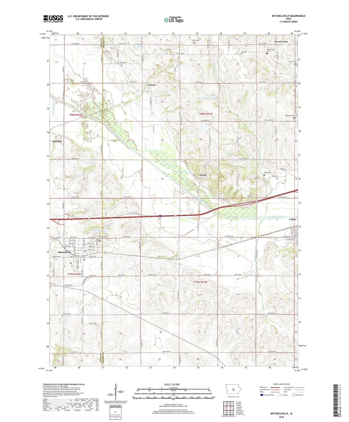
2023 topographic map quadrangle Mitchellville in the state of Iowa. Scale: 1:24000. Based on the newly updated USGS 7.5' US Topo map series, this map is in the following counties: Jasper, Polk. The map contains contour data, water features, and other items you are used to seeing on USGS maps, but also has updated roads and other features. This is the next generation of topographic maps. Printed on high-quality waterproof paper with UV fade-resistant inks.
Quads adjacent to this one:
West: Altoona
Northwest: Loring
North: Mingo
Northeast: Baxter
East: Colfax
Southeast: Prairie City
South: Runnells
Southwest: Rising Sun
This map covers the same area as the classic USGS quad with code o41093f3.
Contains the following named places: Apple Grove Post Office, City of Mitchellville, City of Valeria, Clarks Lake, Colfax Golf Club, First Congregational Church, Fisher Cemetery, Green Castle, Greencastle Cemetery, Greencastle Post Office, Heartland Co-op Elevator, Hoffman Wildlife Area, Iowa Correctional Institution for Women, McKeever Cemetery, Mitchell Station, Mitchell Village Care Center, Mitchellville, Mitchellville Assembly of God Church, Mitchellville Cemetery, Mitchellville Christian Church, Mitchellville Elementary School, Mitchellville Fire Department, Mitchellville Post Office, Mitchellville Public Library, Mitchellville United Methodist Church, Nobleton Post Office, Oswalt, Oswalt Bridge Area, Oswalt Post Office, Sams Cemetery, Santiago, Santiago Creek, Santiago Post Office, Shipp Cemetery, Squaw Creek, Sugar Creek, Township of Poweshiek, Township of Washington, Valeria, Valeria Post Office, WHO-AM (Des Moines), Williamsville, Williamsville Post Office, Woodcock Wildlife Area, Woodville, ZIP Code: 50169