MyTopo
Runnells Iowa US Topo Map
Couldn't load pickup availability
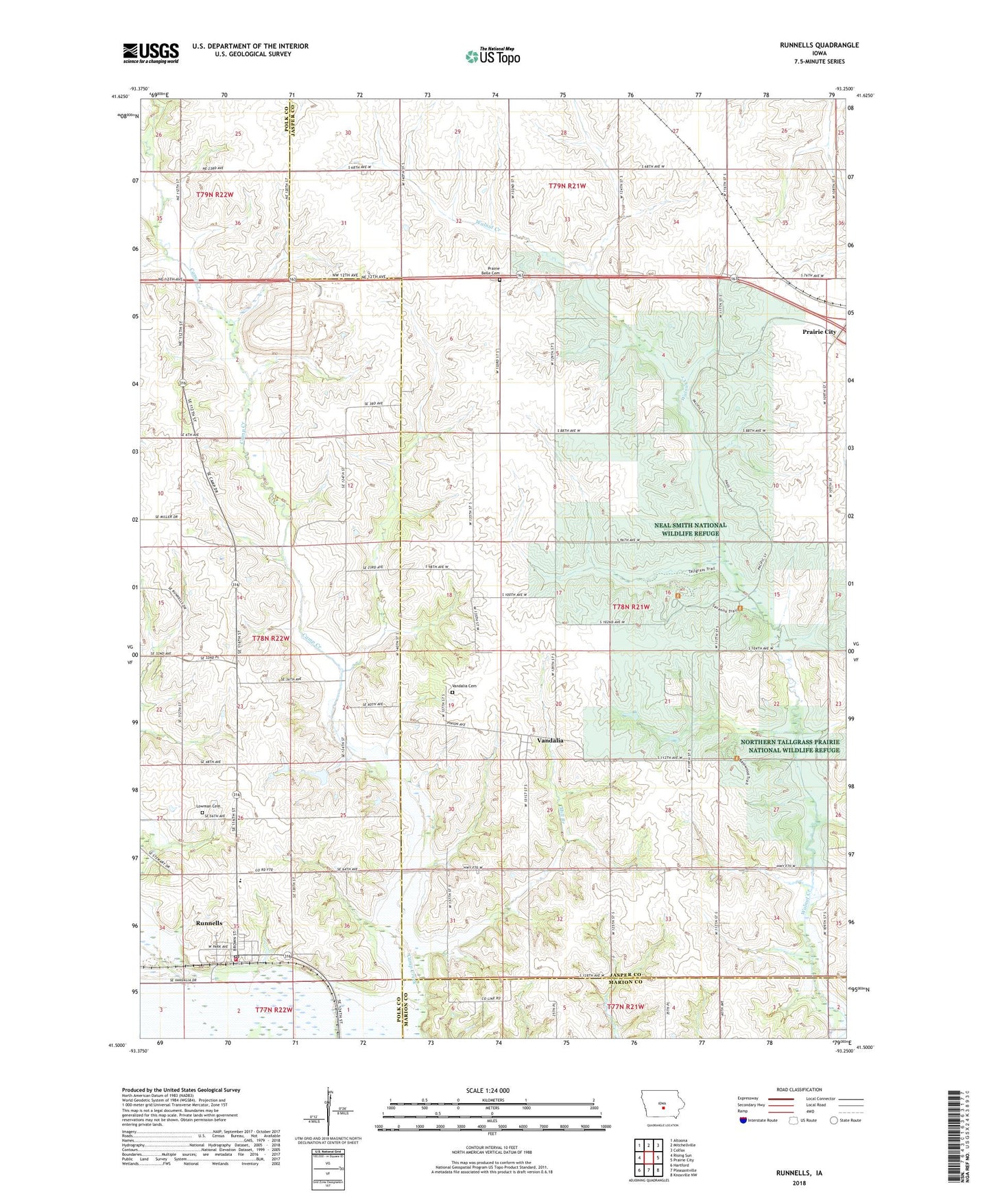
2022 topographic map quadrangle Runnells in the state of Iowa. Scale: 1:24000. Based on the newly updated USGS 7.5' US Topo map series, this map is in the following counties: Jasper, Polk, Marion. The map contains contour data, water features, and other items you are used to seeing on USGS maps, but also has updated roads and other features. This is the next generation of topographic maps. Printed on high-quality waterproof paper with UV fade-resistant inks.
Quads adjacent to this one:
West: Rising Sun
Northwest: Altoona
North: Mitchellville
Northeast: Colfax
East: Prairie City
Southeast: Knoxville NW
South: Pleasantville
Southwest: Hartford
This map covers the same area as the classic USGS quad with code o41093e3.
Contains the following named places: City of Runnells, Howard Lake, KDMG-FM (Pella), Lowman Cemetery, Marybell Post Office, Mill Branch, Morgan Valley Church, Neal Smith National Wildlife Refuge, Prairie Belle Cemetery, Prairiebell, Prairiebell Post Office, Runnells, Runnells - Camp Township Fire Department, Runnells Christian Church, Runnells City Hall, Runnells Elementary School, Runnells Post Office, The Church of Jesus Christ of Latter Day Saints, Township of Des Moines, Vandalia, Vandalia Cemetery, Vandalia Church of Christ, Vandalia Post Office, Vandalia Wildlife Area, Walnut Creek National Wildlife Refuge, ZIP Code: 50237