MyTopo
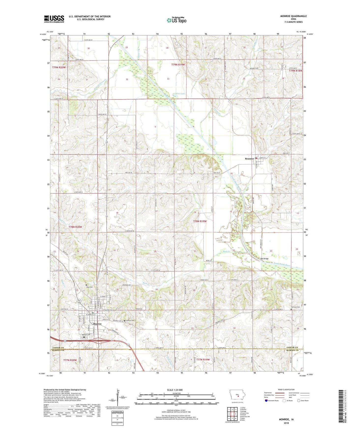
Monroe Iowa US Topo Map
Couldn't load pickup availability
2022 topographic map quadrangle Monroe in the state of Iowa. Scale: 1:24000. Based on the newly updated USGS 7.5' US Topo map series, this map is in the following counties: Jasper, Marion. The map contains contour data, water features, and other items you are used to seeing on USGS maps, but also has updated roads and other features. This is the next generation of topographic maps. Printed on high-quality waterproof paper with UV fade-resistant inks.
Quads adjacent to this one:
West: Prairie City
Northwest: Colfax
North: Newton
Northeast: Kellogg
East: Killduff
Southeast: Pella
South: Otley
Southwest: Knoxville NW
This map covers the same area as the classic USGS quad with code o41093e1.
Contains the following named places: Buck Creek, Cardinal Creek, Carson Creek, Cherry Creek, City of Monroe, City of Reasnor, Draper Post Office, Fairview Cemetery, Fairview Wildlife Area, First Baptist Church, Franklin, Gateway Recreation Golf Course, Gifford Cemetery, Kish-Ke-Kosh Prairie State Preserve, Monroe, Monroe Cemetery, Monroe City Hall, Monroe Elementary School, Monroe Family Health Center, Monroe Fire Department, Monroe Library and Community Building, Monroe Post Office, Monroe Presbyterian Church, PCM High School, Reasnor, Reasnor City Hall, Reasnor Creek, Reasnor Fire and Rescue, Reasnor Post Office, Red Bridge, Riverview Honor Farm, Seay Cemetery, Tools Chapel, Township of Fairview, United Methodist Church, Warren Grove Creek, Warren Grove Post Office, Warren Grove School, Wire Lake, ZIP Code: 50170