MyTopo
Dickens Iowa US Topo Map
Couldn't load pickup availability
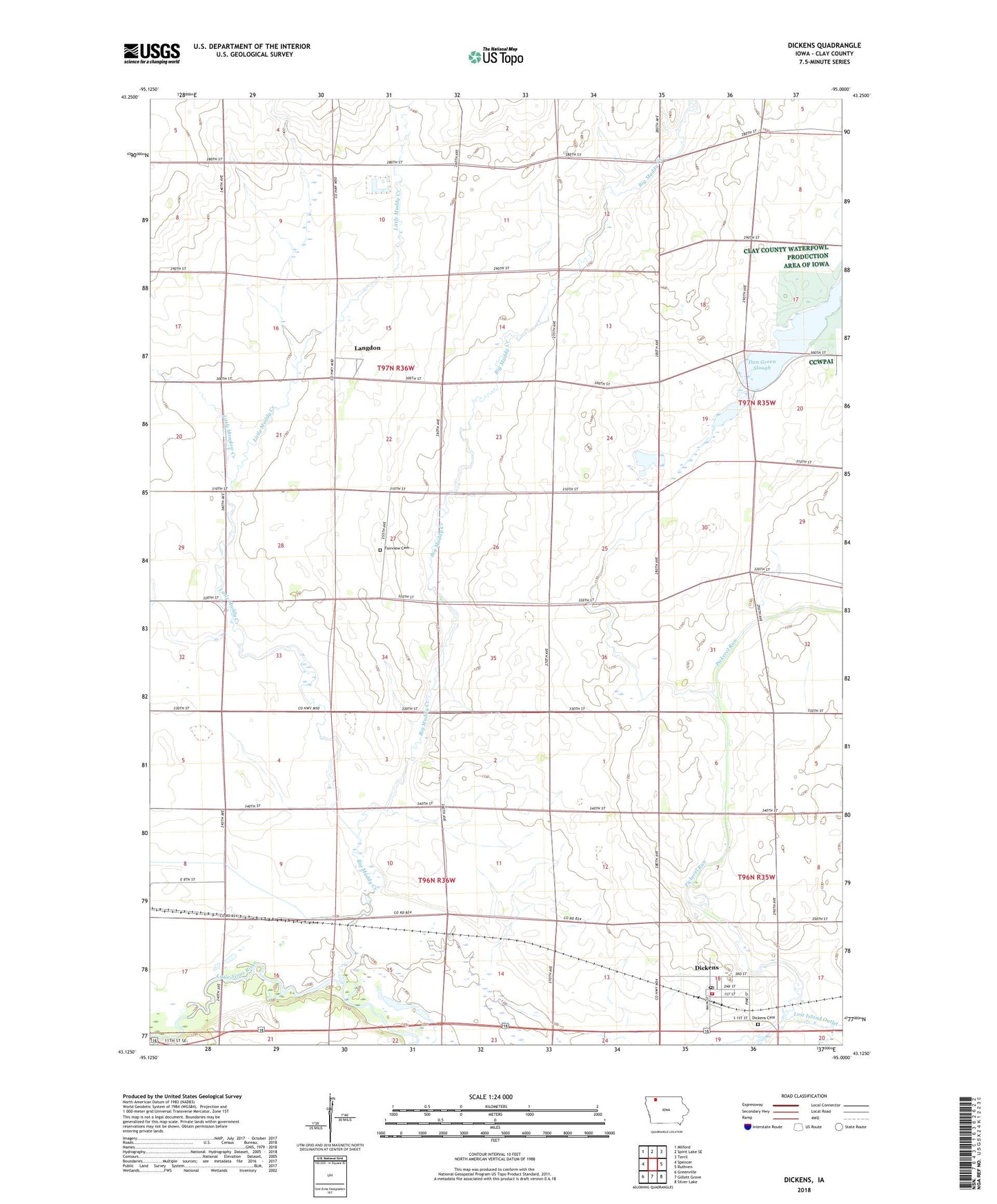
2022 topographic map quadrangle Dickens in the state of Iowa. Scale: 1:24000. Based on the newly updated USGS 7.5' US Topo map series, this map is in the following counties: Clay. The map contains contour data, water features, and other items you are used to seeing on USGS maps, but also has updated roads and other features. This is the next generation of topographic maps. Printed on high-quality waterproof paper with UV fade-resistant inks.
Quads adjacent to this one:
West: Spencer
Northwest: Milford
North: Spirit Lake SE
Northeast: Terril
East: Ruthven
Southeast: Silver Lake
South: Gillett Grove
Southwest: Greenville
This map covers the same area as the classic USGS quad with code o43095b1.
Contains the following named places: A K Stock Farms, Big Muddy Creek, City of Dickens, Country Villa Mobile Home Park, Dan Green Slough, De Wolf Park, Dickens, Dickens Cemetery, Dickens Fire Department, Dickens Post Office, Dickens Public Library, Double D Farms, Fairview Cemetery, Freeman Post Office, Hamrick Farms, Hansen Farms, Hawk Valley Wildlife Management Area, Iowlea Farms, Kingdom Hall, KJJG-FM (Spencer), KRGS-FM (Spencer), Langdon, Langdon Post Office, Little Meadow Creek, Little Muddy Creek, McCune Farm, Oneota Little Sioux Access, Oneota Park, Pickerel Run, Plum Broke Ranch, Prospect, Prospect Post Office, Schmerse Wildlife Area, Stouffer Memorial Wildlife Preserve, Swart Farms, Township of Meadow, West Bend Elevator Company Elevator