MyTopo
Greenville Iowa US Topo Map
Couldn't load pickup availability
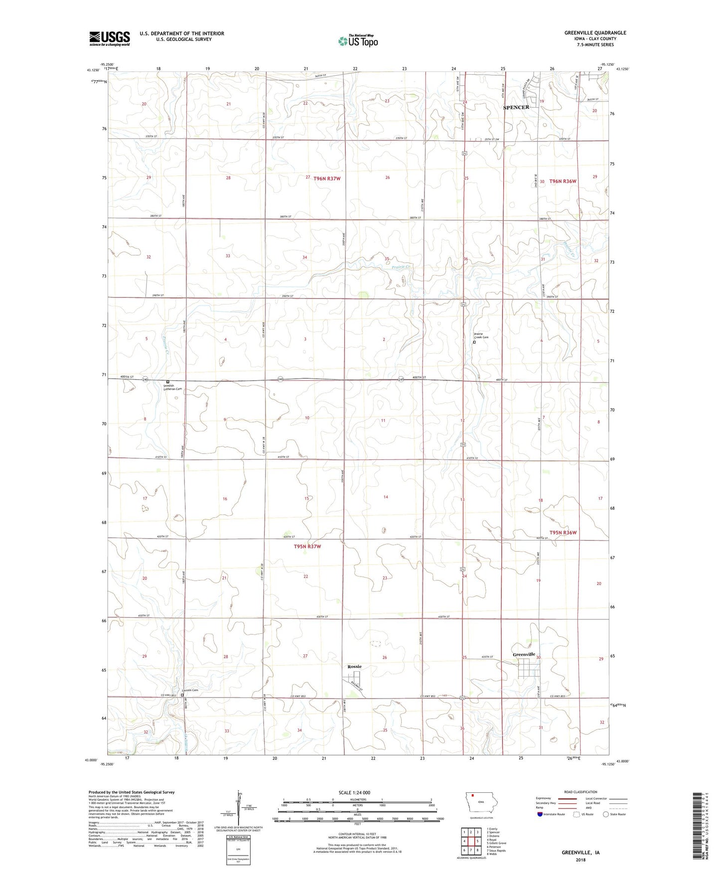
2022 topographic map quadrangle Greenville in the state of Iowa. Scale: 1:24000. Based on the newly updated USGS 7.5' US Topo map series, this map is in the following counties: Clay. The map contains contour data, water features, and other items you are used to seeing on USGS maps, but also has updated roads and other features. This is the next generation of topographic maps. Printed on high-quality waterproof paper with UV fade-resistant inks.
Quads adjacent to this one:
West: Royal
Northwest: Everly
North: Spencer
Northeast: Dickens
East: Gillett Grove
Southeast: Webb
South: Sioux Rapids
Southwest: Peterson
This map covers the same area as the classic USGS quad with code o43095a2.
Contains the following named places: Annieville, Annieville Post Office, Church of Christ, City of Greenville, City of Rossie, Clay County, Fairchild Farms, Greenville, Greenville Post Office, Larsen Farm, Lincoln Cemetery, Prairie Creek Cemetery, Rossie, Rossie Feed and Grain Company Elevator, Rossie Post Office, Rossie United Church of Christ, Shady Lane Farms, Spencer Municipal Golf Course, Swanson Farms, Swedish Lutheran Cemetery, Thiesen Farms, Township of Lincoln, Township of Riverton, Tunink Farms, Waterway Park