MyTopo
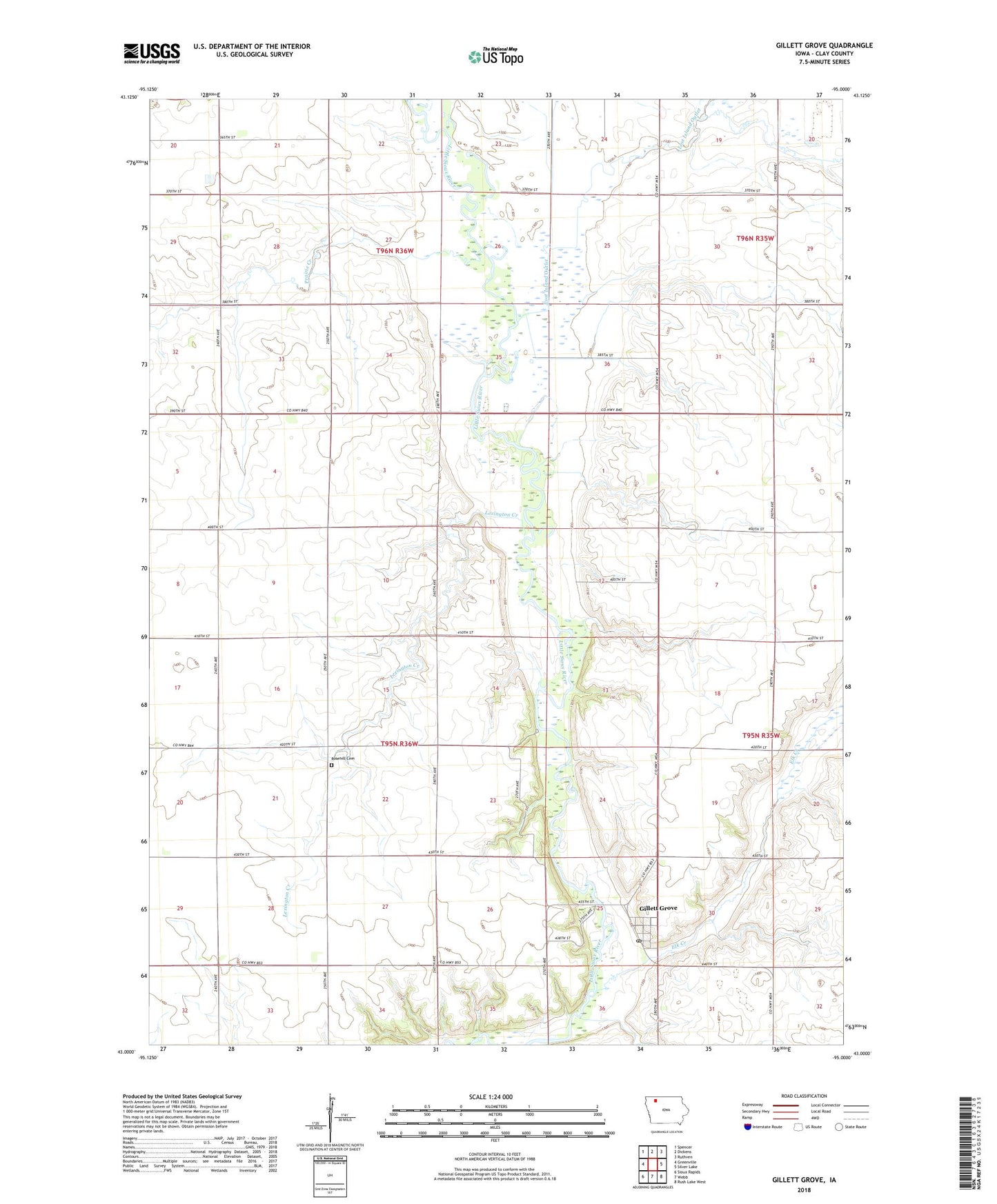
Gillett Grove Iowa US Topo Map
Couldn't load pickup availability
2022 topographic map quadrangle Gillett Grove in the state of Iowa. Scale: 1:24000. Based on the newly updated USGS 7.5' US Topo map series, this map is in the following counties: Clay. The map contains contour data, water features, and other items you are used to seeing on USGS maps, but also has updated roads and other features. This is the next generation of topographic maps. Printed on high-quality waterproof paper with UV fade-resistant inks.
Quads adjacent to this one:
West: Greenville
Northwest: Spencer
North: Dickens
Northeast: Ruthven
East: Silver Lake
Southeast: Rush Lake West
South: Webb
Southwest: Sioux Rapids
This map covers the same area as the classic USGS quad with code o43095a1.
Contains the following named places: Anderson Farms, City of Gillett Grove, Dickens Pit, Elk Creek, Fen Valley Area, Gillett Grove, Gillett Grove City Hall, Gillett Grove Post Office, Gillett Grove United Methodist Church, Gustoff Farms, High Grove Farm, Lexington Creek, Little Sioux Wildlife Management Area, Lost Island Outlet, Prairie Creek, Rosehill Cemetery, Salton Farms, Shady Blue Farms, South Clay Elementary School, Township of Gillett Grove, Township of Sioux, ZIP Codes: 51341, 51343