MyTopo
Sheldon Creek Iowa US Topo Map
Couldn't load pickup availability
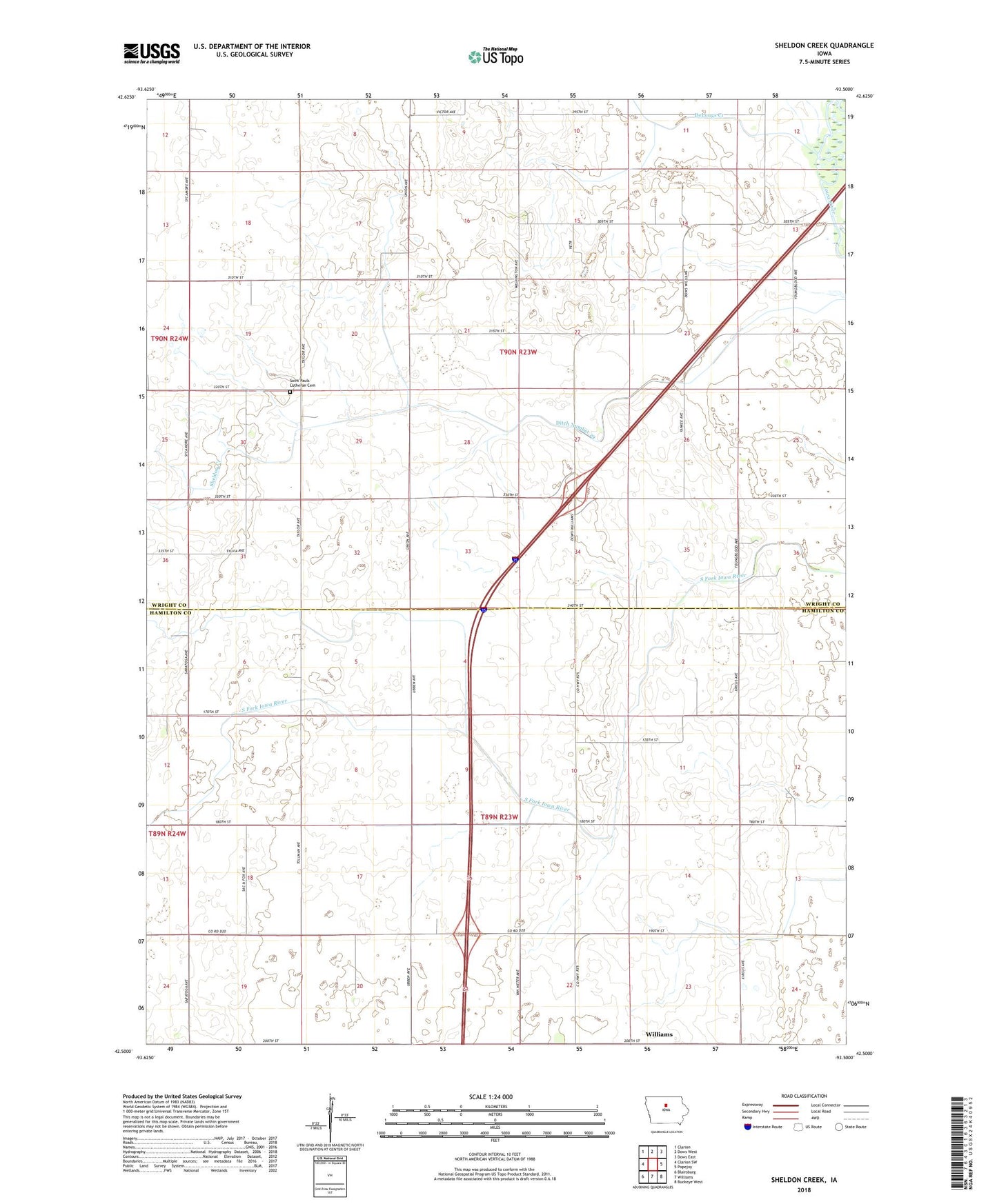
2022 topographic map quadrangle Sheldon Creek in the state of Iowa. Scale: 1:24000. Based on the newly updated USGS 7.5' US Topo map series, this map is in the following counties: Wright, Hamilton. The map contains contour data, water features, and other items you are used to seeing on USGS maps, but also has updated roads and other features. This is the next generation of topographic maps. Printed on high-quality waterproof paper with UV fade-resistant inks.
Quads adjacent to this one:
West: Clarion SW
Northwest: Clarion
North: Dows West
Northeast: Dows East
East: Popejoy
Southeast: Buckeye West
South: Williams
Southwest: Blairsburg
This map covers the same area as the classic USGS quad with code o42093e5.
Contains the following named places: DeLongs Creek, Ditch Number 29, Dry Lake Post Office, Saint Pauls Lutheran Church Cemetery, Township of Vernon, Township of Williams, Vernon Church