MyTopo
Popejoy Iowa US Topo Map
Couldn't load pickup availability
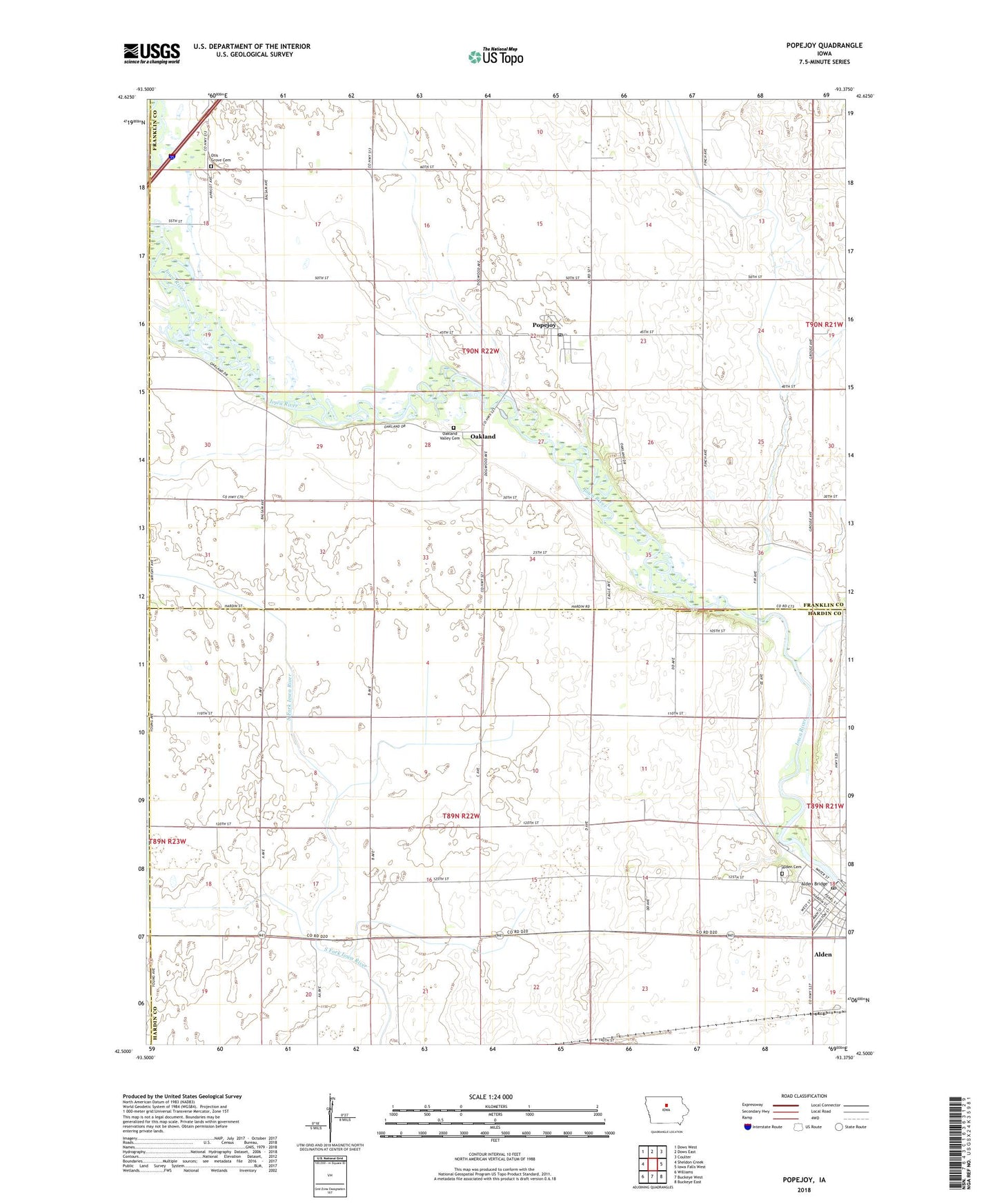
2022 topographic map quadrangle Popejoy in the state of Iowa. Scale: 1:24000. Based on the newly updated USGS 7.5' US Topo map series, this map is in the following counties: Franklin, Hardin, Hamilton, Wright. The map contains contour data, water features, and other items you are used to seeing on USGS maps, but also has updated roads and other features. This is the next generation of topographic maps. Printed on high-quality waterproof paper with UV fade-resistant inks.
Quads adjacent to this one:
West: Sheldon Creek
Northwest: Dows West
North: Dows East
Northeast: Coulter
East: Iowa Falls West
Southeast: Buckeye East
South: Buckeye West
Southwest: Williams
This map covers the same area as the classic USGS quad with code o42093e4.
Contains the following named places: Alden, Alden Bridge, Alden Cemetery, Alden Post Office, Alden Station, Bessman-Kemp County Park, Bigelow County Park, City of Alden, City of Popejoy, Immanuel Memorial Church, Oak Hill Cemetery, Oakland, Oakland Post Office, Oakland Valley Game Management Area, Oakland Valley Post Office, Oakland-Iowa River County Park, Ollin Post Office, Otis Grove Cemetery, Popejoy, Popejoy County Park, Popejoy Post Office, Sheldon Creek, Township of Alden, Township of Oakland, United Methodist Church, Whitetail Flats Wildlife Management Area, ZIP Codes: 50006, 50227