MyTopo
Early Iowa US Topo Map
Couldn't load pickup availability
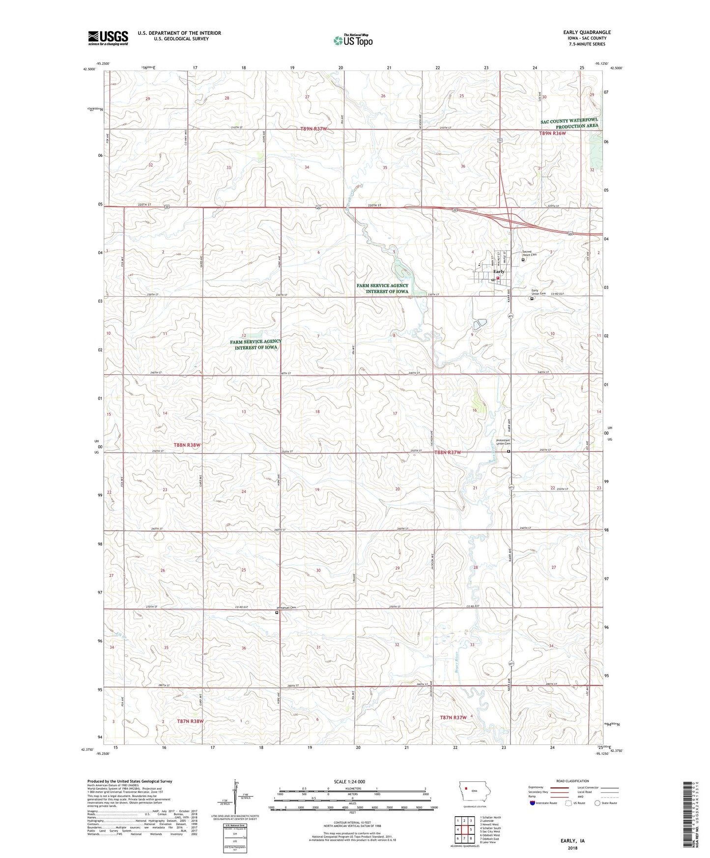
2022 topographic map quadrangle Early in the state of Iowa. Scale: 1:24000. Based on the newly updated USGS 7.5' US Topo map series, this map is in the following counties: Sac. The map contains contour data, water features, and other items you are used to seeing on USGS maps, but also has updated roads and other features. This is the next generation of topographic maps. Printed on high-quality waterproof paper with UV fade-resistant inks.
Quads adjacent to this one:
West: Schaller South
Northwest: Schaller North
North: Lakeside
Northeast: Newell West
East: Sac City West
Southeast: Lake View
South: Odebolt East
Southwest: Odebolt West
This map covers the same area as the classic USGS quad with code o42095d2.
Contains the following named places: Cedar Forks Post Office, City of Early, Early, Early Fire and Rescue, Early Post Office, Early Public Library, Early Union Cemetery, Faith Lutheran Church, Farmers Co-op Elevator, Immanuel Cemetery, Immanuel Church, Prairie Pedlar, Presbyterian Church, Protestant Union Cemetery, Reiff Park, Ridge View Middle School, Sacred Heart Catholic Church, Sacred Heart Cemetery, Sacred Heart Church, Sacred Heart School, Township of Boyer Valley, United Methodist Church, ZIP Code: 50535