MyTopo
Schaller North Iowa US Topo Map
Couldn't load pickup availability
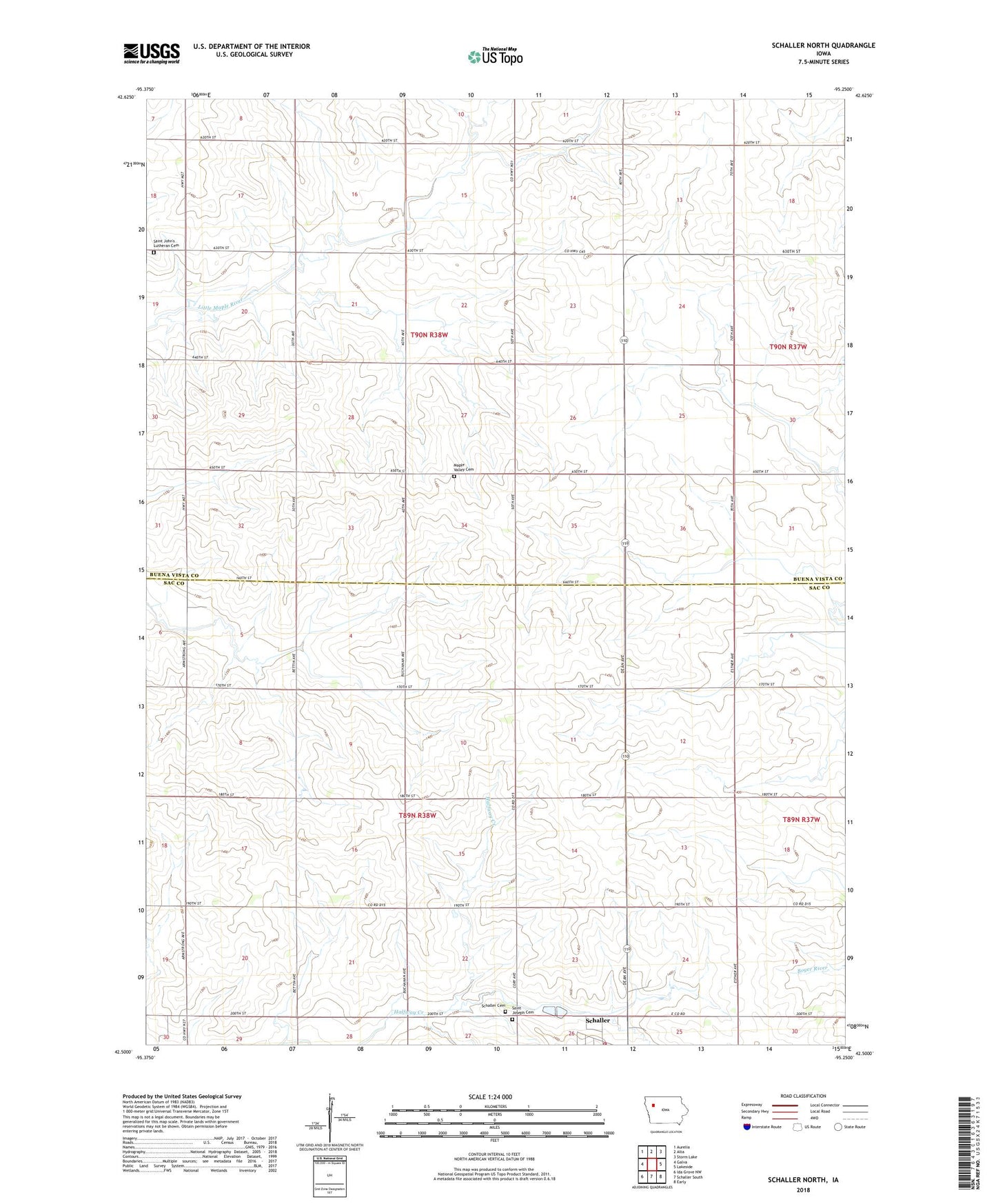
2022 topographic map quadrangle Schaller North in the state of Iowa. Scale: 1:24000. Based on the newly updated USGS 7.5' US Topo map series, this map is in the following counties: Buena Vista, Sac. The map contains contour data, water features, and other items you are used to seeing on USGS maps, but also has updated roads and other features. This is the next generation of topographic maps. Printed on high-quality waterproof paper with UV fade-resistant inks.
Quads adjacent to this one:
West: Galva
Northwest: Aurelia
North: Alta
Northeast: Storm Lake
East: Lakeside
Southeast: Early
South: Schaller South
Southwest: Ida Grove NW
This map covers the same area as the classic USGS quad with code o42095e3.
Contains the following named places: Blain, Blaine Post Office, First Co-op Association Elevator, Hanover, Hanover Post Office, Maple Valley Cemetery, Mount Hope Post Office, Sac County Ambulance Service, Saint John Lutheran Cemetery, Saint John School, Saint John's Lutheran Church, Saint Josephs Catholic Church Cemetery, Schaller, Schaller Cemetery, Schaller Fire Department, Schaller Library, Stille Turkey Farm, Township of Eureka, Township of Maple Valley