MyTopo
Elgin Iowa US Topo Map
Couldn't load pickup availability
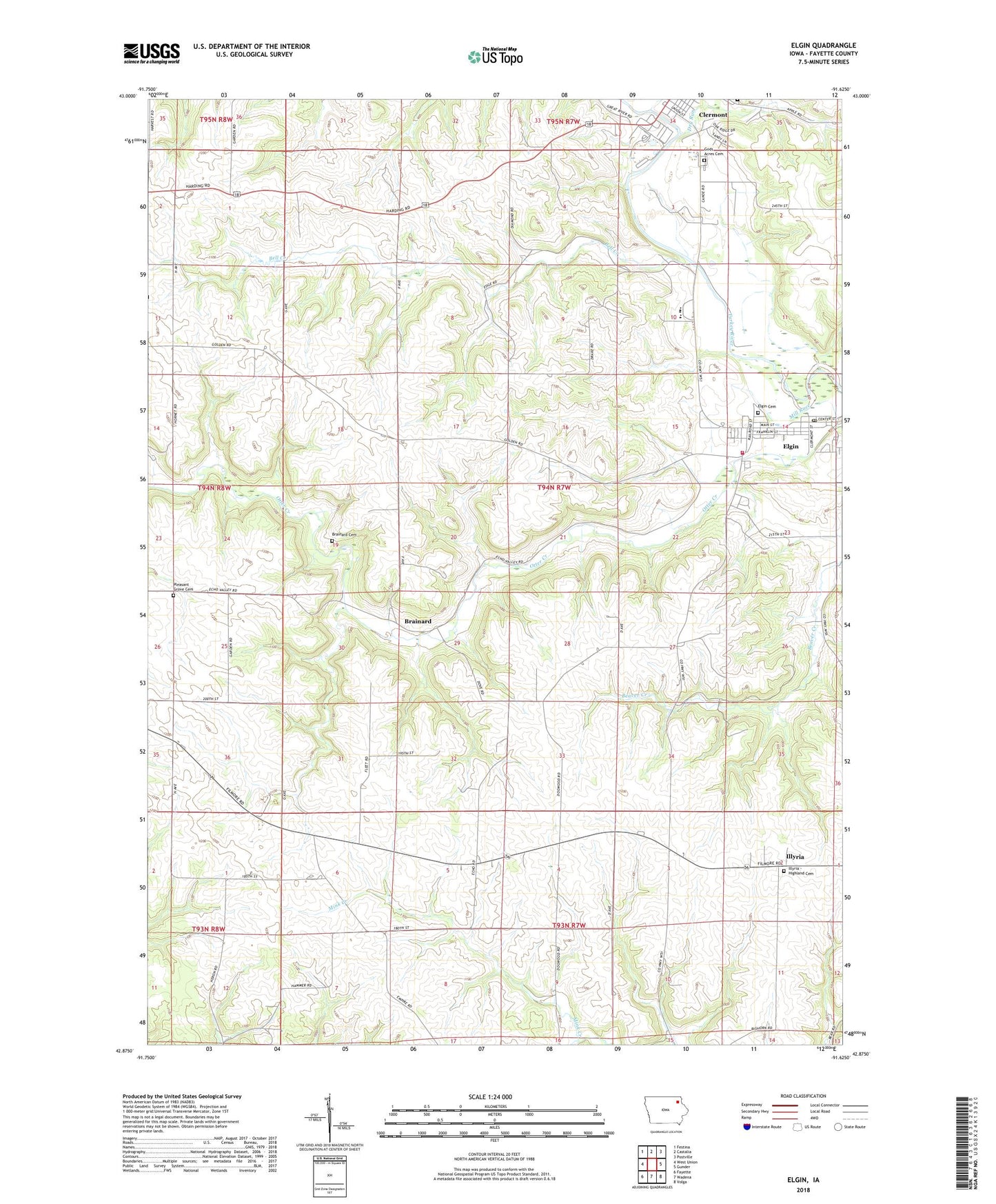
2022 topographic map quadrangle Elgin in the state of Iowa. Scale: 1:24000. Based on the newly updated USGS 7.5' US Topo map series, this map is in the following counties: Fayette. The map contains contour data, water features, and other items you are used to seeing on USGS maps, but also has updated roads and other features. This is the next generation of topographic maps. Printed on high-quality waterproof paper with UV fade-resistant inks.
Quads adjacent to this one:
West: West Union
Northwest: Festina
North: Castalia
Northeast: Postville
East: Gunder
Southeast: Volga
South: Wadena
Southwest: Fayette
This map covers the same area as the classic USGS quad with code o42091h6.
Contains the following named places: Apostolic Christian Church, Area Ambulance Service Elgin, Bell Creek, Brainard, Brainard Cemetery, Brainard Post Office, City of Clermont, City of Elgin, Clermont, Dibble Creek, Dry Run, Elgin, Elgin Cemetery, Elgin City Hall, Elgin Fire Department, Elgin Lutheran Church, Elgin Post Office, Elgin Public Library, First Baptist Church, Gods Acres Cemetery, Gospel Message Church, Illyria, Illyria Cemetery, Illyria Community Church, Illyria Post Office, Leo Post Office, Mill Race, Miller-Gunderson Clinic, North Fayette Middle School, Pleasant Grove Cemetery, Saint Pauls United Methodist Church, Saint Peters Church, Sandy Creek, Skip-A-Way RV Park and Campground, Township of Pleasant Valley, Valley Canoe Access, Valley Elementary School, Valley High School, ZIP Code: 52141