MyTopo
Castalia Iowa US Topo Map
Couldn't load pickup availability
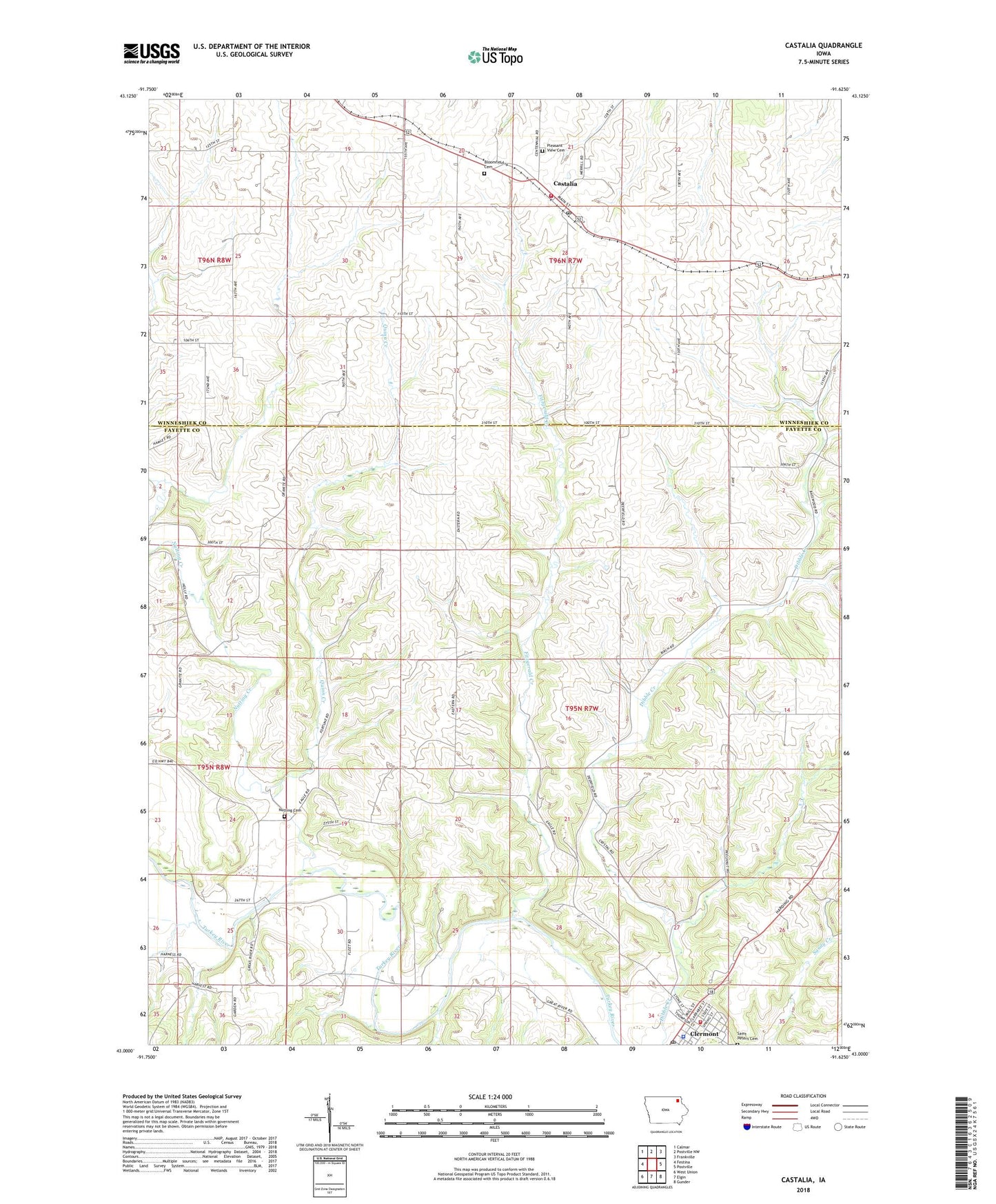
2022 topographic map quadrangle Castalia in the state of Iowa. Scale: 1:24000. Based on the newly updated USGS 7.5' US Topo map series, this map is in the following counties: Fayette, Winneshiek. The map contains contour data, water features, and other items you are used to seeing on USGS maps, but also has updated roads and other features. This is the next generation of topographic maps. Printed on high-quality waterproof paper with UV fade-resistant inks.
Quads adjacent to this one:
West: Festina
Northwest: Calmar
North: Postville NW
Northeast: Frankville
East: Postville
Southeast: Gunder
South: Elgin
Southwest: West Union
This map covers the same area as the classic USGS quad with code o43091a6.
Contains the following named places: Area Ambulance Service Clermont Unit, Bloomfield Cemetery, Castalia, Castalia City Park, Castalia Fire Department, Castalia Post Office, Church of the Saviour Episcopal, City of Castalia, Clermont, Clermont City Hall, Clermont Fire Department, Clermont Library, Clermont Museum, Clermont Park, Clermont Police Department, Clermont Post Office, Clermont Presbyterian Church, Dover Mills, Dover Mills Post Office, Fitzgerald Creek, Junction, Lutheran Church West, Molineland Museum, Montauk State Historical Site, Nutting Cemetery, Nutting Creek, Pleasant Valley Sports Club, Pleasant View Cemetery, Quinn Creek, Saint Peters Cemetery, Township of Clermont, William Larrabee House, Zion Lutheran Church, ZIP Codes: 52133, 52135