MyTopo
Postville Iowa US Topo Map
Couldn't load pickup availability
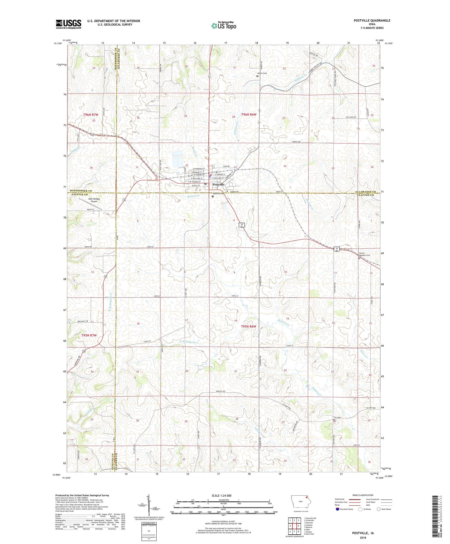
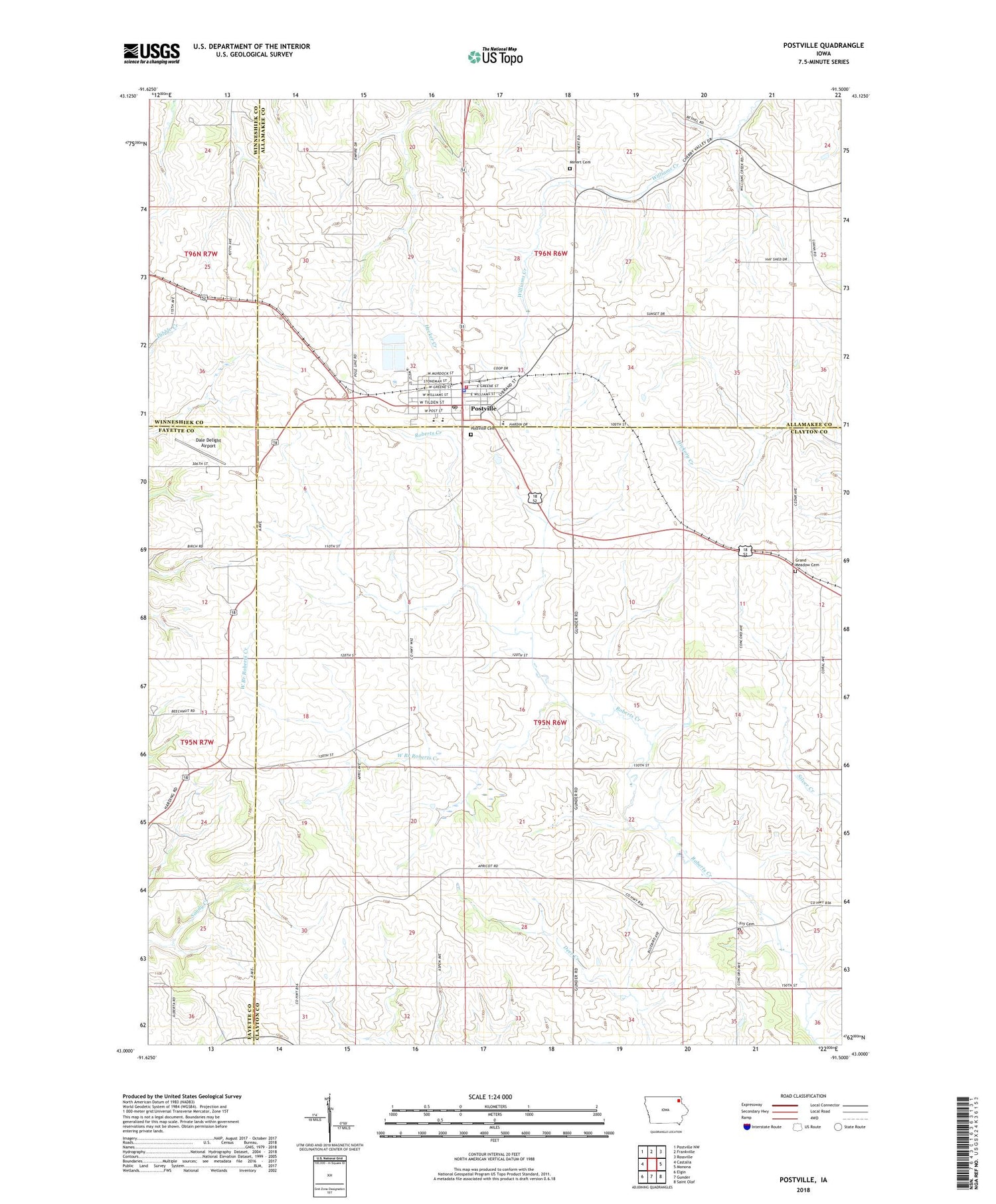
2022 topographic map quadrangle Postville in the state of Iowa. Scale: 1:24000. Based on the newly updated USGS 7.5' US Topo map series, this map is in the following counties: Clayton, Allamakee, Fayette, Winneshiek. The map contains contour data, water features, and other items you are used to seeing on USGS maps, but also has updated roads and other features. This is the next generation of topographic maps. Printed on high-quality waterproof paper with UV fade-resistant inks.
Quads adjacent to this one:
West: Castalia
Northwest: Postville NW
North: Frankville
Northeast: Rossville
East: Monona
Southeast: Saint Olaf
South: Gunder
Southwest: Elgin
This map covers the same area as the classic USGS quad with code o43091a5.
Contains the following named places: Bais Chaya Mushka - Oholei Menachem Torah, Big Four Fair Grounds, City of Postville, Clinton Meyer Park, Cora Darling Elementary School, Dale Delight Airport, Forest Mills United Methodist Church, Fry Cemetery, Grand Meadow Cemetery, Grand Meadow Post Office, Grand Meadow Townhall, Henderson Prairie Post Office, John Mott Middle School / High School, Lull's Park, Miller-Gunderson Clinic, Post Township Cemetery, Postville, Postville Area Ambulance, Postville Cemetery, Postville Chiropractic Clinic, Postville City Ball Diamond, Postville Fire Department, Postville Good Samaritan Center, Postville Medical Clinic, Postville Memorial Hall, Postville Police Department, Postville Post Office, Postville Public Library, Presbyterian Church, Ridley, Roberts Park, Saint Bridgets Catholic Church, Saint Pauls Lutheran Church, Springfield, Township of Grand Meadow, Township of Post, West Branch Roberts Creek, Winneshiek Post Office, ZIP Code: 52162