MyTopo
Littleport Iowa US Topo Map
Couldn't load pickup availability
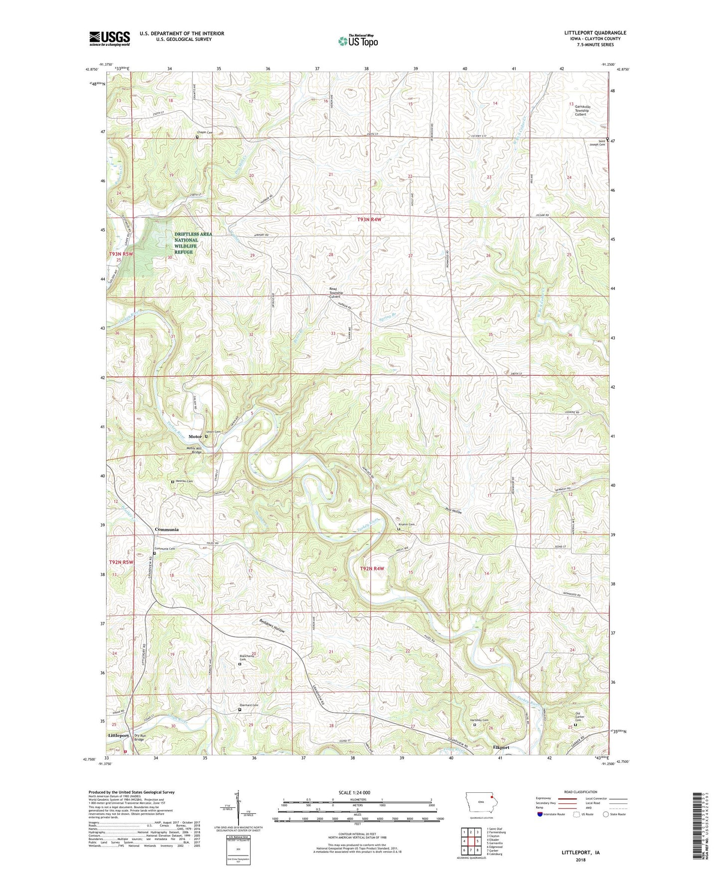
2022 topographic map quadrangle Littleport in the state of Iowa. Scale: 1:24000. Based on the newly updated USGS 7.5' US Topo map series, this map is in the following counties: Clayton. The map contains contour data, water features, and other items you are used to seeing on USGS maps, but also has updated roads and other features. This is the next generation of topographic maps. Printed on high-quality waterproof paper with UV fade-resistant inks.
Quads adjacent to this one:
West: Elkader
Northwest: Saint Olaf
North: Farmersburg
Northeast: Clayton
East: Garnavillo
Southeast: Colesburg
South: Garber
Southwest: Edgewood
This map covers the same area as the classic USGS quad with code o42091g3.
Contains the following named places: Beddows Hollow, Bente Branch, Blanchaine Cemetery, Chapin Cemetery, Clayton County, Clayton County Fairgrounds, Communia, Communia Cemetery, Communia Post Office, Doe Creek, Dry Mill Creek, Dry Run Bridge, Eberhard Cemetery, Garnavillo Township Culbert, Hartshey Cemetery, Honey Creek, Krumm Cemetery, Littleport, Littleport Fire Department, Littleport First Respond Ambulance Service, Littleport Post Office, Littleport Public Library, Meenan Cemetery, Motor, Motor Mill, Motor Mill Access, Motor Mill Bridge, Old Garber Cemetery, Panther Creek, Pine Hollow, Read Township Culvert, Rentz Memorial Woods State Preserve, Roberts Creek, Saint Joseph Cemetery, Spring Branch, Township of Read, Township of Volga, Union Cemetery, ZIP Code: 52044