MyTopo
Farmersburg Iowa US Topo Map
Couldn't load pickup availability
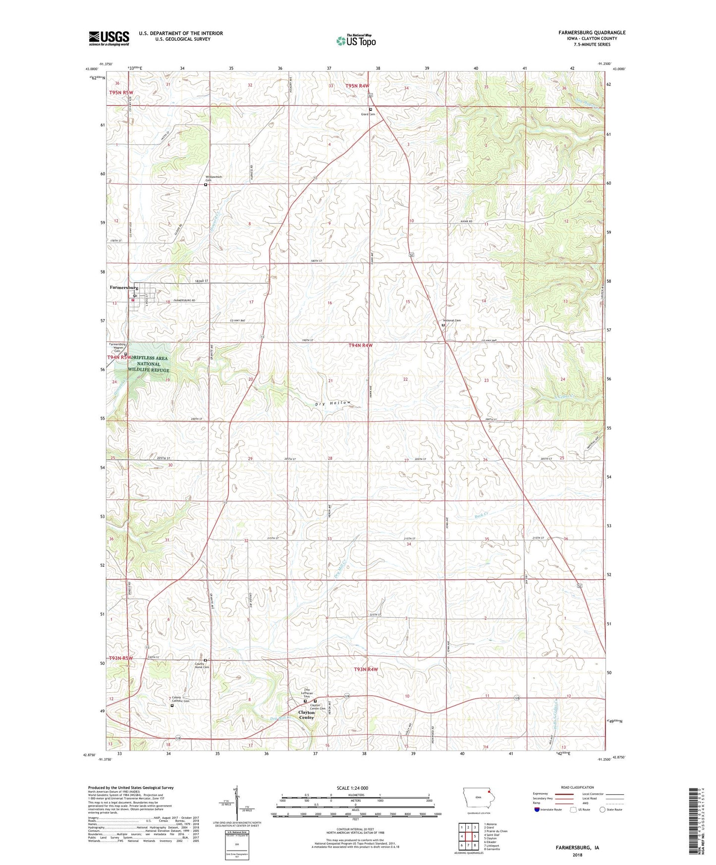
2022 topographic map quadrangle Farmersburg in the state of Iowa. Scale: 1:24000. Based on the newly updated USGS 7.5' US Topo map series, this map is in the following counties: Clayton. The map contains contour data, water features, and other items you are used to seeing on USGS maps, but also has updated roads and other features. This is the next generation of topographic maps. Printed on high-quality waterproof paper with UV fade-resistant inks.
Quads adjacent to this one:
West: Saint Olaf
Northwest: Monona
North: Giard
Northeast: Prairie du Chien
East: Clayton
Southeast: Garnavillo
South: Littleport
Southwest: Elkader
This map covers the same area as the classic USGS quad with code o42091h3.
Contains the following named places: Bismark Post Office, Bismark Station, City of Farmersburg, Clayton Center, Clayton Center Cemetery, Clayton County Farm, Colony Catholic Cemetery, County Home Cemetery, Driftless Area National Wildlife Refuge, Dry Hollow, Farmersburg, Farmersburg - Wagner Cemetery, Farmersburg Fire Department, Farmersburg Library, Farmersburg Post Office, Giard Cemetery, KCTN-FM (Garnavillo), National, National Cemetery, National Post Office, Read Post Office, Saint John Lutheran Church, Sigel Post Office, Township of Farmersburg, Wabasha Post Office, Winkawitsch Cemetery, Zion Lutheran Cemetery, ZIP Code: 52047