MyTopo
Evanston Iowa US Topo Map
Couldn't load pickup availability
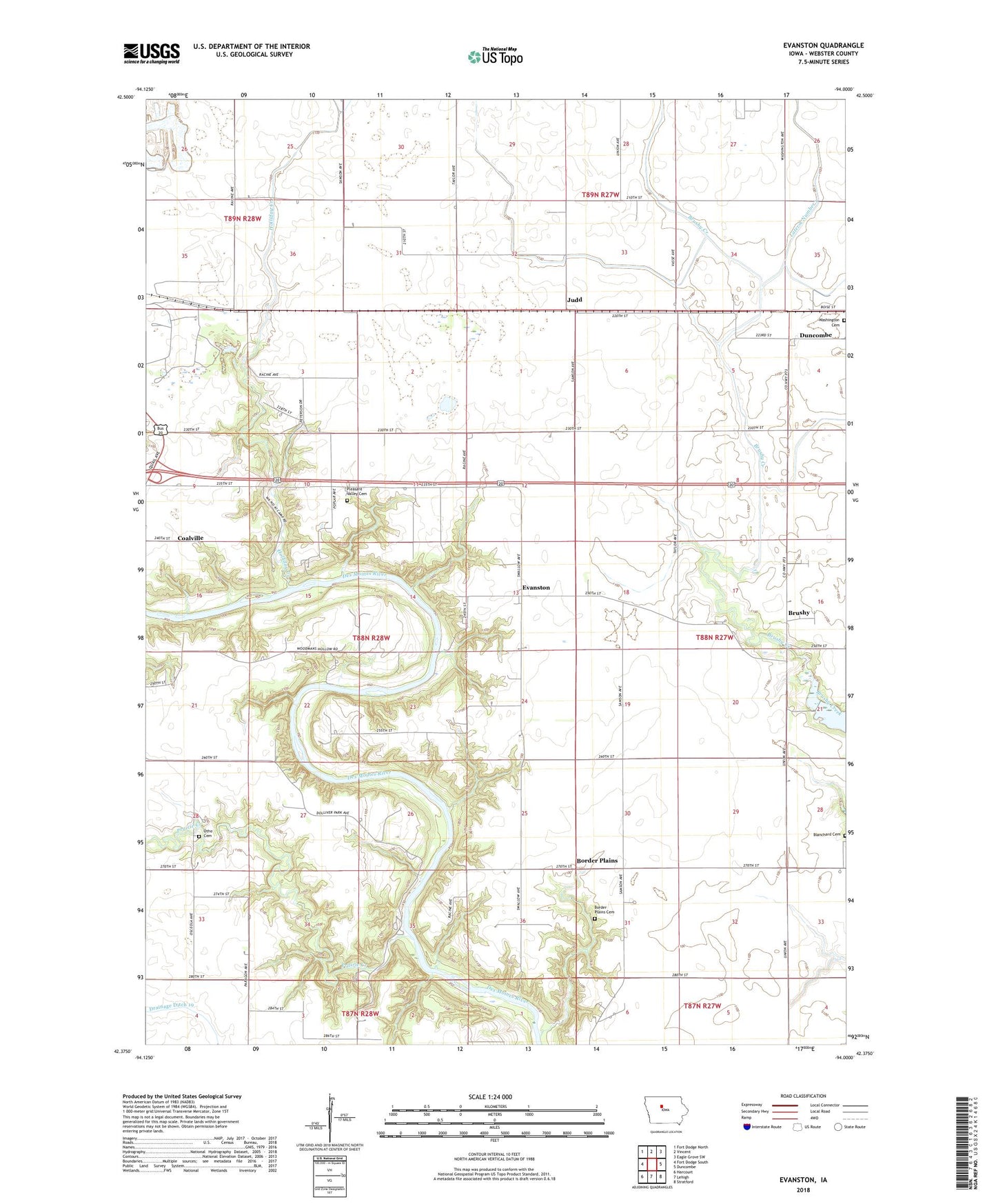
2022 topographic map quadrangle Evanston in the state of Iowa. Scale: 1:24000. Based on the newly updated USGS 7.5' US Topo map series, this map is in the following counties: Webster. The map contains contour data, water features, and other items you are used to seeing on USGS maps, but also has updated roads and other features. This is the next generation of topographic maps. Printed on high-quality waterproof paper with UV fade-resistant inks.
Quads adjacent to this one:
West: Fort Dodge South
Northwest: Fort Dodge North
North: Vincent
Northeast: Eagle Grove SW
East: Duncombe
Southeast: Stratford
South: Lehigh
Southwest: Harcourt
This map covers the same area as the classic USGS quad with code o42094d1.
Contains the following named places: Blanchard Cemetery, Border Plains, Border Plains Cemetery, Border Plains Post Office, Brushy, Brushy Post Office, Coalville Census Designated Place, Dolliver Memorial State Park, Drainage Ditch Number 57, Evanston, Evanston Post Office, Holaday Creek Cemetery, Holliday Creek, Holliday Creek Area Park, Judd, Judd Post Office, Ortho Post Office, Otho Cemetery, Prairie Creek, Township of Pleasant Valley, Township of Washington, Washington Township Cemetery, Woodmans Hollow State Park, ZIP Code: 50532