MyTopo
Duncombe Iowa US Topo Map
Couldn't load pickup availability
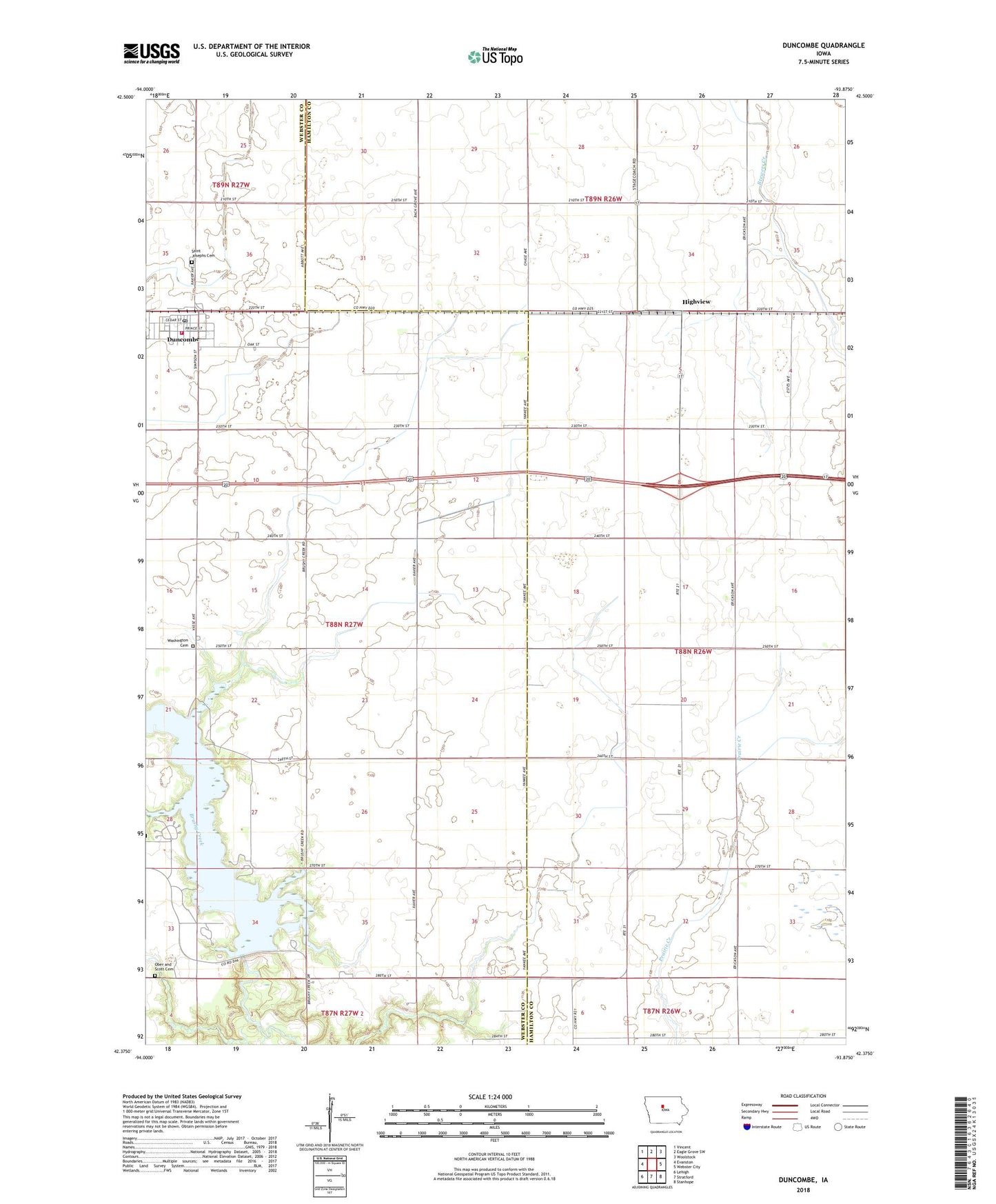
2022 topographic map quadrangle Duncombe in the state of Iowa. Scale: 1:24000. Based on the newly updated USGS 7.5' US Topo map series, this map is in the following counties: Hamilton, Webster. The map contains contour data, water features, and other items you are used to seeing on USGS maps, but also has updated roads and other features. This is the next generation of topographic maps. Printed on high-quality waterproof paper with UV fade-resistant inks.
Quads adjacent to this one:
West: Evanston
Northwest: Vincent
North: Eagle Grove SW
Northeast: Woolstock
East: Webster City
Southeast: Stanhope
South: Stratford
Southwest: Lehigh
This map covers the same area as the classic USGS quad with code o42093d8.
Contains the following named places: Brushy Creek Dam, Brushy Creek Lake, Brushy Creek State Park, Brushy Creek Trail, Bushy Creek Campground, City of Duncombe, Duncombe, Duncombe City Hall, Duncombe Fire Department, Duncombe Police Department, Duncombe Post Office, Duncombe Public Library, Duncombe United Methodist Church, Flugstad, Flugstad Post Office, Gordon's Marsh Area, Highview, Highview Post Office, Ober and Scott Cemetery, Prairie Pond Wildlife Area, Russell's Grove Post Office, Saint Joseph Catholic Church, Saint Josephs Cemetery, Township of Freedom, Washington Cemetery