MyTopo
Vincent Iowa US Topo Map
Couldn't load pickup availability
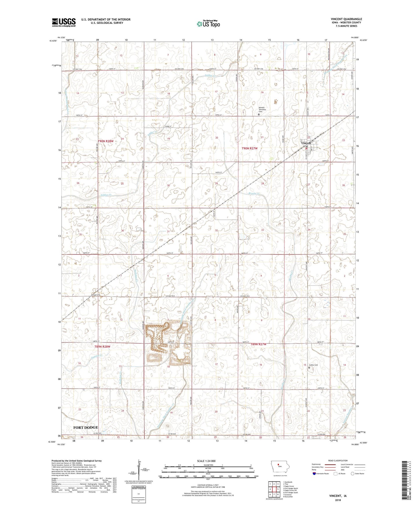
2022 topographic map quadrangle Vincent in the state of Iowa. Scale: 1:24000. Based on the newly updated USGS 7.5' US Topo map series, this map is in the following counties: Webster. The map contains contour data, water features, and other items you are used to seeing on USGS maps, but also has updated roads and other features. This is the next generation of topographic maps. Printed on high-quality waterproof paper with UV fade-resistant inks.
Quads adjacent to this one:
West: Fort Dodge North
Northwest: Humboldt
North: Thor
Northeast: Eagle Grove
East: Eagle Grove SW
Southeast: Duncombe
South: Evanston
Southwest: Fort Dodge South
This map covers the same area as the classic USGS quad with code o42094e1.
Contains the following named places: City of Vincent, Colfax Cemetery, Colfax Townhall, Colfax Township Hall, Drainage Ditch 102, Industry, Industry Post Office, Lateral Ditch Number 1, Lateral Number 1, Newark Township Cemetery, Rossow County Prairie, Saint Johns Church, South Enes Lutheran Church, Township of Colfax, Township of Newark, Vincent, Vincent City Hall, Vincent Methodist Church, Vincent Post Office, Vincent Town Community Hall, Vincent Volunteer Fire Department, ZIP Code: 50594