MyTopo
Hazleton Iowa US Topo Map
Couldn't load pickup availability
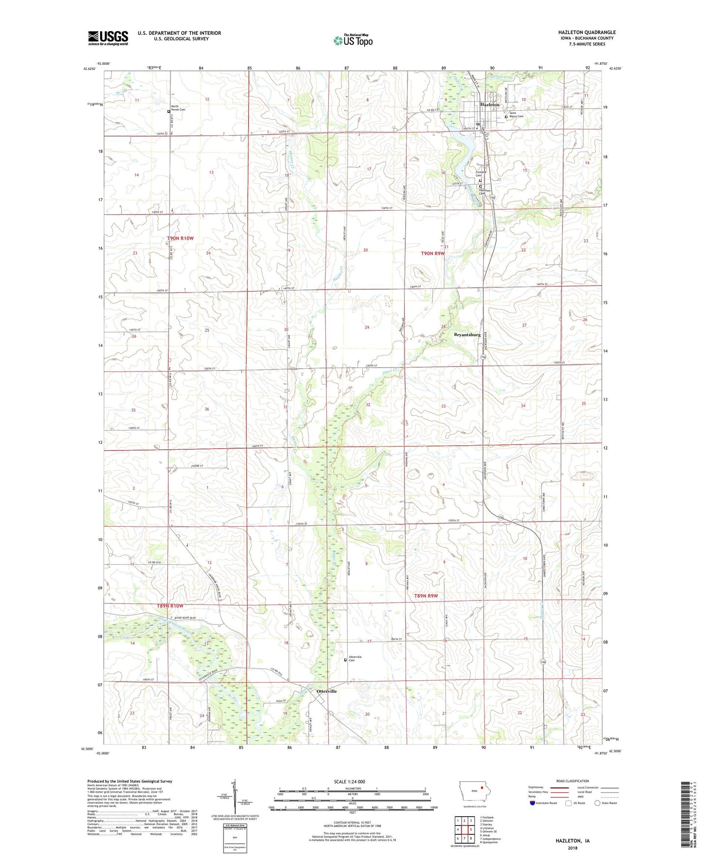
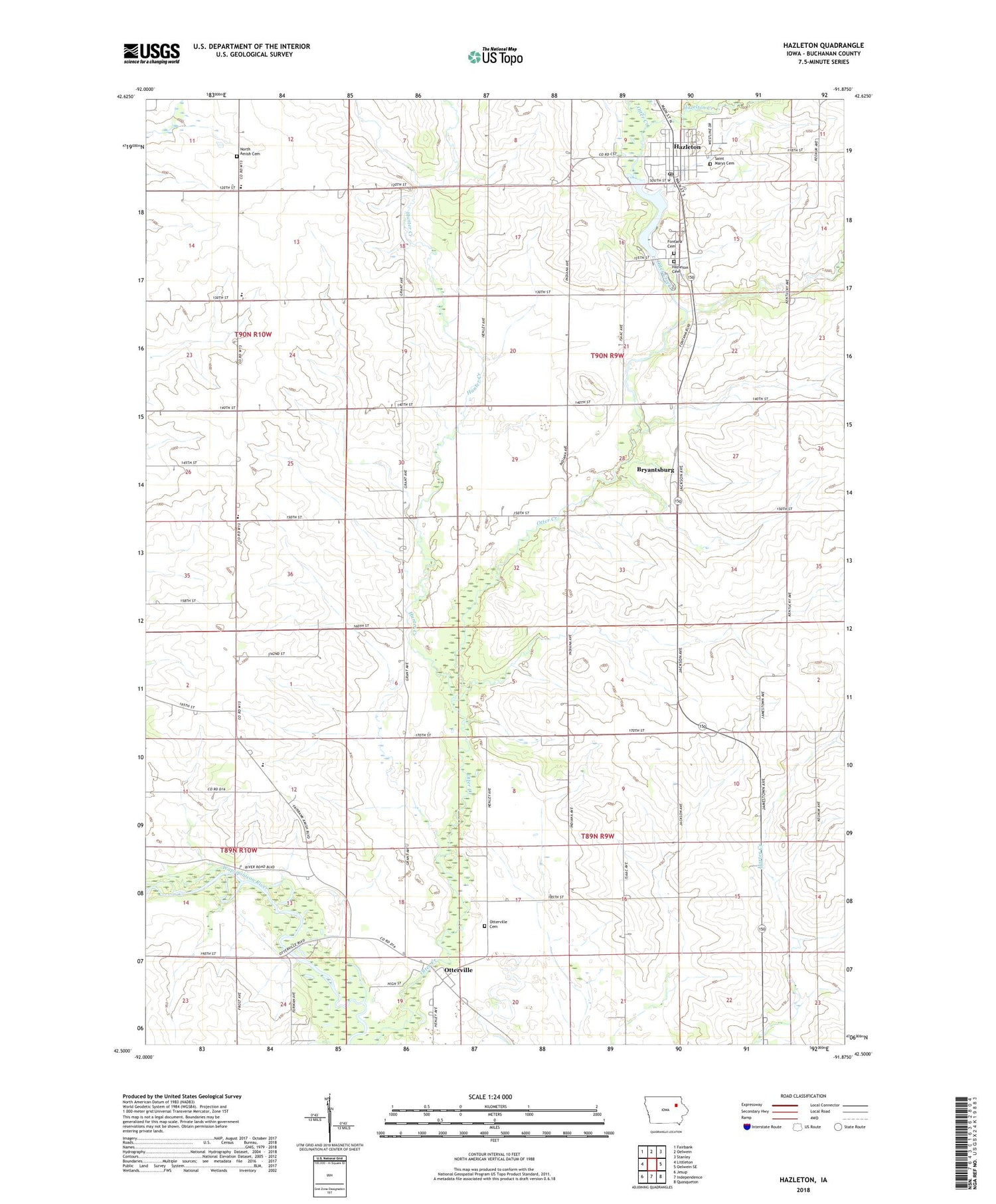
2022 topographic map quadrangle Hazleton in the state of Iowa. Scale: 1:24000. Based on the newly updated USGS 7.5' US Topo map series, this map is in the following counties: Buchanan. The map contains contour data, water features, and other items you are used to seeing on USGS maps, but also has updated roads and other features. This is the next generation of topographic maps. Printed on high-quality waterproof paper with UV fade-resistant inks.
Quads adjacent to this one:
West: Littleton
Northwest: Fairbank
North: Oelwein
Northeast: Stanley
East: Oelwein SE
Southeast: Quasqueton
South: Independence
Southwest: Jesup
This map covers the same area as the classic USGS quad with code o42091e8.
Contains the following named places: Bryantburg, Bryantsburg, Byrantburg Post Office, Charity Flat School, City of Hazleton, First Presbyterian Church, Fontana Cemetery, Fontana Hazleton Cemetery, Fontana Lake, Fontana Milldam, Fontana Park, Hazelton City Hall, Hazelton Creek, Hazleton, Hazleton First Respond Ambulance Service, Hazleton Post Office, Hickory Grove School, Hilltop View School, Hunter Creek, Lake oelwein, North Amish Cemetery, Otter Creek Wildlife Area, Otterville, Otterville Bridge, Otterville Bridge State Access, Otterville Cemetery, Otterville Post Office, Perry Number 1 Elementary School, Perry Number One School, Prairie Grove Elementary School, Rural Elementary School Number 2, Saint Mary's Catholic Church, Saint Marys Cemetery, Township of Hazleton, Township of Washington, Trinity United Methodist Church, Wapsie Valley Number Three School, Wapsie Valley Rural School Number 3, West Prairie Church, ZIP Code: 50641