MyTopo
Littleton Iowa US Topo Map
Couldn't load pickup availability
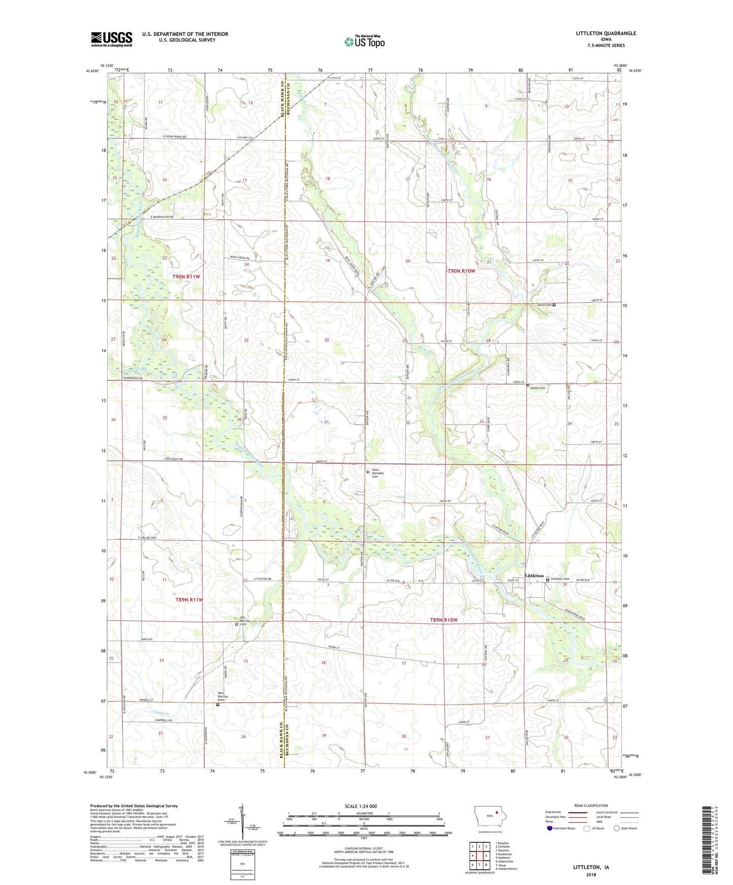
2022 topographic map quadrangle Littleton in the state of Iowa. Scale: 1:24000. Based on the newly updated USGS 7.5' US Topo map series, this map is in the following counties: Buchanan, Black Hawk. The map contains contour data, water features, and other items you are used to seeing on USGS maps, but also has updated roads and other features. This is the next generation of topographic maps. Printed on high-quality waterproof paper with UV fade-resistant inks.
Quads adjacent to this one:
West: Dunkerton
Northwest: Readlyn
North: Fairbank
Northeast: Oelwein
East: Hazleton
Southeast: Independence
South: Jesup
Southwest: Gilbertville
This map covers the same area as the classic USGS quad with code o42092e1.
Contains the following named places: Amish Cemetery, Barclay Cemetery, Barclay Post Office, Brown School, Bruggeman County Park, Buck Creek, Camp Creek, Crane Creek, Cutshaw Bridge State Access Area, Kier, Kier Post Office, Little Wapsipinicon River, Littleton, Littleton Cemetery, Littleton Post Office, Mickey Fox Wildlife Area, New Barclay Cemetery, Rigdon Access County Park, River Birch Bottom County Park, Saint Michaels Cemetery, Township of Fairbank, Township of Perry, Triumph Elementary School, Union Cemetery, Wapsie Bluff County Park, Wapsie Valley Rural Elementary School Number 4