MyTopo
Clayton Iowa US Topo Map
Couldn't load pickup availability
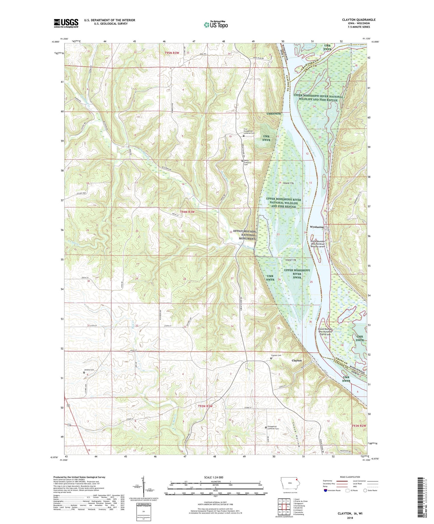
2022 topographic map quadrangle Clayton in the states of Iowa, Wisconsin. Scale: 1:24000. Based on the newly updated USGS 7.5' US Topo map series, this map is in the following counties: Clayton, Grant, Crawford. The map contains contour data, water features, and other items you are used to seeing on USGS maps, but also has updated roads and other features. This is the next generation of topographic maps. Printed on high-quality waterproof paper with UV fade-resistant inks.
Quads adjacent to this one:
West: Farmersburg
Northwest: Giard
North: Prairie du Chien
Northeast: Bridgeport
East: Brodtville
Southeast: Guttenberg
South: Garnavillo
Southwest: Littleport
Contains the following named places: Adams Dairy, Buck Creek Area Park, Catfish Slough, City of Clayton, Clayton, Clayton Cemetery, Clayton Post Office, Evangelical Lutheran Cemetery, First Evangelical Church, First Evangelical Lutheran Cemetery, Gassner Lake, Glass Lake, Glen Lake, Great River Road Trail, Island 176, Island 178, Island Number One Hundred Eighty-one, Island Number One Hundred Seventy-seven, Jenkins Cemetery, Johnsons Slough, J-Wood Camp Grounds, Methodist Lake, Moody Run, North Cedar Creek, Norwegian Church, Norwegian Church Cemetery, Norwegian Lake, Old Stone Schoolhouse Historical Marker, Paradise Valley Campground, Pikes Peak State Park, Sny Magill, Sny Magill Creek, Sny Magill North Cedar Creek Wildlife Management Area, Township of Clayton, Wisconsin River, Wyalusing, Wyalusing Slough, ZIP Code: 52049