MyTopo
Gilbertville Iowa US Topo Map
Couldn't load pickup availability
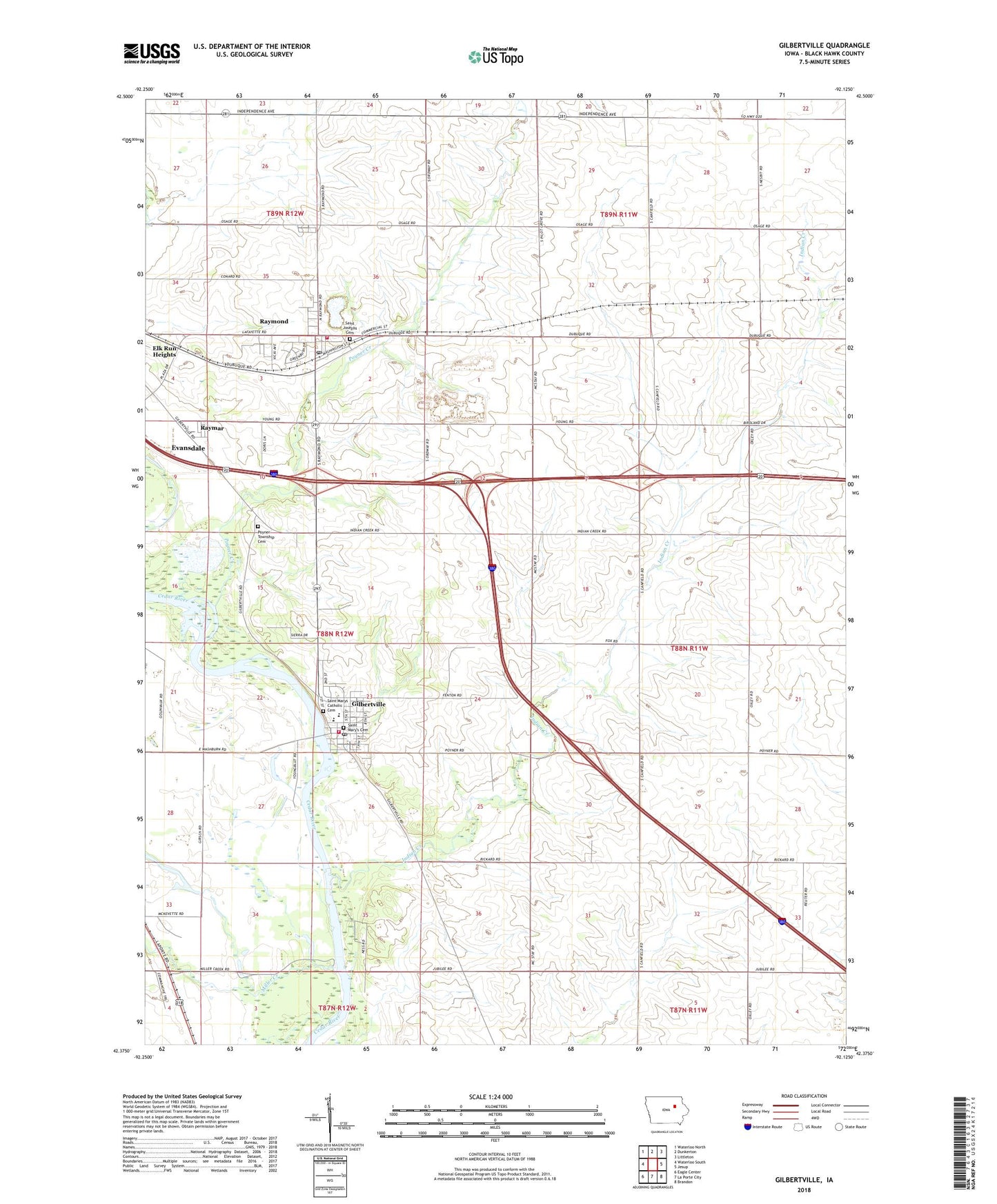
2022 topographic map quadrangle Gilbertville in the state of Iowa. Scale: 1:24000. Based on the newly updated USGS 7.5' US Topo map series, this map is in the following counties: Black Hawk. The map contains contour data, water features, and other items you are used to seeing on USGS maps, but also has updated roads and other features. This is the next generation of topographic maps. Printed on high-quality waterproof paper with UV fade-resistant inks.
Quads adjacent to this one:
West: Waterloo South
Northwest: Waterloo North
North: Dunkerton
Northeast: Littleton
East: Jesup
Southeast: Brandon
South: La Porte City
Southwest: Eagle Center
This map covers the same area as the classic USGS quad with code o42092d2.
Contains the following named places: Barclay Townhall, Black Hawk County Park, Cedar River Natural Resource Area, City of Gilbertville, City of Raymond, Don Bosco High School, Gilbertville, Gilbertville Fire and Rescue, Gilbertville Police Department, Gilbertville Post Office, Gilbertville Town Hall, Gilbertville Wastewater Plant, Immaculate Conception - Saint Joseph School, Immaculate Conception Church, Indian Creek, Miller Creek, Poyner Creek, Poyner Township Cemetery, Prairie View Acres Mobile Home Park, Public Square Park, Raymar, Raymond, Raymond City Hall, Raymond Park, Raymond Post Office, Raymond Quarry, Raymond United Methodist Church, Raymond Volunteer Fire Department, Saint Joseph's Cemetery, Saint Josephs School, Saint Marys Catholic Cemetery, Saint Mary's Cemetery, Schmidt Park, Township of Poyner, Veterans Park, ZIP Codes: 50634, 50667