MyTopo
Jesup Iowa US Topo Map
Couldn't load pickup availability
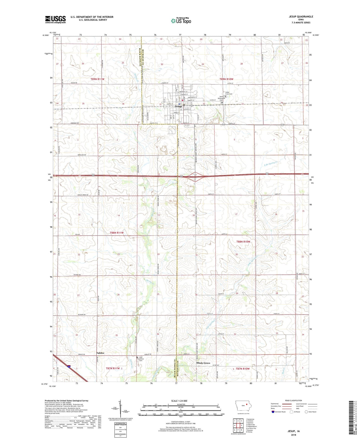
2022 topographic map quadrangle Jesup in the state of Iowa. Scale: 1:24000. Based on the newly updated USGS 7.5' US Topo map series, this map is in the following counties: Buchanan, Black Hawk. The map contains contour data, water features, and other items you are used to seeing on USGS maps, but also has updated roads and other features. This is the next generation of topographic maps. Printed on high-quality waterproof paper with UV fade-resistant inks.
Quads adjacent to this one:
West: Gilbertville
Northwest: Dunkerton
North: Littleton
Northeast: Hazleton
East: Independence
Southeast: Cheney
South: Brandon
Southwest: La Porte City
This map covers the same area as the classic USGS quad with code o42092d1.
Contains the following named places: American Lutheran Church, Cedar Crest Cemetery, City of Jesup, Coller Airstrip, Covenant Clinic, Energy Post Office, Faith Baptist Academy, Faith Bible Fellowship, First Conservative Baptist Church, First United Methodist Church, Fox Townhall, Grace Lutheran Church, Idlewild Post Office, Jesup, Jesup Ambulance Service, Jesup City Hall, Jesup Clinic, Jesup Elementary School, Jesup Fire Department, Jesup High School, Jesup Middle School, Jesup Police Department, Jesup Post Office, Jesup Public Library, Jesup Wastewater Plant, Jubilee, Jubilee Post Office, KNNS-FM (Waterloo), KNWS-FM (Waterloo), KOKZ-FM (Waterloo), Midway Trailer Court, North Street Mobile Home Park, Poyner Airport, Presbyterian Church, Saint Athanasius Cemetery, Saint Athanasius Church, Saint Athanasius School, Shady Grove, Shady Grove Cemetery, Shady Grove Post Office, Steinbron Quarry, Township of Fox, Township of Westburg, Wise, Zion Lutheran Cemetery, Zion Lutheran Church, ZIP Code: 50648