MyTopo
Brandon Iowa US Topo Map
Couldn't load pickup availability
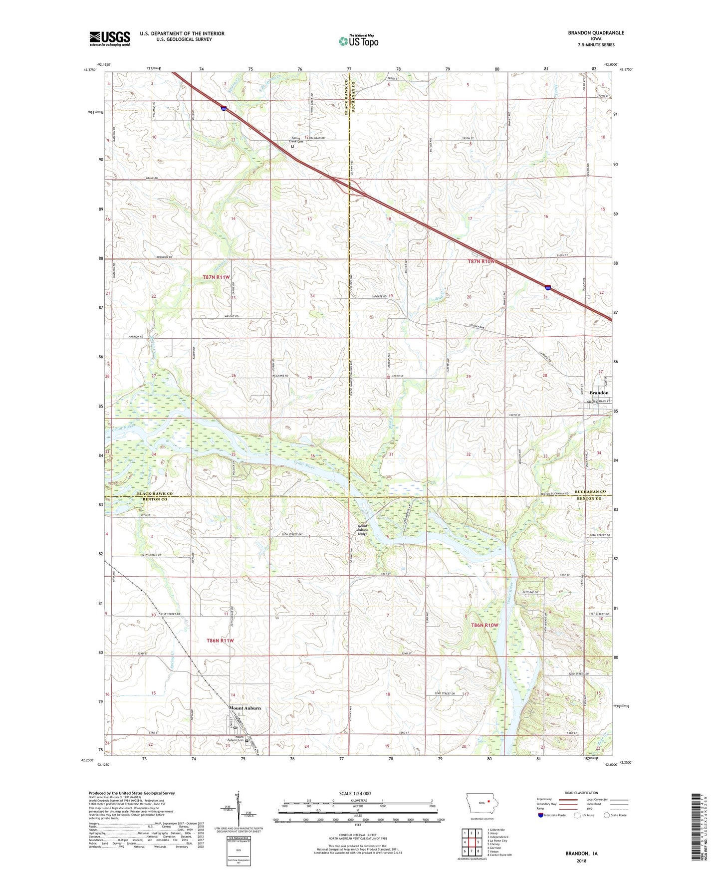
2022 topographic map quadrangle Brandon in the state of Iowa. Scale: 1:24000. Based on the newly updated USGS 7.5' US Topo map series, this map is in the following counties: Benton, Buchanan, Black Hawk. The map contains contour data, water features, and other items you are used to seeing on USGS maps, but also has updated roads and other features. This is the next generation of topographic maps. Printed on high-quality waterproof paper with UV fade-resistant inks.
Quads adjacent to this one:
West: La Porte City
Northwest: Gilbertville
North: Jesup
Northeast: Independence
East: Cheney
Southeast: Center Point NW
South: Vinton
Southwest: Garrison
This map covers the same area as the classic USGS quad with code o42092c1.
Contains the following named places: Brandon, Brandon Post Office, Brandon Town Hall, Brandon United Methodist Church, Brandon Volunteer Fire Department, Cedar - Mount Auburn Fire Department, City of Brandon, City of Mount Auburn, East Branch Spring Creek, Frink's Grove Post Office, Lime Creek, Methodist Church, Minne Estema Park, Mount Auburn, Mount Auburn Bridge, Mount Auburn Bridge Park, Mount Auburn Cemetery, Mount Auburn City Hall, Mount Auburn Post Office, Mud Creek, Spring Creek, Spring Creek Cemetery, Sunny Side, Sunny Side Post Office, Township of Cedar, Township of Jefferson, Township of Spring Creek, Winegar Lake - Tobin Area, ZIP Code: 52313