MyTopo
La Porte City Iowa US Topo Map
Couldn't load pickup availability
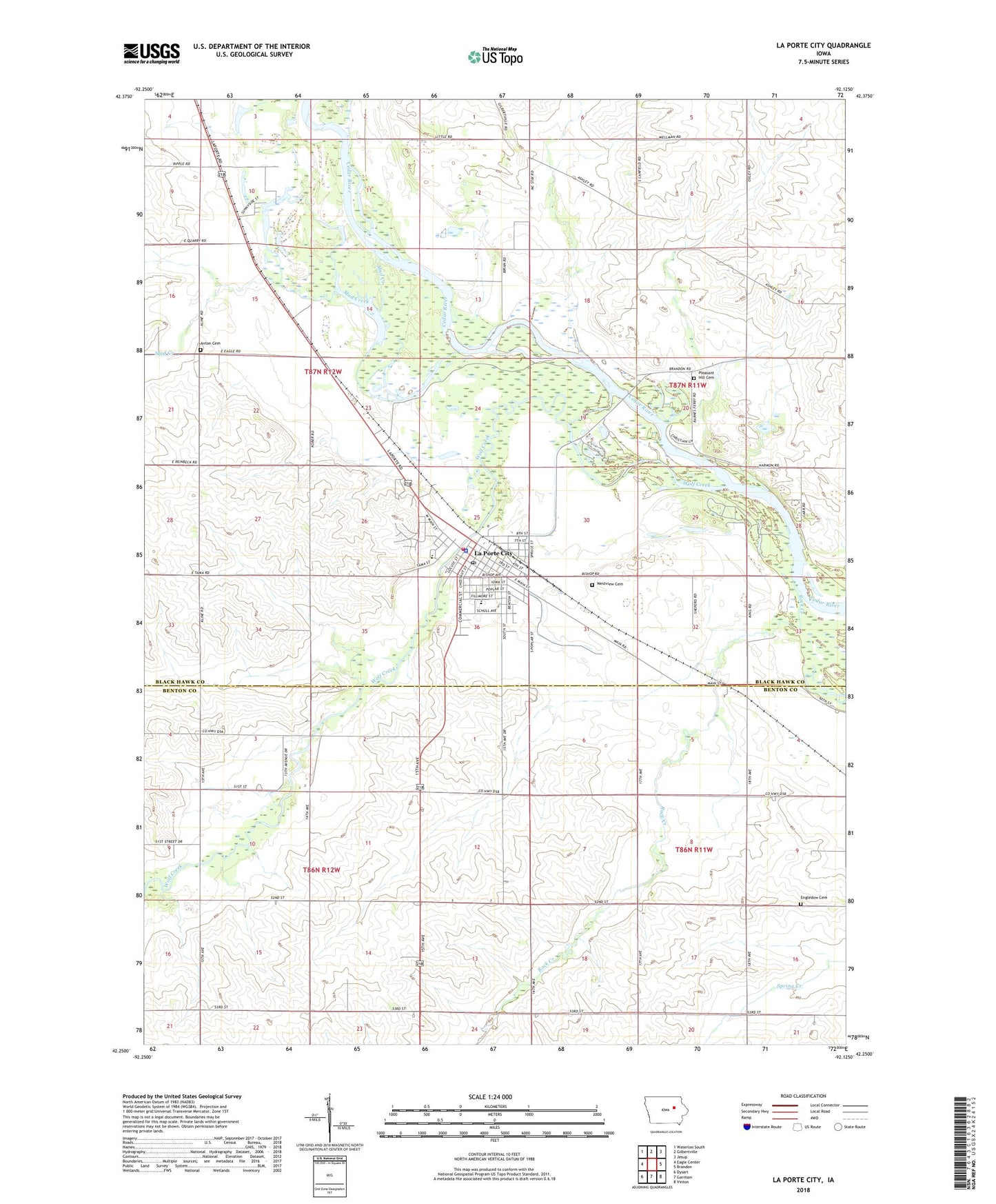
2022 topographic map quadrangle La Porte City in the state of Iowa. Scale: 1:24000. Based on the newly updated USGS 7.5' US Topo map series, this map is in the following counties: Black Hawk, Benton. The map contains contour data, water features, and other items you are used to seeing on USGS maps, but also has updated roads and other features. This is the next generation of topographic maps. Printed on high-quality waterproof paper with UV fade-resistant inks.
Quads adjacent to this one:
West: Eagle Center
Northwest: Waterloo South
North: Gilbertville
Northeast: Jesup
East: Brandon
Southeast: Vinton
South: Garrison
Southwest: Dysart
This map covers the same area as the classic USGS quad with code o42092c2.
Contains the following named places: American Lutheran Church, Anton Cemetery, Bruce Townhall, Cedar River Access Area, City of La Porte City, Eliza Post Office, Engledow Cemetery, Enterprise, Enterprise Post Office, FFA Historical and Ag Museum, First United Presbyterian Church, Hawkins Memorial Library, Heartland Community Church, Indian Hills Recreation Area, La Porte City, La Porte City Clinic, La Porte City Elementary School, La Porte City Fire Department, La Porte City Hall, La Porte City Nursing and Rehabilitation Center, La Porte City Police Department, La Porte City Post Office, McFarlane State Park, Mud Creek, Rock Creek, Sacred Heart Catholic Church, Saint Paul United Methodist Church, Sawyer Cemetery, Township of Big Creek, Township of Bruce, Trinity Wesleyan Church, Union High School, Westview Cemetery, Wolf Creek, Zeien Sand and Gravel Pit, ZIP Code: 50651