MyTopo
Granville East Iowa US Topo Map
Couldn't load pickup availability
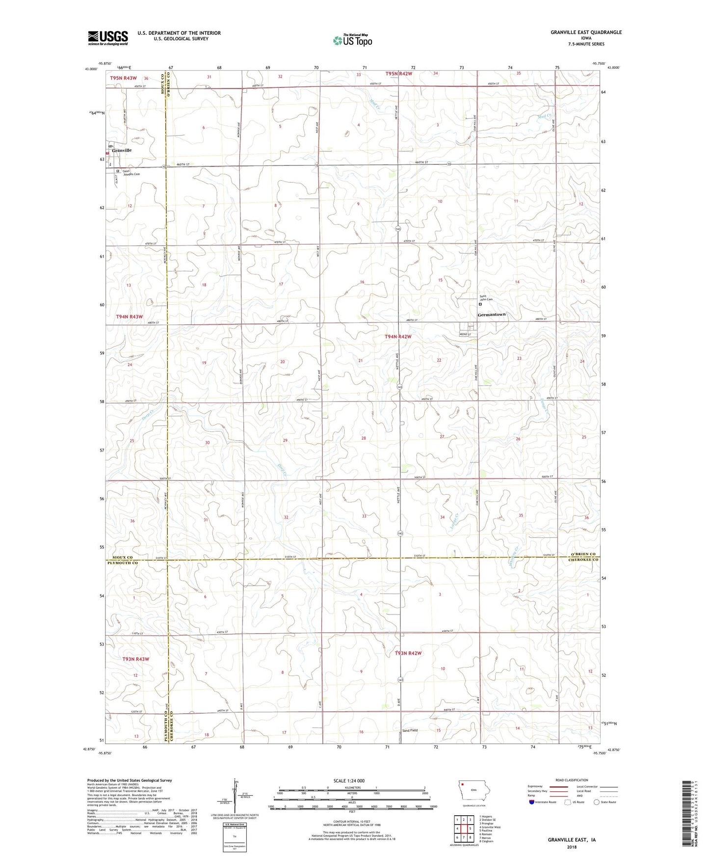
2022 topographic map quadrangle Granville East in the state of Iowa. Scale: 1:24000. Based on the newly updated USGS 7.5' US Topo map series, this map is in the following counties: O'Brien, Cherokee, Sioux, Plymouth. The map contains contour data, water features, and other items you are used to seeing on USGS maps, but also has updated roads and other features. This is the next generation of topographic maps. Printed on high-quality waterproof paper with UV fade-resistant inks.
Quads adjacent to this one:
West: Granville West
Northwest: Hospers
North: Sheldon SE
Northeast: Primghar
East: Paullina
Southeast: Cleghorn
South: Marcus
Southwest: Remsen
This map covers the same area as the classic USGS quad with code o42095h7.
Contains the following named places: Atsma Dairy Farms, Brady Farms, Ebel Farms, Farmers Cooperative Company Elevator, Germantown, Germantown Post Office, Granville, Granville Fire and Rescue, Granville Post Office, Hattermann Farms, Juhl Farm, Olsen Farm, Saint John Cemetery, Saint Johns Lutheran Church, Saint Joseph Cemetery, Saint Joseph Church, Sand Field, Shabbona Post Office, Spalding Catholic Junior High School, Spalding Catholic Schools - Granville Center, Top Line Feed and Supply Incorporated Elevator, Township of Caledonia, ZIP Code: 51022