MyTopo
Granville West Iowa US Topo Map
Couldn't load pickup availability
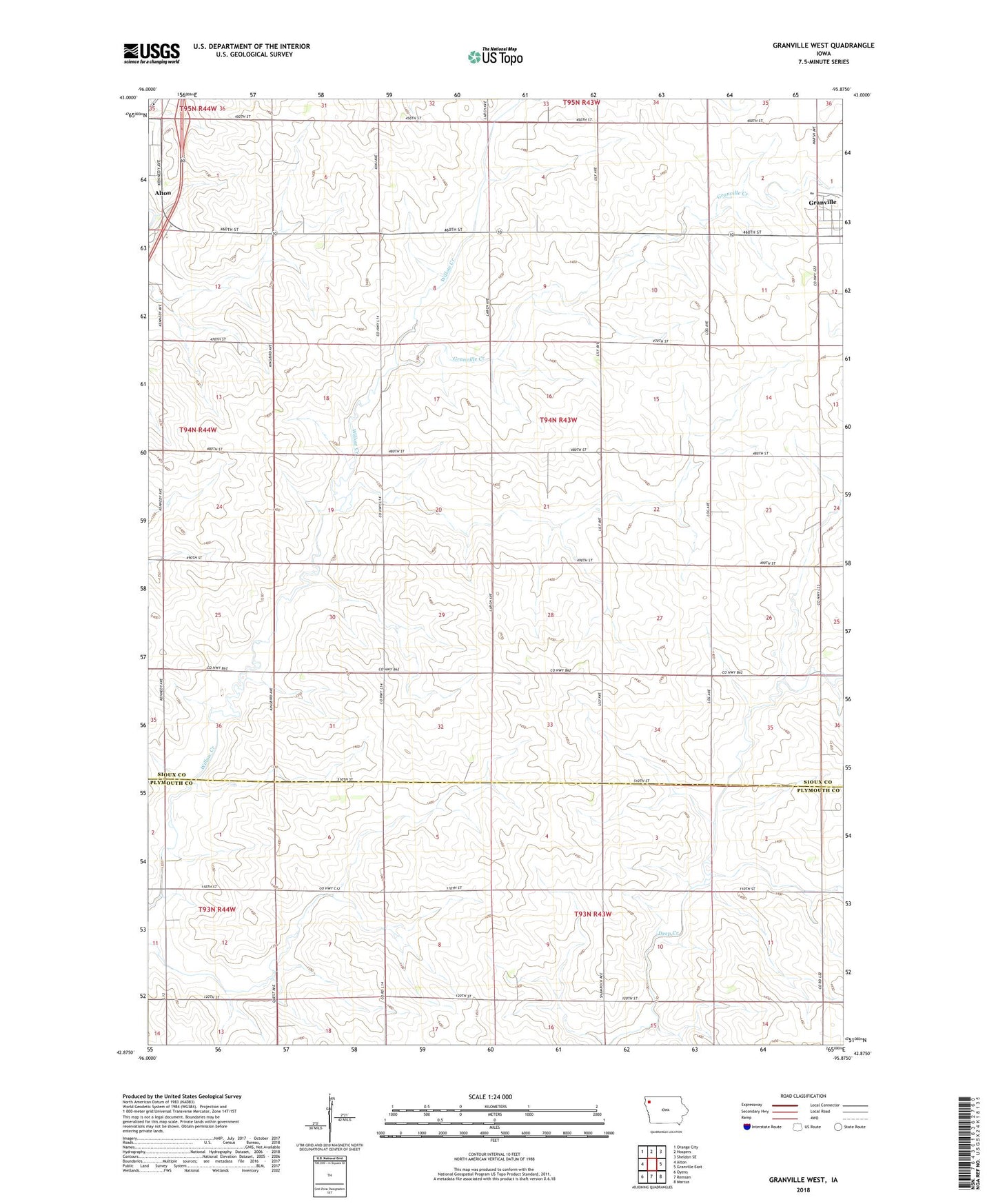
2022 topographic map quadrangle Granville West in the state of Iowa. Scale: 1:24000. Based on the newly updated USGS 7.5' US Topo map series, this map is in the following counties: Sioux, Plymouth. The map contains contour data, water features, and other items you are used to seeing on USGS maps, but also has updated roads and other features. This is the next generation of topographic maps. Printed on high-quality waterproof paper with UV fade-resistant inks.
Quads adjacent to this one:
West: Alton
Northwest: Orange City
North: Hospers
Northeast: Sheldon SE
East: Granville East
Southeast: Marcus
South: Remsen
Southwest: Oyens
This map covers the same area as the classic USGS quad with code o42095h8.
Contains the following named places: City of Granville, Delperdang Farms, Granville Creek, Kerr Airport, Krug Farms, Township of East Orange, ZIP Code: 51003