MyTopo
Marcus Iowa US Topo Map
Couldn't load pickup availability
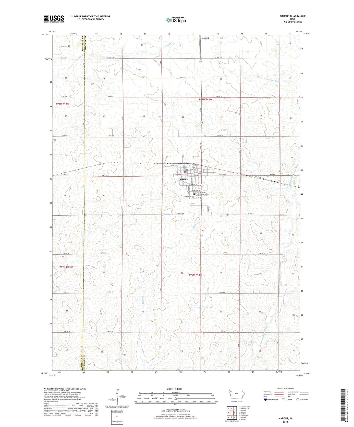
2022 topographic map quadrangle Marcus in the state of Iowa. Scale: 1:24000. Based on the newly updated USGS 7.5' US Topo map series, this map is in the following counties: Cherokee, Plymouth. The map contains contour data, water features, and other items you are used to seeing on USGS maps, but also has updated roads and other features. This is the next generation of topographic maps. Printed on high-quality waterproof paper with UV fade-resistant inks.
Quads adjacent to this one:
West: Remsen
Northwest: Granville West
North: Granville East
Northeast: Paullina
East: Cleghorn
Southeast: Quimby
South: Fielding
Southwest: Kingsley NW
This map covers the same area as the classic USGS quad with code o42095g7.
Contains the following named places: C L Farms, Carousel Farms, Cave Farms, City of Marcus, Faith Lutheran Church, Farmers Co-op Elevator, Five In One Farms, Grace United Methodist Church, Heartland Care Center, Heline Farms, Holy Name Catholic Church, Holy Name Cemetery, Jochims Farms, Marcus, Marcus - Amherst Cemetery, Marcus Chiropractic Health Center, Marcus Clinic Floyd Valley Hospital, Marcus Community Golf Club, Marcus Fire Department and Ambulance Service, Marcus Police Department, Marcus Post Office, Marcus Public Library, MMCRU High School, MMCRU Marcus Elementary School, Norris Farms, Peace Lutheran Church, Pine Grove Farms, Sioux Valley Medical Association - Marcus, Township of Amherst, Township of Marcus, Trinity Church, Willies Bomber Patch Airport, ZIP Code: 51035