MyTopo
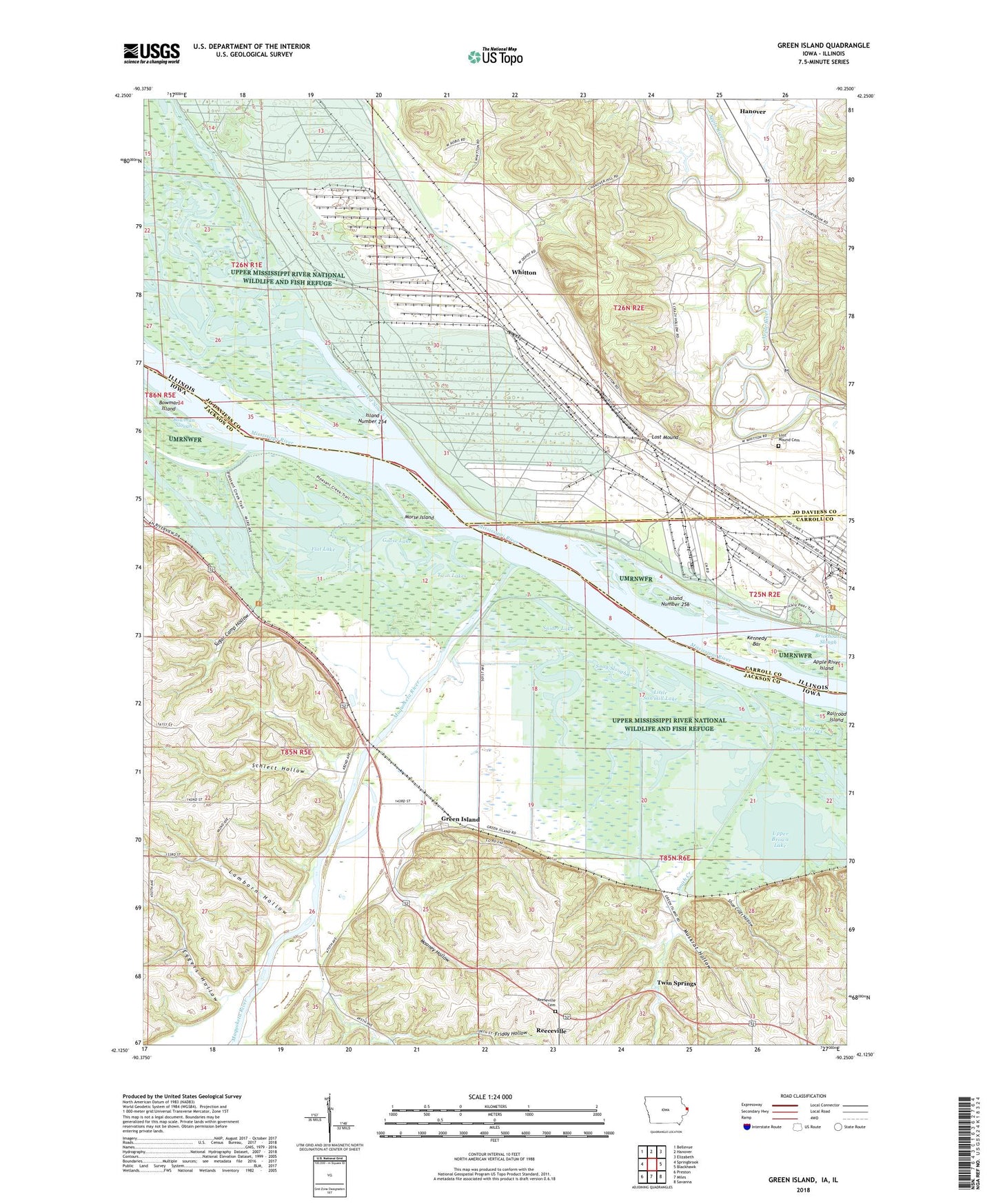
Green Island Iowa US Topo Map
Couldn't load pickup availability
2022 topographic map quadrangle Green Island in the states of Iowa, Illinois. Scale: 1:24000. Based on the newly updated USGS 7.5' US Topo map series, this map is in the following counties: Jackson, Jo Daviess, Carroll. The map contains contour data, water features, and other items you are used to seeing on USGS maps, but also has updated roads and other features. This is the next generation of topographic maps. Printed on high-quality waterproof paper with UV fade-resistant inks.
Quads adjacent to this one:
West: Springbrook
Northwest: Bellevue
North: Hanover
Northeast: Elizabeth
East: Blackhawk
Southeast: Savanna
South: Miles
Southwest: Preston
Contains the following named places: Apple River Island, Bar Slough, Blakes Lake, Bonnie Lake, Bowman Island, Bowman Slough, Brickhouse Slough, Brinksburg, Crooked Slough, Densmore Lake, Eggers Hollow, Fish Lake, Flat Lake, Friday Hollow, Golden Lake, Goose Lake, Grand View School, Green Island, Green Island Post Office, Green Island Wildlife Management Area, Hanover Bluff Nature Preserve, Island Number 254, Island Number 256, Jackson Lake, Kennedy Bar, Lamborn Hollow, Little Sawmill Lake, Lost Mound, Lost Mound Cemetery, Lost Mound School, Maquoketa River, Mooney Hollow, Morse Island, Muskrat Hollow, Nobis School, Reeceville, Reeseville Cemetery, Savanna Army Depot, Sawmill Lake, Schlect Hollow, Shoe Craft Hollow, Smith Creek, Smith Creek School, Snag Slough, Snider Lake, Storybrook Country Club, Sugar Camp Hollow, Township of Hanover, Township of Washington, Twin Lakes, Twin Springs, Upper Brown Lake, Western Pond, Whitton