MyTopo
Villisca Iowa US Topo Map
Couldn't load pickup availability
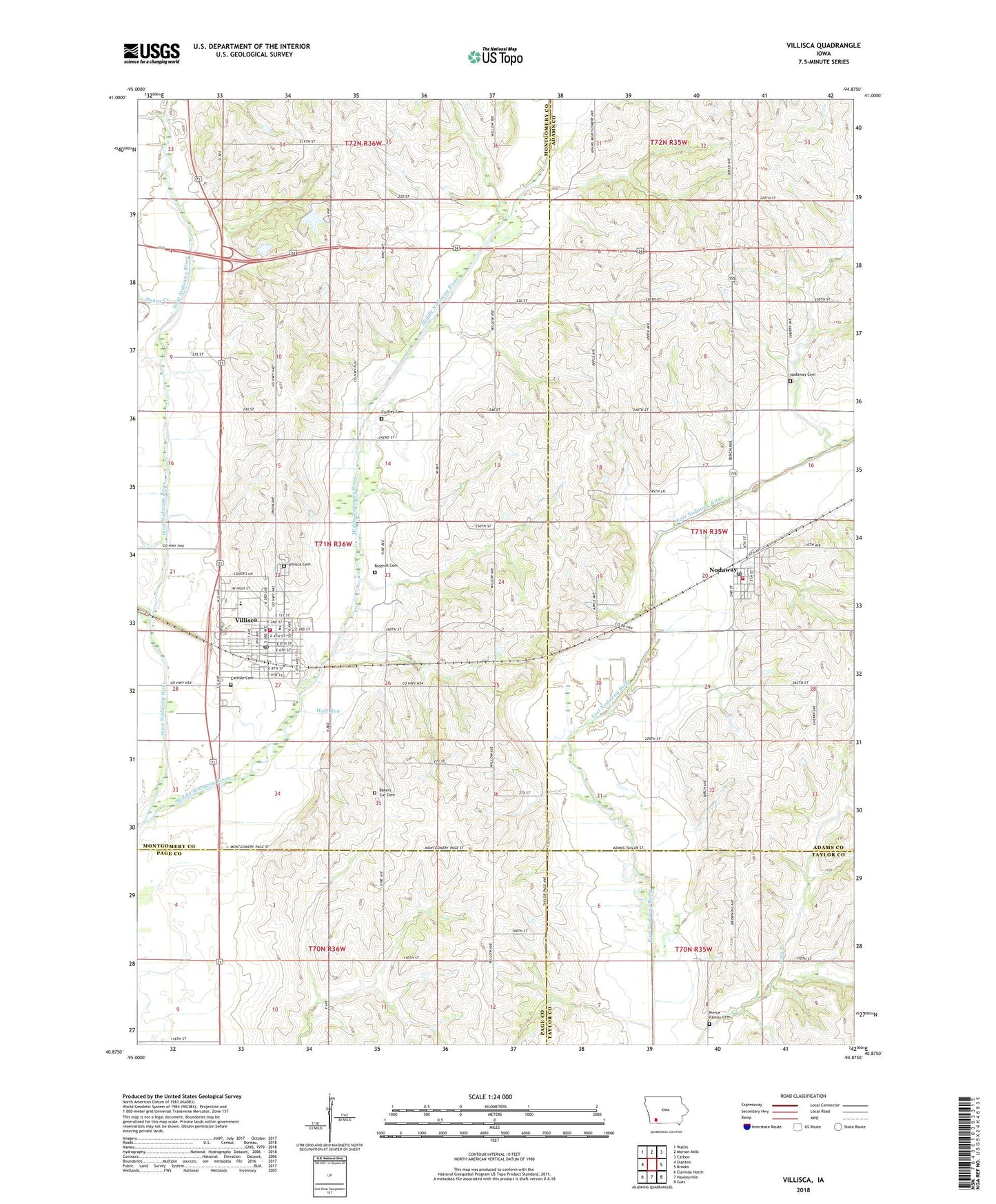
2022 topographic map quadrangle Villisca in the state of Iowa. Scale: 1:24000. Based on the newly updated USGS 7.5' US Topo map series, this map is in the following counties: Montgomery, Adams, Page, Taylor. The map contains contour data, water features, and other items you are used to seeing on USGS maps, but also has updated roads and other features. This is the next generation of topographic maps. Printed on high-quality waterproof paper with UV fade-resistant inks.
Quads adjacent to this one:
West: Stanton
Northwest: Wallin
North: Morton Mills
Northeast: Carbon
East: Brooks
Southeast: Guss
South: Hawleyville
Southwest: Clarinda North
This map covers the same area as the classic USGS quad with code o40094h8.
Contains the following named places: Advent Christian Church, Axe Murder House, Bakers Cut Cemetery, Carlisle Cemetery, City of Nodaway, City of Villisca, Clarinda Regular Baptist Church, Dunns Creek, Enarson Elementary School, Findley Cemetery, Hacklebarney Woods County Park, Middle Nodaway River, Mount Calvary Lutheran Church, Nodaway, Nodaway Cemetery, Nodaway Elevator Incorporated Elevator, Nodaway Play Park, Nodaway Post Office, Nodaway Volunteer Fire Department, Olson/Linn Museum, Pierce Family Cemetery, Presbyterian Church, Red Oak Internal Medicine Clinic, Rosehill Cemetery, Ross Grove Post Office, Saint Josephs Catholic Church, Southwest Valley Middle School, Township of East, United Methodist Church, Villisca, Villisca Ambulance Service, Villisca Cemetery, Villisca City Hall, Villisca Country Club, Villisca Elevator Incorporated Elevator, Villisca Family Health Center, Villisca Fire Department, Villisca Good Samaritan Center, Villisca Post Office, Villisca Public Library, ZIP Codes: 50857, 50864