MyTopo
Hawleyville Iowa US Topo Map
Couldn't load pickup availability
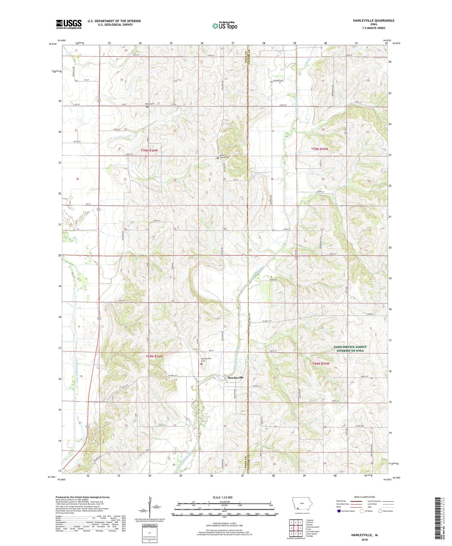
2022 topographic map quadrangle Hawleyville in the state of Iowa. Scale: 1:24000. Based on the newly updated USGS 7.5' US Topo map series, this map is in the following counties: Page, Taylor. The map contains contour data, water features, and other items you are used to seeing on USGS maps, but also has updated roads and other features. This is the next generation of topographic maps. Printed on high-quality waterproof paper with UV fade-resistant inks.
Quads adjacent to this one:
West: Clarinda North
Northwest: Stanton
North: Villisca
Northeast: Brooks
East: Guss
Southeast: Ladoga
South: New Market
Southwest: Clarinda South
This map covers the same area as the classic USGS quad with code o40094g8.
Contains the following named places: Fairview Cemetery, Hawleyville, Hawleyville Cemetery, Hawleyville Post Office, Henshaw, Henshaw Post Office, Long Branch, Neele Branch, Nodaway Valley County Park, North Grove Cemetery, North Mills, North Mills Post Office, Township of Nebraska, Township of Valley