MyTopo
Harvey Iowa US Topo Map
Couldn't load pickup availability
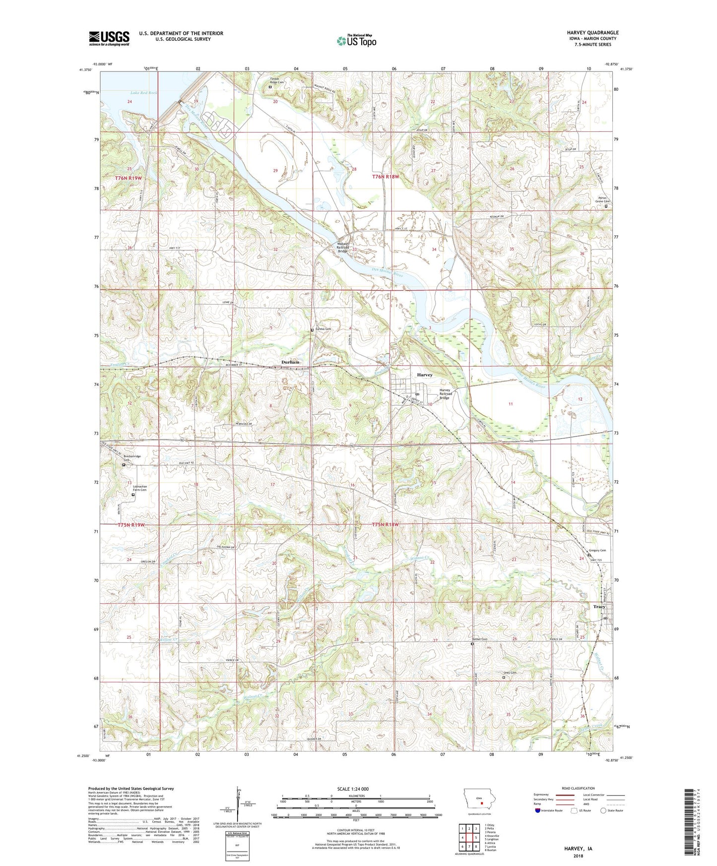
2022 topographic map quadrangle Harvey in the state of Iowa. Scale: 1:24000. Based on the newly updated USGS 7.5' US Topo map series, this map is in the following counties: Marion. The map contains contour data, water features, and other items you are used to seeing on USGS maps, but also has updated roads and other features. This is the next generation of topographic maps. Printed on high-quality waterproof paper with UV fade-resistant inks.
Quads adjacent to this one:
West: Knoxville
Northwest: Otley
North: Pella
Northeast: Peoria
East: Leighton
Southeast: Buxton
South: Lovilia
Southwest: Attica
This map covers the same area as the classic USGS quad with code o41092c8.
Contains the following named places: Amsterdam Post Office, Assembly of God Church, Berry Post Office, Bethel Cemetery, Bethel City, Bethel Post Office, Breckenridge Cemetery, City of Harvey, Crooked Creek, Durham, Durham Mine, Durham Post Office, English Creek, English Settlement, English Settlement Post Office, Eureka Cemetery, Gregory Cemetery, Harvey, Harvey Post Office, Harvey Railroad Bridge, Howell Station Campground Lake Red Rock, Iola Post Office, Ivan's Park, Loynachan Farm Cemetery, Orey Cemetery, Pella State Game Management Area, Porter Grove Cemetery, Price Creek, Red Rock Dam, Red Rock Visitor Center, South Overlook Park, Timber Ridge Cemetery, Township of Clay, Tracey Church, Tracy, Tracy Christian Reformed Church, Tracy Post Office, Tracy United Methodist Church, Volksweg Trail, Wabash Railroad Bridge, Willow Creek, ZIP Codes: 50119, 50256