MyTopo
Lovilia Iowa US Topo Map
Couldn't load pickup availability
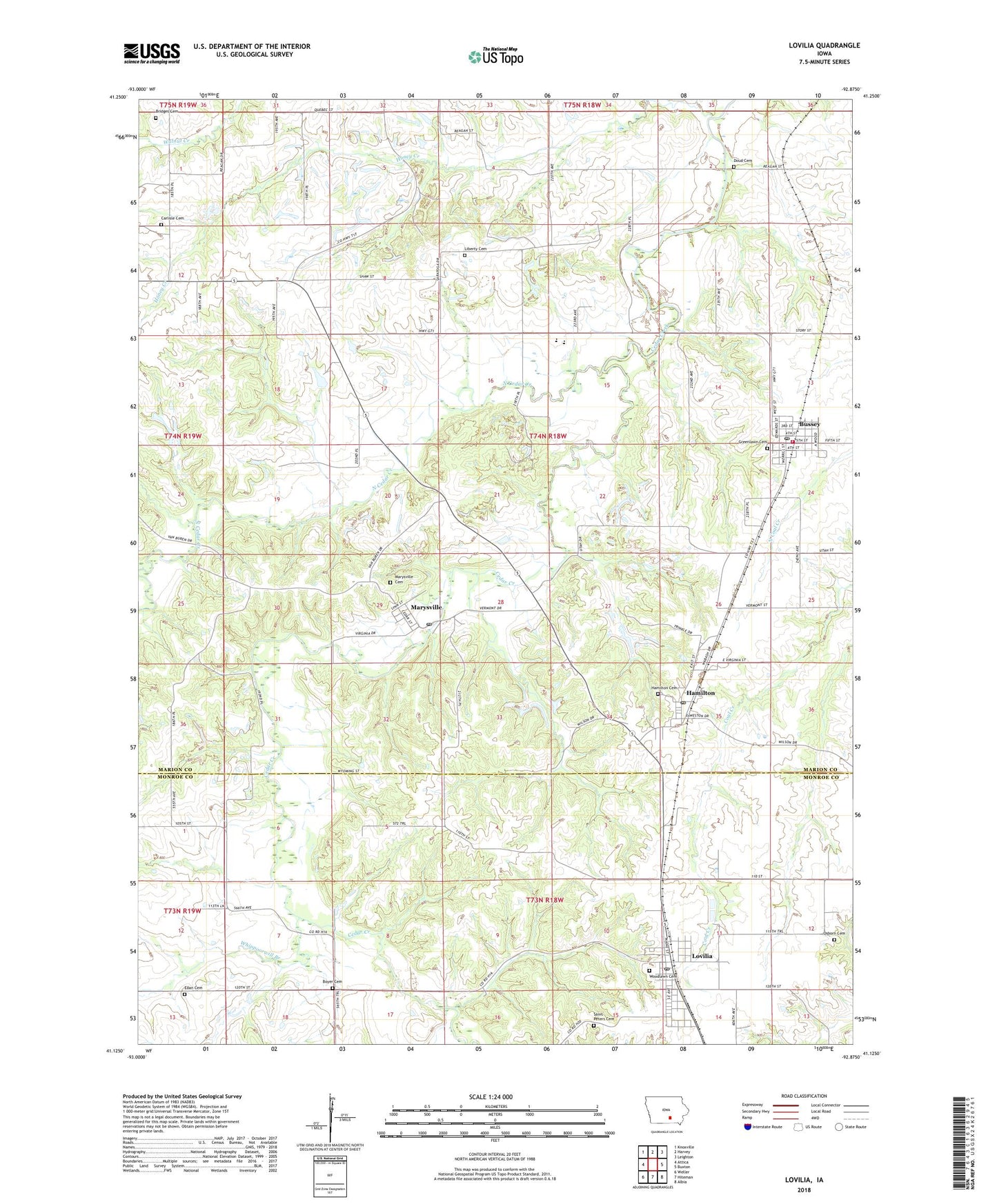
2022 topographic map quadrangle Lovilia in the state of Iowa. Scale: 1:24000. Based on the newly updated USGS 7.5' US Topo map series, this map is in the following counties: Marion, Monroe. The map contains contour data, water features, and other items you are used to seeing on USGS maps, but also has updated roads and other features. This is the next generation of topographic maps. Printed on high-quality waterproof paper with UV fade-resistant inks.
Quads adjacent to this one:
West: Attica
Northwest: Knoxville
North: Harvey
Northeast: Leighton
East: Buxton
Southeast: Albia
South: Hiteman
Southwest: Weller
This map covers the same area as the classic USGS quad with code o41092b8.
Contains the following named places: Boyer Cemetery, Bridges Cemetery, Bussey, Bussey City Hall, Bussey Community Library, Bussey Family Health Center, Bussey Post Office, Bussey Volunteer Fire Department, Buxton State Historical Marker, Carlisle Cemetery, City of Bussey, City of Hamilton, City of Lovilia, City of Marysville, Coal Ridge School, Doud Cemetery, Dry Ridge School, Eden Cemetery, Everist Post Office, Greenlawn Cemetery, Hamilton, Hamilton Cemetery, Hamilton Post Office, Highland School, Honey Creek, Independent Bible Church, Liberty Cemetery, Lovilia, Lovilia City Hall, Lovilia First Responders, Lovilia Post Office, Marysville, Marysville Cemetery, Marysville Post Office, North Cedar Creek, Osborn Cemetery, Paul Todd Wildlife Area, Red Cedar Mills Post Office, Saint Peters Cemetery, Saint Peters Church, Shiloh School, Township of Liberty, Twin Cedars Elementary School, Twin Cedars Junior - Senior High School, United Methodist Church, Weldon Landing Strip, Whippoorwill Branch, Wilcox Wildlife Area, Woodlawn Cemetery, ZIP Codes: 50044, 50116, 50150