MyTopo
Otley Iowa US Topo Map
Couldn't load pickup availability
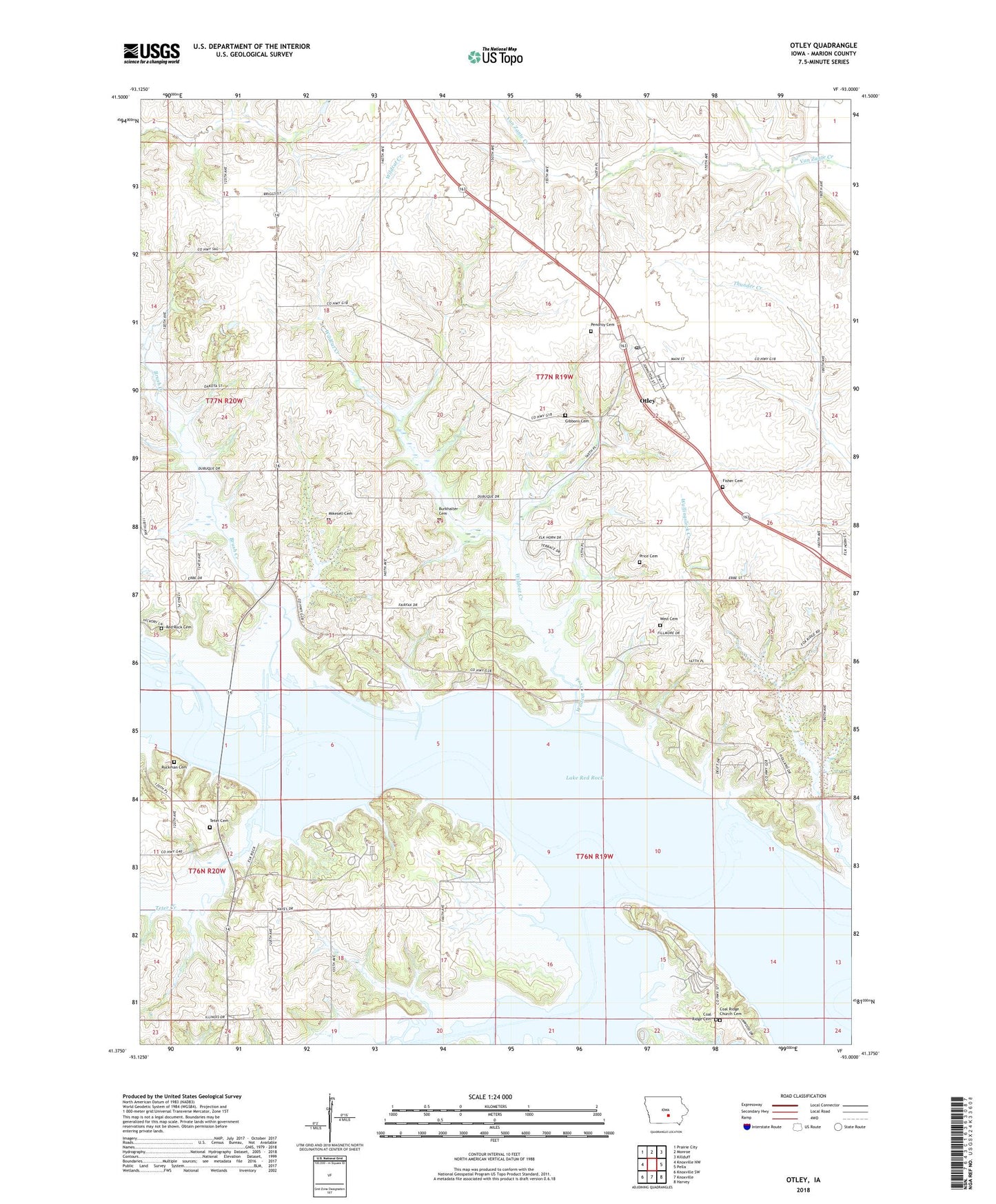
2022 topographic map quadrangle Otley in the state of Iowa. Scale: 1:24000. Based on the newly updated USGS 7.5' US Topo map series, this map is in the following counties: Marion. The map contains contour data, water features, and other items you are used to seeing on USGS maps, but also has updated roads and other features. This is the next generation of topographic maps. Printed on high-quality waterproof paper with UV fade-resistant inks.
Quads adjacent to this one:
West: Knoxville NW
Northwest: Prairie City
North: Monroe
Northeast: Killduff
East: Pella
Southeast: Harvey
South: Knoxville
Southwest: Knoxville SW
This map covers the same area as the classic USGS quad with code o41093d1.
Contains the following named places: Brush Creek, Burkhalter Cemetery, Centennial Elm Planted in 1876 Historical Marker, Coal Ridge Cemetery, Coal Ridge Church Cemetery, Cordova, Cordova Park, Cordova Post Office, Eifield, Elk Rock State Park, Fifield, Fifield Park, Fifield Post Office, Fisher Cemetery, Gibbons Cemetery, Jehovahs Witnesses, Lake Red Rock, Middle Creek, Mikesell Cemetery, Otley, Otley Post Office, Otley Reformed Church, Pella Community School, Pendroy Cemetery, Price Cemetery, Red Rock, Red Rock Cemetery, Red Rock Post Office, Red Rock Public Hunting Area, Roberts Creek, Roberts Creek Park, Rousseau Post Office, Ruckman Cemetery, Teter Cemetery, Teter Creek, The Dragoon Trail in Marion County Historical Marker, Township of Summit, West Cemetery, White Breast Creek, Whitebreast Park, Wildcat Creek, ZIP Code: 50214