MyTopo
Independence Iowa US Topo Map
Couldn't load pickup availability
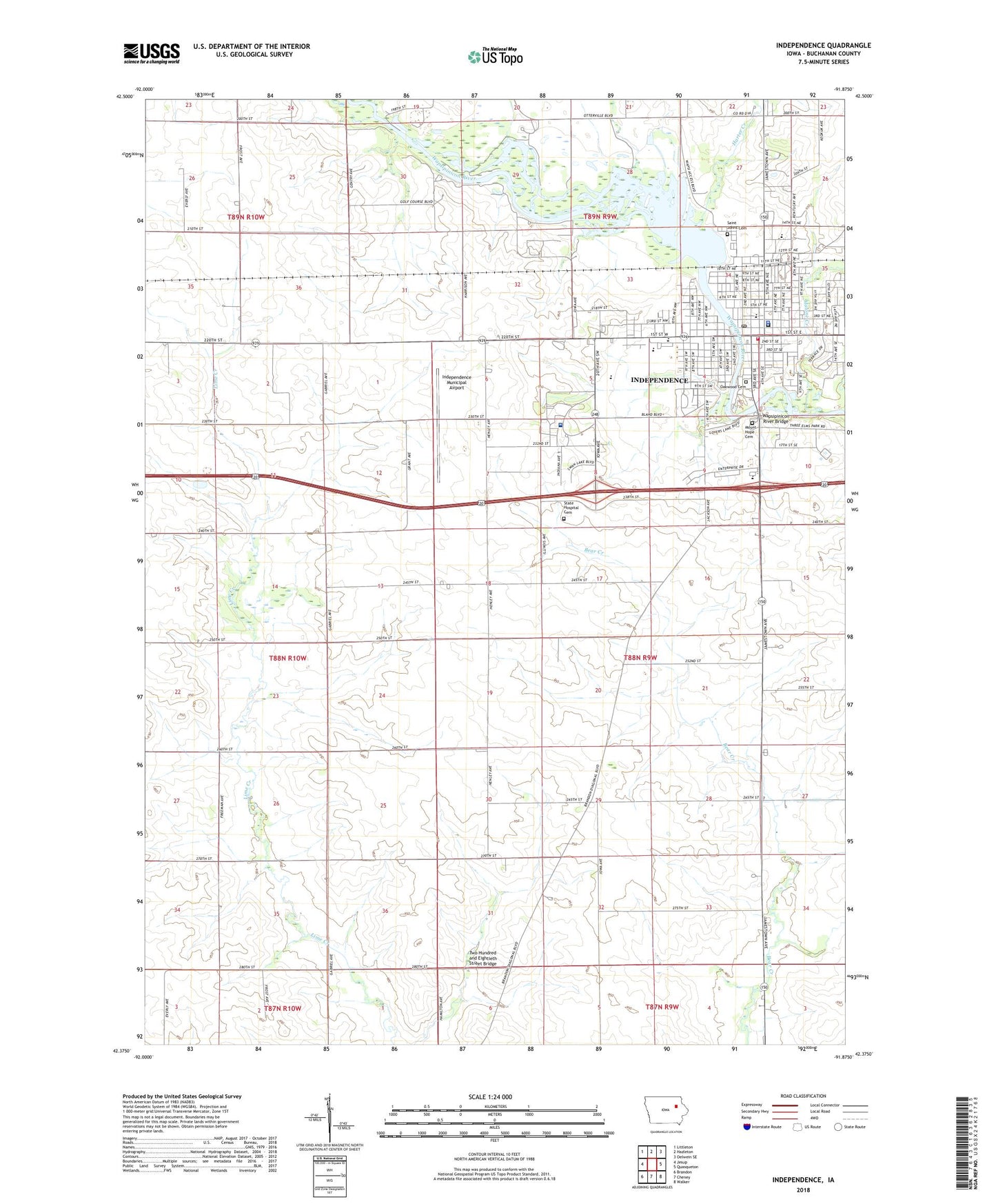
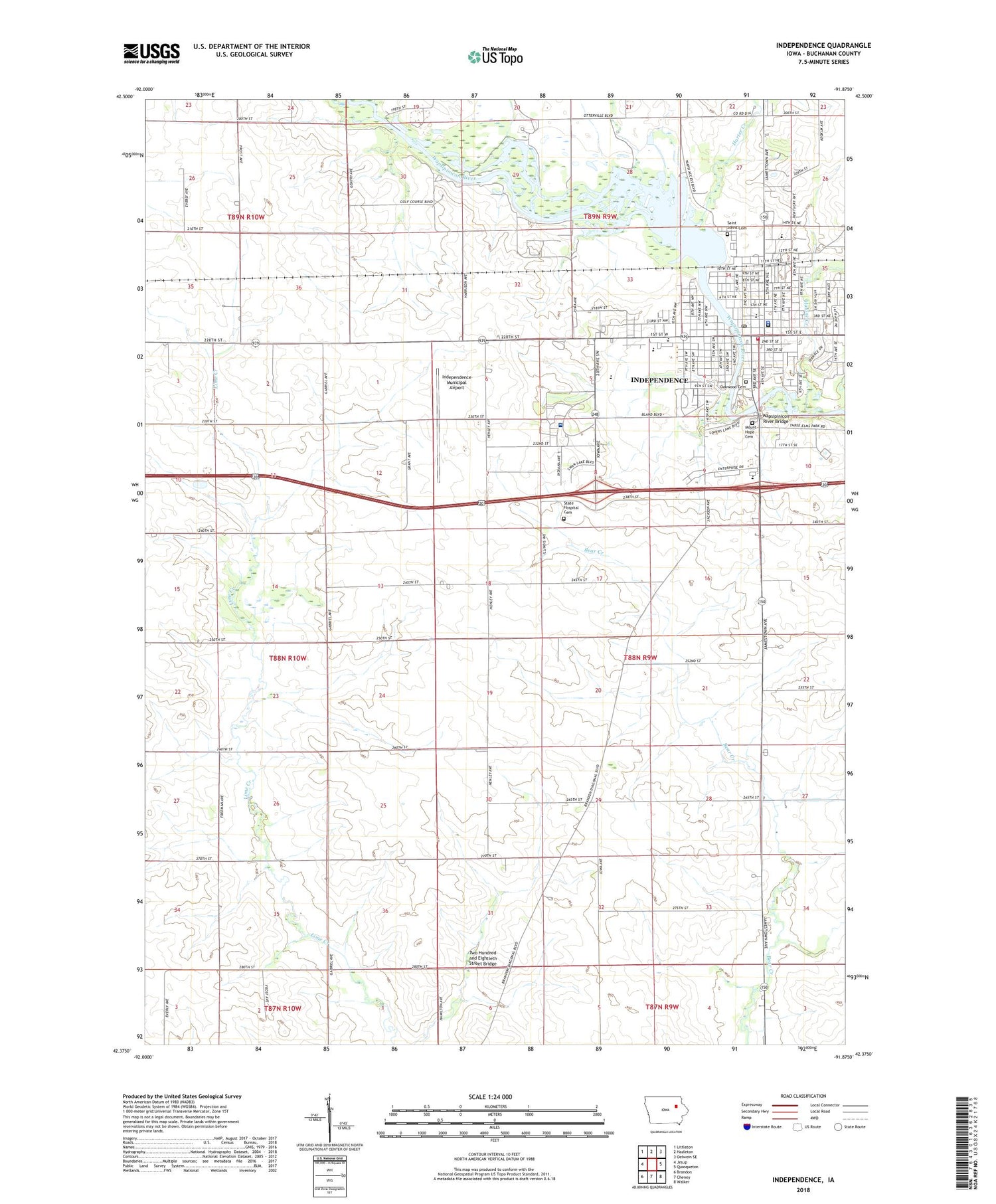
2022 topographic map quadrangle Independence in the state of Iowa. Scale: 1:24000. Based on the newly updated USGS 7.5' US Topo map series, this map is in the following counties: Buchanan. The map contains contour data, water features, and other items you are used to seeing on USGS maps, but also has updated roads and other features. This is the next generation of topographic maps. Printed on high-quality waterproof paper with UV fade-resistant inks.
Quads adjacent to this one:
West: Jesup
Northwest: Littleton
North: Hazleton
Northeast: Oelwein SE
East: Quasqueton
Southeast: Walker
South: Cheney
Southwest: Brandon
This map covers the same area as the classic USGS quad with code o42091d8.
Contains the following named places: Assembly of God Church, Bethel Baptist Church, Buchanan County Correctional Center, Buchanan County Courthouse, Buchanan County Fairgrounds, Buchanan County Jail, Buchanan County Sheriff's Office, Buchanan County Success Center, City of Independence, Cornerstone Foursquare Church, Crumbacher Wildlife Area, East Elementary School, First Baptist Church, First Presbyterian Church, First United Methodist Church, Freedom Baptist Church, Grace Evangelical Church, Harter Creek, Hope Wesleyan Church, Immanuel Lutheran Church, Independence, Independence Christian Academy, Independence City Hall, Independence City Police Department, Independence Fire Department, Independence Junior / Senior High School, Independence Mental Health Institute, Independence Middle School, Independence Motor Speedway, Independence Municipal Airport, Independence Post Office, Independence Public Library, Independence United Methodist Church, Independence Wastewater Treatment Plant, Kingdom Hall, KOUR-AM (Independence), KOUR-FM (Independence), Living Water Church, Loeck School, Malone Creek, Medical Associates Center, Mount Hope Cemetery, Oakwood Cemetery, Otter Creek, Our Redeemer Church, Pine Ridge Mobile Home Court, Saint James Episcopal Church, Saint John's Catholic Church, Saint Johns Cemetery, Saint Johns School, State Hospital Cemetery, Sumner Townhall, The Church of Jesus Christ of Latter Day Saints, Township of Sumner, Two Hundred and Eightieth Street Bridge, United Pentecostal Church, Vista, Vista Post Office, Wapsipinicon Country Club, Wapsipinicon Mill, Wapsipinicon River Access County Park, Wapsipinicon River Bridge, West Elementary School, Westburg Townhall, ZIP Code: 50644