MyTopo
Galva Iowa US Topo Map
Couldn't load pickup availability
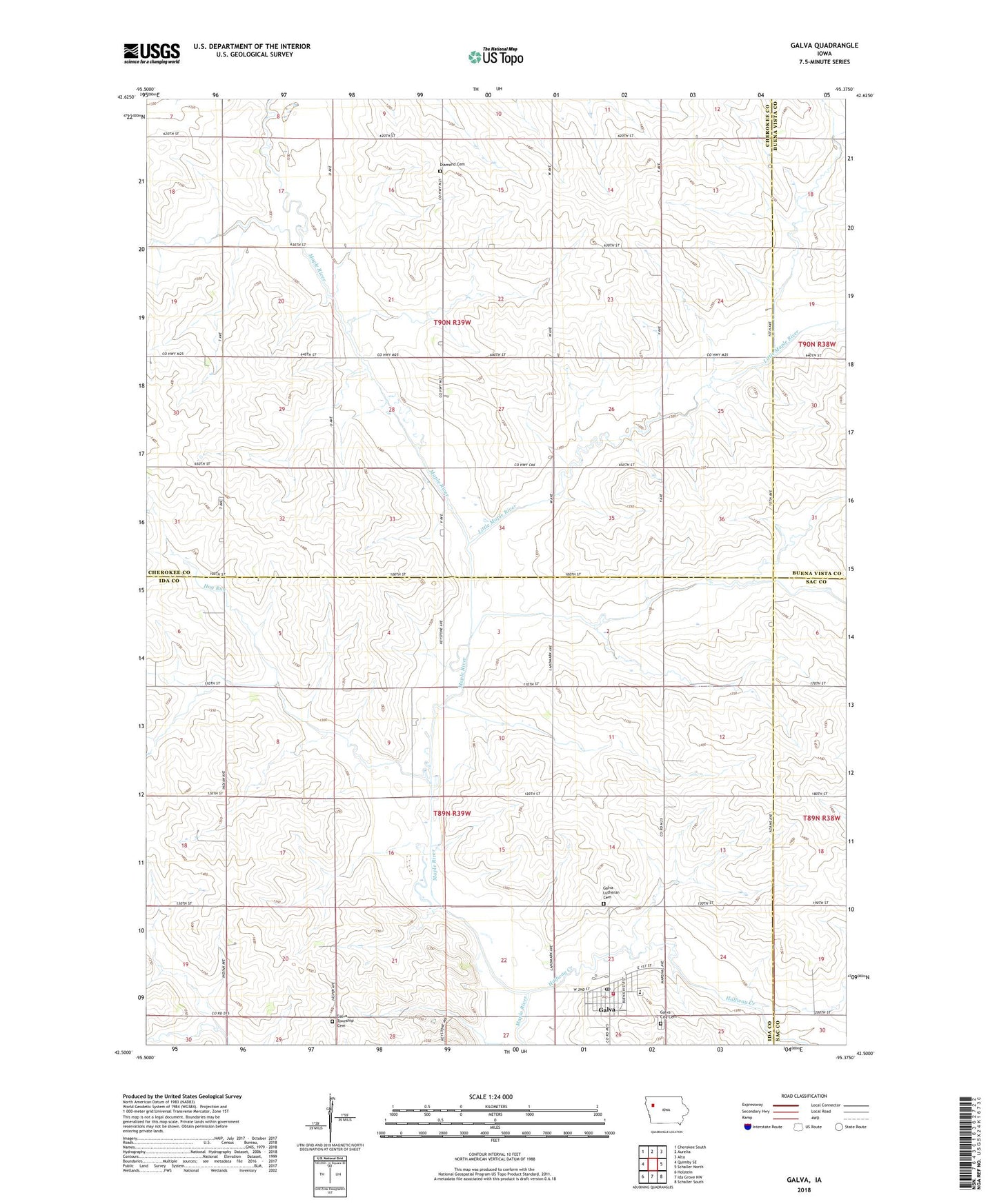
2022 topographic map quadrangle Galva in the state of Iowa. Scale: 1:24000. Based on the newly updated USGS 7.5' US Topo map series, this map is in the following counties: Ida, Cherokee, Buena Vista, Sac. The map contains contour data, water features, and other items you are used to seeing on USGS maps, but also has updated roads and other features. This is the next generation of topographic maps. Printed on high-quality waterproof paper with UV fade-resistant inks.
Quads adjacent to this one:
West: Quimby SE
Northwest: Cherokee South
North: Aurelia
Northeast: Alta
East: Schaller North
Southeast: Schaller South
South: Ida Grove NW
Southwest: Holstein
This map covers the same area as the classic USGS quad with code o42095e4.
Contains the following named places: Buell Farm, City of Galva, Coulson Post Office, Diamond Cemetery, Diamond Center, Diamond Post Office, Doxtad Farm, Engdahl Hog Farm, Galva, Galva Fire Department, Galva Post Office, Galva Public Library, Galva Township Cemetery, Galva Township Cemetery East, Galva Union Elevator, Galva United Methodist Church, Galva Upper Elementary School, Halfway Creek, Hog Run, Little Maple River, Lutheran Church of Galva, Saint Johns Lutheran Cemetery, Township of Diamond, Township of Galva, Vohs Farms, ZIP Code: 51020