MyTopo
Iowa Falls West Iowa US Topo Map
Couldn't load pickup availability
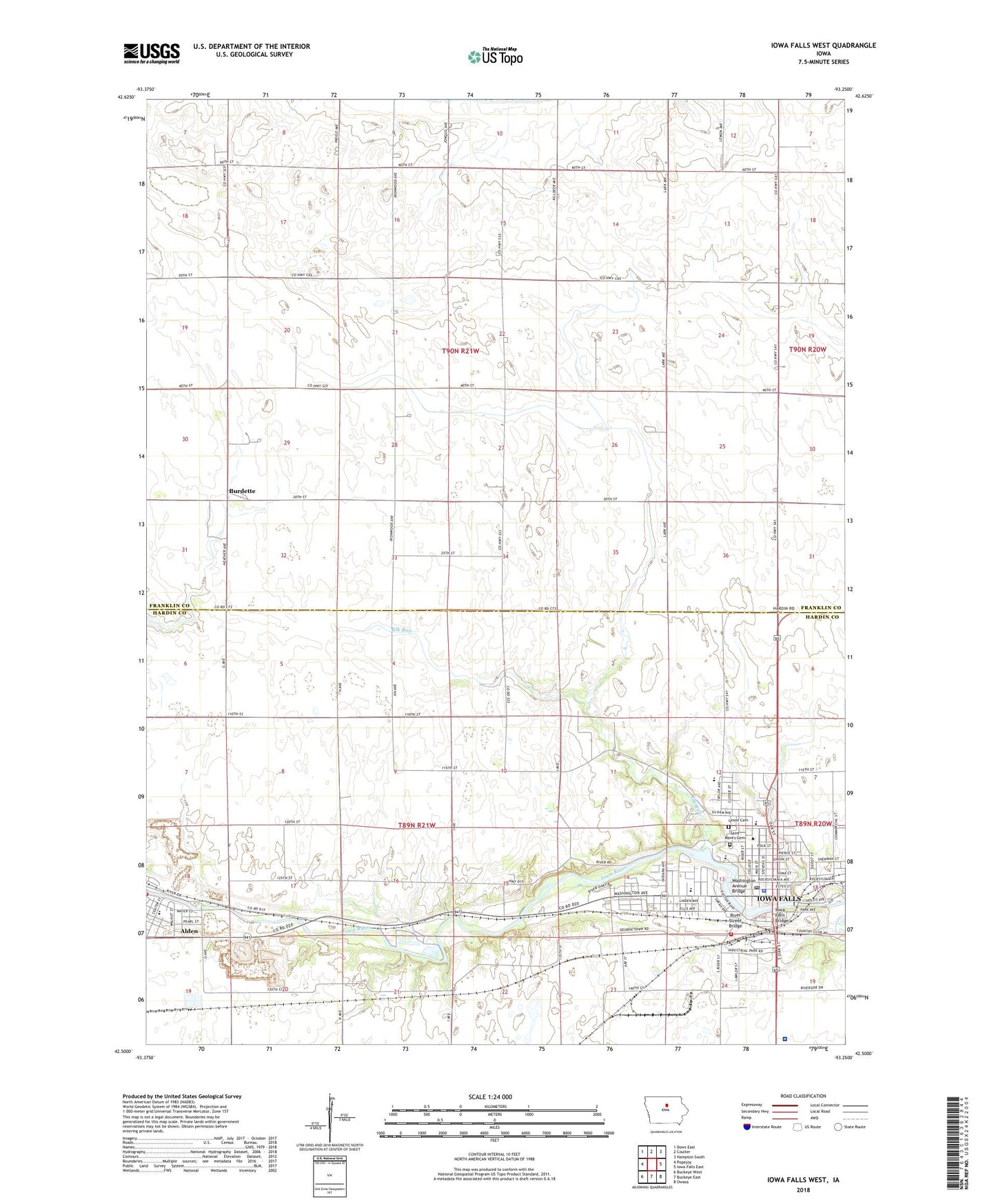
2022 topographic map quadrangle Iowa Falls West in the state of Iowa. Scale: 1:24000. Based on the newly updated USGS 7.5' US Topo map series, this map is in the following counties: Franklin, Hardin. The map contains contour data, water features, and other items you are used to seeing on USGS maps, but also has updated roads and other features. This is the next generation of topographic maps. Printed on high-quality waterproof paper with UV fade-resistant inks.
Quads adjacent to this one:
West: Popejoy
Northwest: Dows East
North: Coulter
Northeast: Hampton South
East: Iowa Falls East
Southeast: Owasa
South: Buckeye East
Southwest: Buckeye West
This map covers the same area as the classic USGS quad with code o42093e3.
Contains the following named places: Alden, Alden City Hall, Alden Elementary School, Alden Fire Department, Alden River Access, American Medical Response, Assembly Park, Bethany Lutheran Church, Bethel Baptist Church, Buena Vista University - Iowa Falls Campus, Bullock Jones Building, Burdette, Burdette Post Office, Cadet Field, Central School, Christ Community Church, Church of God, Church of the Nazarene, Church of the Open Bible, Circle C Campground, City of Iowa Falls, Elk Run, Ellsworth Community College, Ellsworth Municipal Hospital, Ellsworth Municipal Hospital Clinic, Ellsworth Park, Estes Park, Farmers Cooperative Elevator, First Baptist Church, First Christian Church, First Congregational Church, First United Methodist Church, Fitz Riverbend Park, Foster Park, Founders of Iowa Falls Historical Marker, Gentle Student Center, Gifford United Methodist Church, Hansen Family Hospital, Hansen Swamp Area, Hardin County Emergency Squad, Heritage Care Center, Highland Golf Club, Ilco Park, Immanuel Lutheran Church, Iowa Falls, Iowa Falls - Alden High School, Iowa Falls Bridge, Iowa Falls City Hall, Iowa Falls Clinic, Iowa Falls Evangelical Church, Iowa Falls Fire Department, Iowa Falls Historical Museum, Iowa Falls Junction, Iowa Falls Police Department, Iowa Falls Post Office, Iowa Falls Public Library, Jones Park, Kingdom Hall of Jehovah's Witnesses, Kruse Main Building, Lee Center Church, Lee Number Five School, Legion Field, Math-Science Building, McClure Hall, McFarland Clinic, Nichols County Refuge, North Park, Oak Park, Pineview Elementary School, Reg Johnson Hall, River Hills Shopping Center, River Street Bridge, Riverbend Middle School, Roadside Park, Rock Run Elementary School, Saint Mark's Catholic Church, Saint Mark's Cemetery, Saint Matthews Episcopal Church, Saint Paul's Lutheran Church, Scenic Manor, Site of First Normal School Historical Marker, Steinberg Wildlife Area, Stoddard School, Sunnyside Park, Thompson Hall, Township of Lee, Trades and Industry Building, Union Cemetery, Wall Dorm, Washington Avenue Bridge, West School