MyTopo
Lake Park SE Iowa US Topo Map
Couldn't load pickup availability
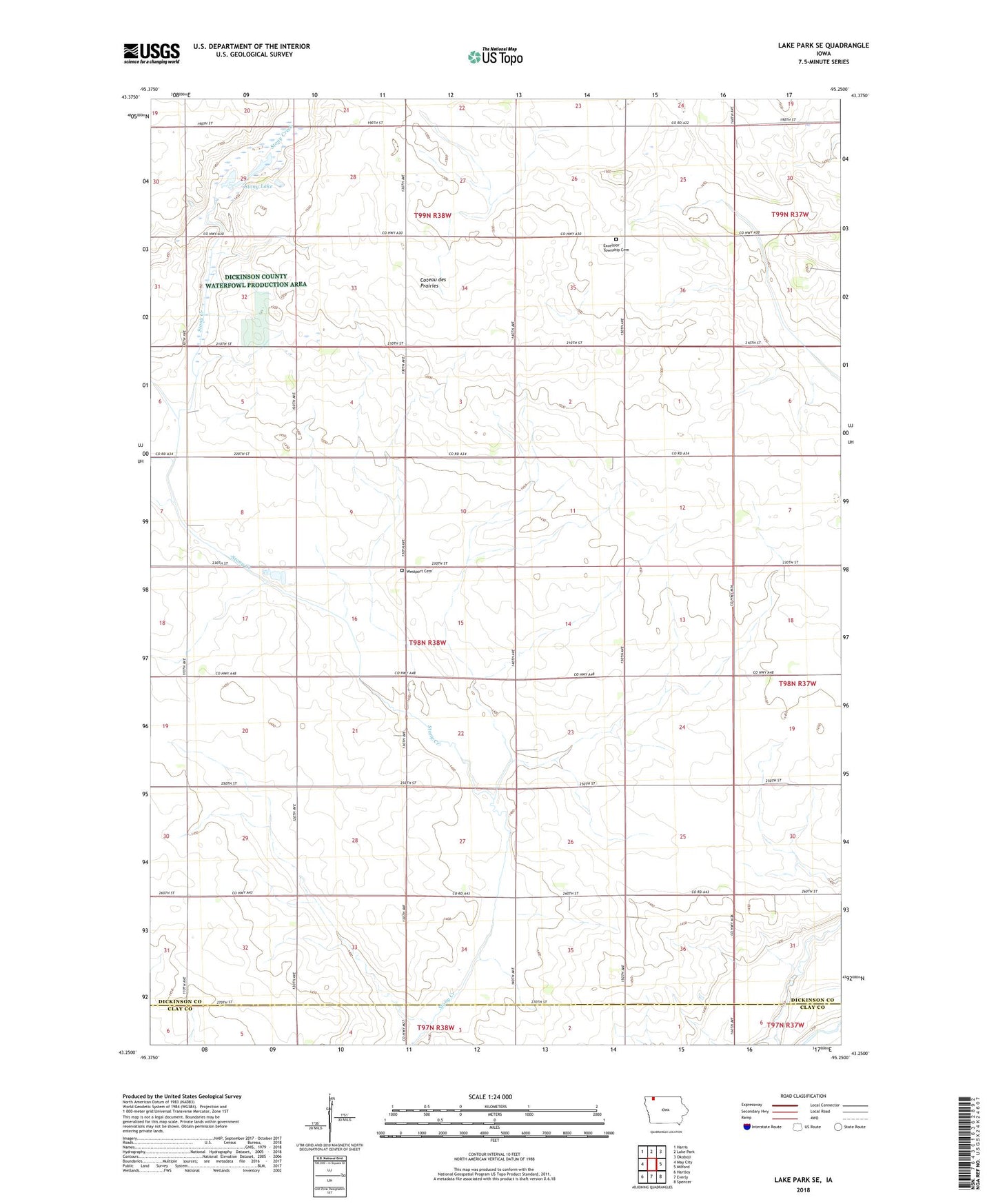
2022 topographic map quadrangle Lake Park SE in the state of Iowa. Scale: 1:24000. Based on the newly updated USGS 7.5' US Topo map series, this map is in the following counties: Dickinson, Clay. The map contains contour data, water features, and other items you are used to seeing on USGS maps, but also has updated roads and other features. This is the next generation of topographic maps. Printed on high-quality waterproof paper with UV fade-resistant inks.
Quads adjacent to this one:
West: May City
Northwest: Harris
North: Lake Park
Northeast: Okoboji
East: Milford
Southeast: Spencer
South: Everly
Southwest: Hartley
This map covers the same area as the classic USGS quad with code o43095c3.
Contains the following named places: Excelsior Church, Excelsior Township Cemetery, Hagerty, Hagerty Post Office, Pillsbury Lake, Stony Lake, Sylvan Lake, Township of Westport, Wallace, Wallace Post Office, Westport Cemetery, Westport Park