MyTopo
Hartley Iowa US Topo Map
Couldn't load pickup availability
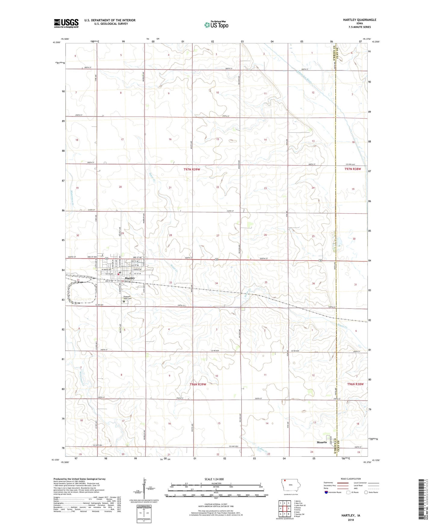
2022 topographic map quadrangle Hartley in the state of Iowa. Scale: 1:24000. Based on the newly updated USGS 7.5' US Topo map series, this map is in the following counties: O'Brien, Clay. The map contains contour data, water features, and other items you are used to seeing on USGS maps, but also has updated roads and other features. This is the next generation of topographic maps. Printed on high-quality waterproof paper with UV fade-resistant inks.
Quads adjacent to this one:
West: Plessis
Northwest: Melvin
North: May City
Northeast: Lake Park SE
East: Everly
Southeast: Royal
South: Hartley SW
Southwest: Gaza
This map covers the same area as the classic USGS quad with code o43095b4.
Contains the following named places: Bruegmann Park, Bruegmann Rea Access, City of Hartley, Community Memorial Health Center, Community Memorial Hospital Heliport, Dave's Sand and Gravel Pit, Farmers Cooperative Elevator, Hartley, Hartley - Melvin - Sanborn Elementary School, Hartley - Melvin - Sanborn High School, Hartley Chiropractic Center, Hartley Clinic, Hartley Emergency Fire Department and Ambulance, Hartley Post Office, Hartley Public Library, Hartley-Melvin-Sanborn High School, Lambert Fechter Municipal Airport, Meadowbrook Golf and Country Club, Mercy Family Care Center - Hartley, Moneta, Moneta Post Office, Pleasant View Cemetery, Saint Joseph Catholic Church, Saint Pauls Lutheran Church, Sweeney Chiropractic Clinic, Terra International Incorporated Elevator, Township of Hartley, Township of Omega, Trinity United Church of Christ, United Methodist Church, ZIP Code: 51346