MyTopo
Everly Iowa US Topo Map
Couldn't load pickup availability
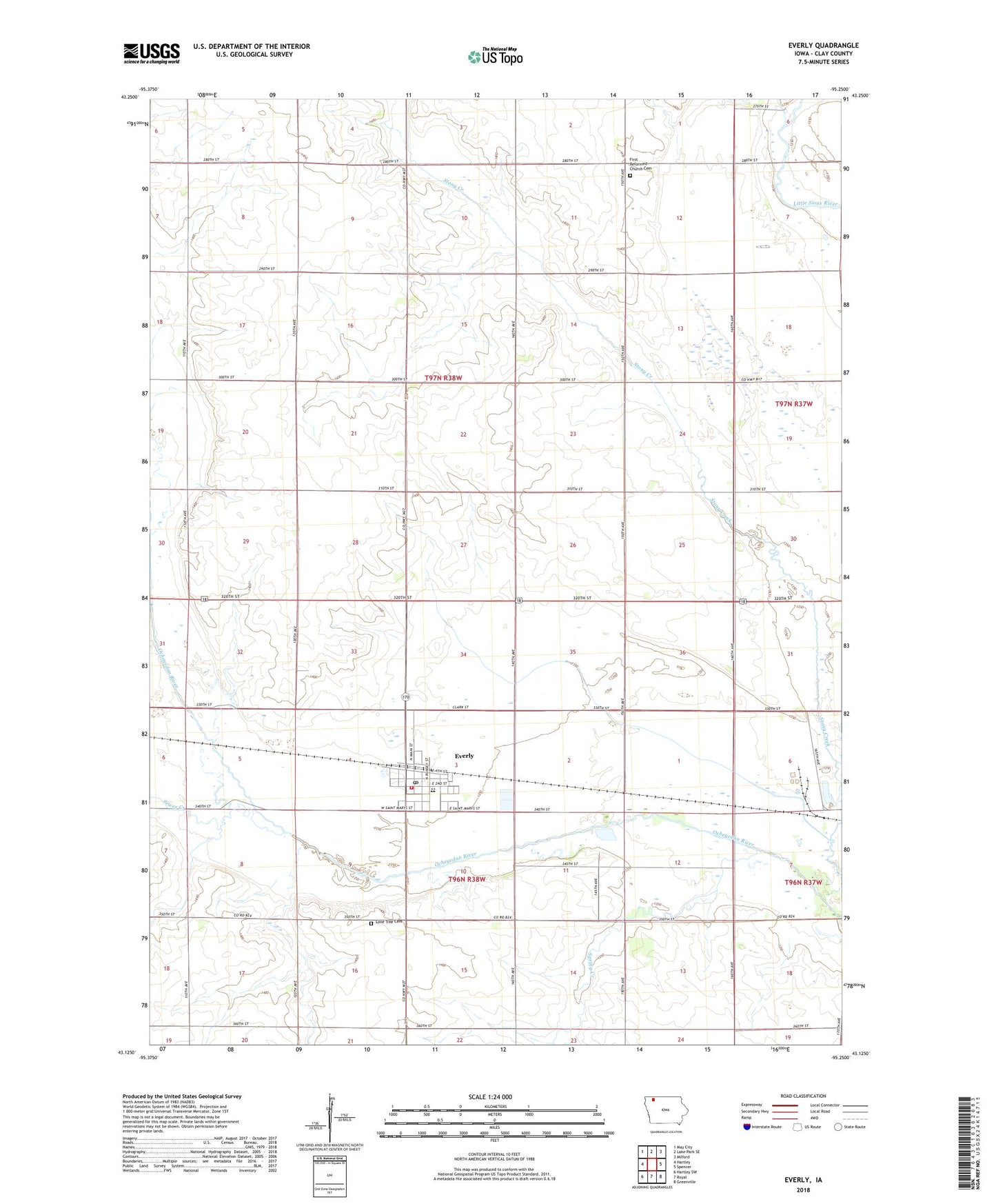
2022 topographic map quadrangle Everly in the state of Iowa. Scale: 1:24000. Based on the newly updated USGS 7.5' US Topo map series, this map is in the following counties: Clay. The map contains contour data, water features, and other items you are used to seeing on USGS maps, but also has updated roads and other features. This is the next generation of topographic maps. Printed on high-quality waterproof paper with UV fade-resistant inks.
Quads adjacent to this one:
West: Hartley
Northwest: May City
North: Lake Park SE
Northeast: Milford
East: Spencer
Southeast: Greenville
South: Royal
Southwest: Hartley SW
This map covers the same area as the classic USGS quad with code o43095b3.
Contains the following named places: Berends Farm, City of Everly, Clay Central - Everly Elementary School at Everly, Clay Central Everly Junior / Senior High School, Cromwell Center Post Office, Everly, Everly City Hall, Everly City Park, Everly Fire and Rescue, Everly Post Office, Everly Public Library, Fairchild Farm, Farmers Co-op Elevator, First Reformed Church, First Reformed Church Cemetery, Foss Farms, Geerdes Farm, Hildreth Farm, Hope Lutheran Church, Jensen Farms, Kirksey Farms, Kruse Farms, Lone Tree Cemetery, Ocheyedan River State Game Refuge, Q B Farm, Saint Marys Catholic Church, Scharnberg County Park, Schoeleman Farms, Sewer Creek, Spring Creek, Sunny Brooks School, Township of Lone Tree, Township of Waterford, Tuttle Marsh Area, United Methodist Church, ZIP Code: 51338