MyTopo
LaMoille Iowa US Topo Map
Couldn't load pickup availability
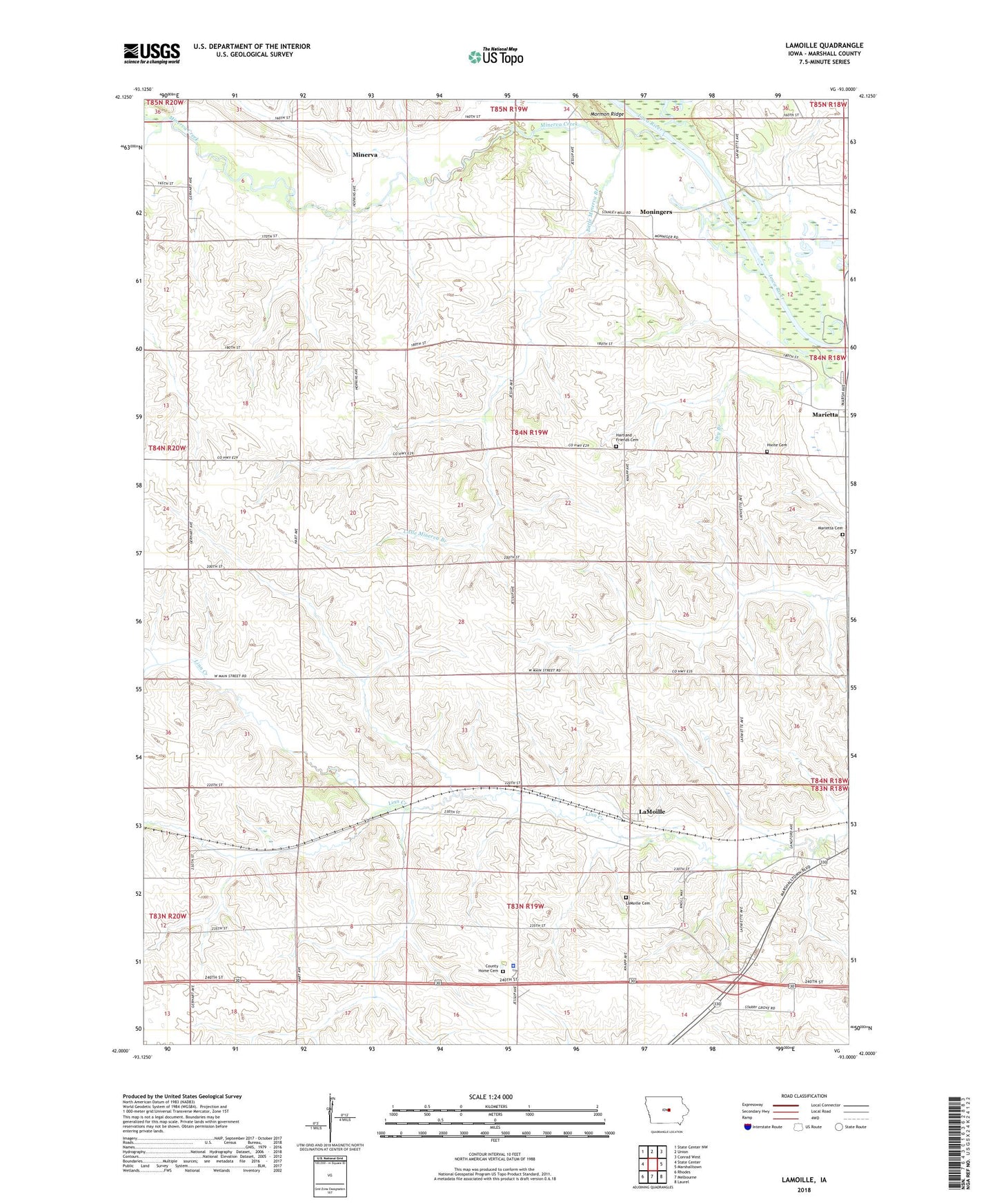
2022 topographic map quadrangle LaMoille in the state of Iowa. Scale: 1:24000. Based on the newly updated USGS 7.5' US Topo map series, this map is in the following counties: Marshall. The map contains contour data, water features, and other items you are used to seeing on USGS maps, but also has updated roads and other features. This is the next generation of topographic maps. Printed on high-quality waterproof paper with UV fade-resistant inks.
Quads adjacent to this one:
West: State Center
Northwest: State Center NW
North: Union
Northeast: Conrad West
East: Marshalltown
Southeast: Laurel
South: Melbourne
Southwest: Rhodes
Contains the following named places: County Home Cemetery, Dry Branch, Elmwood Cemetery, First Marshall County Courthouse Historical Marker, Galvin Post Office, Hartland Church, Hartland Friends Cemetery, Hartland Post Office, Hixite Cemetery, La Moille Post Office, Lamoille, LaMoille, Lamoille Congregational Church, Little Minerva Branch, Marietta, Marietta Cemetery, Marietta Post Office, Marietta Sand Prairie State Preserve, Marshall County Home, Marshall County Jail, Marshall County Sheriff's Office, Minerva, Minerva Church, Minerva Creek, Moningers, Timmons Grove County Park, Township of Marietta