MyTopo
State Center Iowa US Topo Map
Couldn't load pickup availability
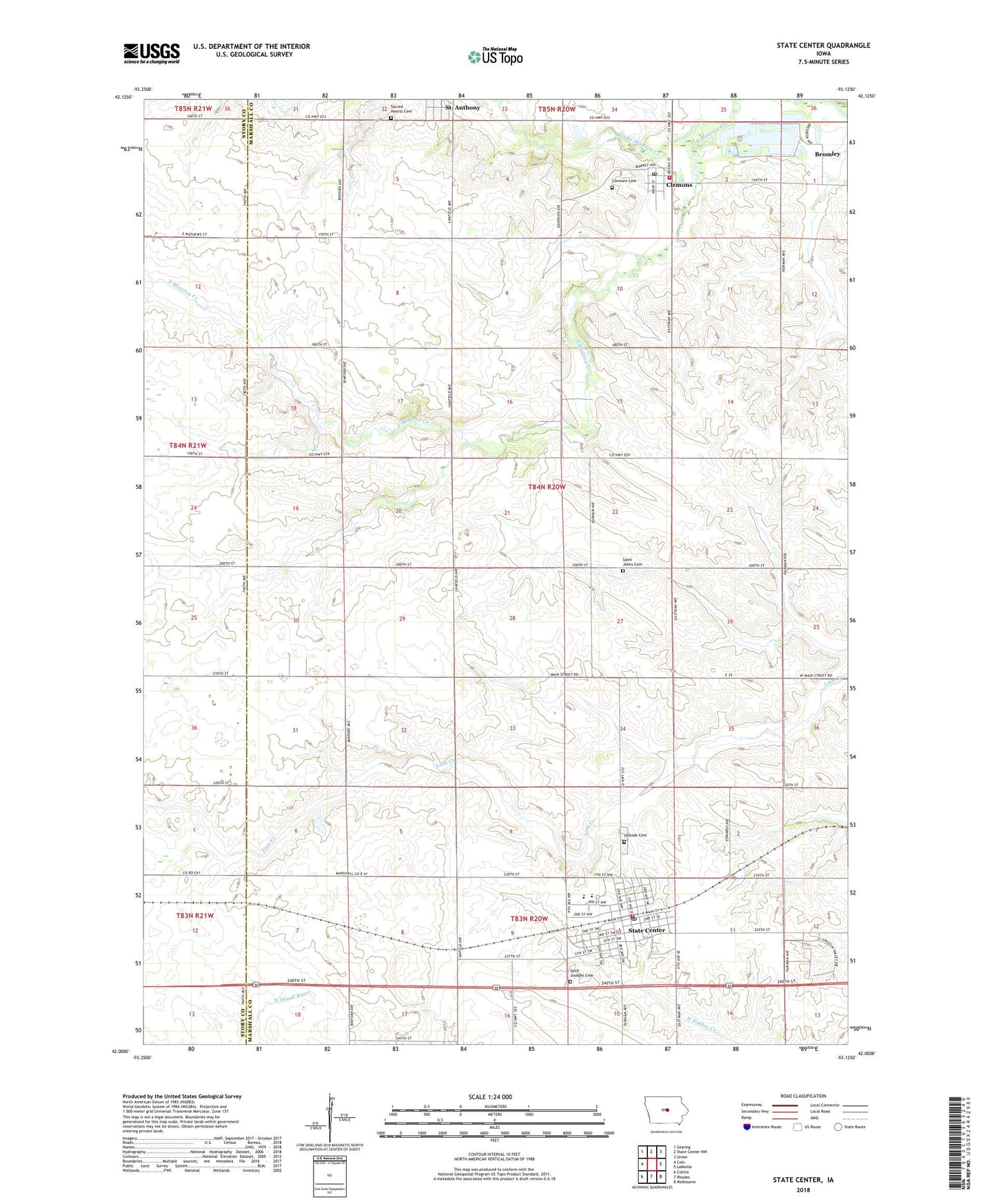
2022 topographic map quadrangle State Center in the state of Iowa. Scale: 1:24000. Based on the newly updated USGS 7.5' US Topo map series, this map is in the following counties: Marshall, Story. The map contains contour data, water features, and other items you are used to seeing on USGS maps, but also has updated roads and other features. This is the next generation of topographic maps. Printed on high-quality waterproof paper with UV fade-resistant inks.
Quads adjacent to this one:
West: Colo
Northwest: Zearing
North: State Center NW
Northeast: Union
East: LaMoille
Southeast: Melbourne
South: Rhodes
Southwest: Collins
This map covers the same area as the classic USGS quad with code o42093a2.
Contains the following named places: Bromley, Bromley Post Office, City of Clemons, City of Saint Anthony, City of State Center, Clemons, Clemons Cemetery, Clemons Fire Department, Clemons Lutheran School, Clemons Post Office, Clemons United Church of Christ, Congregational Christian Church, First United Presbyterian Church, French Grove County Wildlife Area, Gutekunst Public Library, Hillside Cemetery, Mackin Grain Company Elevator, McFarland Clinic, Middle Minerva Creek, Mid-Iowa Co-op Elevator, Minerva Post Office, Rose Capital Mini Mall, Sacred Heart Catholic Church, Sacred Hearts Cemetery, Saint Anthony, Saint Johns Cemetery, Saint Johns Church, Saint Josephs Cemetery, Saint Paul's Lutheran Church, State Center, State Center Fire and Emergency Services, State Center Manor, State Center Post Office, State Center Rose Garden, Township of Minerva, Trinity Lutheran Church, United Methodist Church, West Marshall Elementary School, West Marshall High School, West Marshall Middle School, ZIP Code: 50247