MyTopo
McClelland Iowa US Topo Map
Couldn't load pickup availability
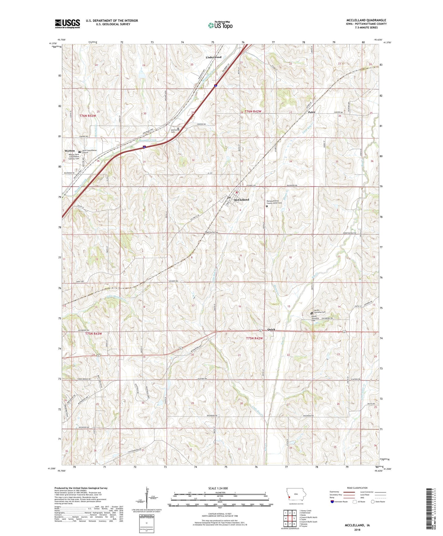
2022 topographic map quadrangle McClelland in the state of Iowa. Scale: 1:24000. Based on the newly updated USGS 7.5' US Topo map series, this map is in the following counties: Pottawattamie. The map contains contour data, water features, and other items you are used to seeing on USGS maps, but also has updated roads and other features. This is the next generation of topographic maps. Printed on high-quality waterproof paper with UV fade-resistant inks.
Quads adjacent to this one:
West: Council Bluffs North
Northwest: Honey Creek
North: Underwood
Northeast: Neola
East: Taylor
Southeast: Treynor
South: Mineola
Southwest: Council Bluffs South
This map covers the same area as the classic USGS quad with code o41095c6.
Contains the following named places: Armour, Armour Post Office, Bent Tree Golf Club, City of McClelland, Downsville Cemetery, Downsville Post Office, Hardin Church, Hardin Township Cemetery, Henchal Creek, Little Keg Creek, Mamie Creek, McClelland, McClelland Post Office, McClelland Volunteer Fire Department, Mount Hope Church, Peter, Pottawattami County Home, Pottawattamie County Home Cemetery, Quick, Quick Post Office, Ryans Airport, Saint Columbanus Cemetery, Saint Columbanus Church, School Number 3, Township of Hardin, Westfair Fairground, Weston, Weston Census Designated Place, Weston Post Office, Weston School, Weston Station, ZIP Code: 51548