MyTopo
Lansing Iowa US Topo Map
Couldn't load pickup availability
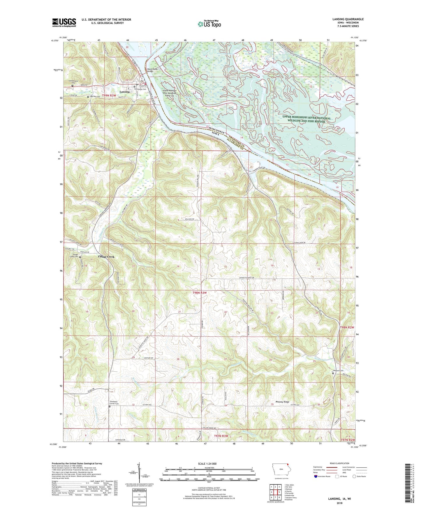
2022 topographic map quadrangle Lansing in the states of Iowa, Wisconsin. Scale: 1:24000. Based on the newly updated USGS 7.5' US Topo map series, this map is in the following counties: Allamakee, Crawford. The map contains contour data, water features, and other items you are used to seeing on USGS maps, but also has updated roads and other features. This is the next generation of topographic maps. Printed on high-quality waterproof paper with UV fade-resistant inks.
Quads adjacent to this one:
West: Church
Northwest: New Albin
North: De Soto
Northeast: Retreat
East: Ferryville
Southeast: Eastman
South: Harpers Ferry
Southwest: Waterville
Contains the following named places: Black Hawk Bridge, Capoli Mill, Capoli Post Office, Chain of Lakes, City of Lansing, Clear Creek, Clear Creek Park, District of Capoli School, Gethsemane Cemetery, Gethsemane Chapel, Gundersen Lutheran Vision Center, Heminway Cemetery, Immaculate Conception Church, Indian Prairie District School, Interstate Power Fishing Access Area, Island Number One Hundred Forty-six, Island Number One Hundred Forty-three, Kee High School, Lafayette Lake, Lafayette Slough, Lansing, Lansing City Library, Lansing Clinic, Lansing Dental Clinic, Lansing Fire Station, Lansing Middle School, Lansing Police Department, Lansing Post Office, Lansing Valley Mobile City, Lansing Volunteer Emergency Medical Services, Mooney Ridge, Mount Hosmer Park, Museum of River History, Oak Hill Cemetery, Our Savior Lutheran Church, Red Barn Resort and Campground, Rivertown Mall, Rush Creek, Russell Independent District School, Stevens Slough, Stone School, Thompson Corner, Thompson Corner Cemetery, Thornton Manor Nursing Center, Township of Lafayette, United Methodist Church, Village Creek, Village Creek Cemetery, Village Creek Post Office, Wexford Cemetery, Wexford District School, Winneshiek Bottoms, Winneshiek Slough