MyTopo
New Hartford Iowa US Topo Map
Couldn't load pickup availability
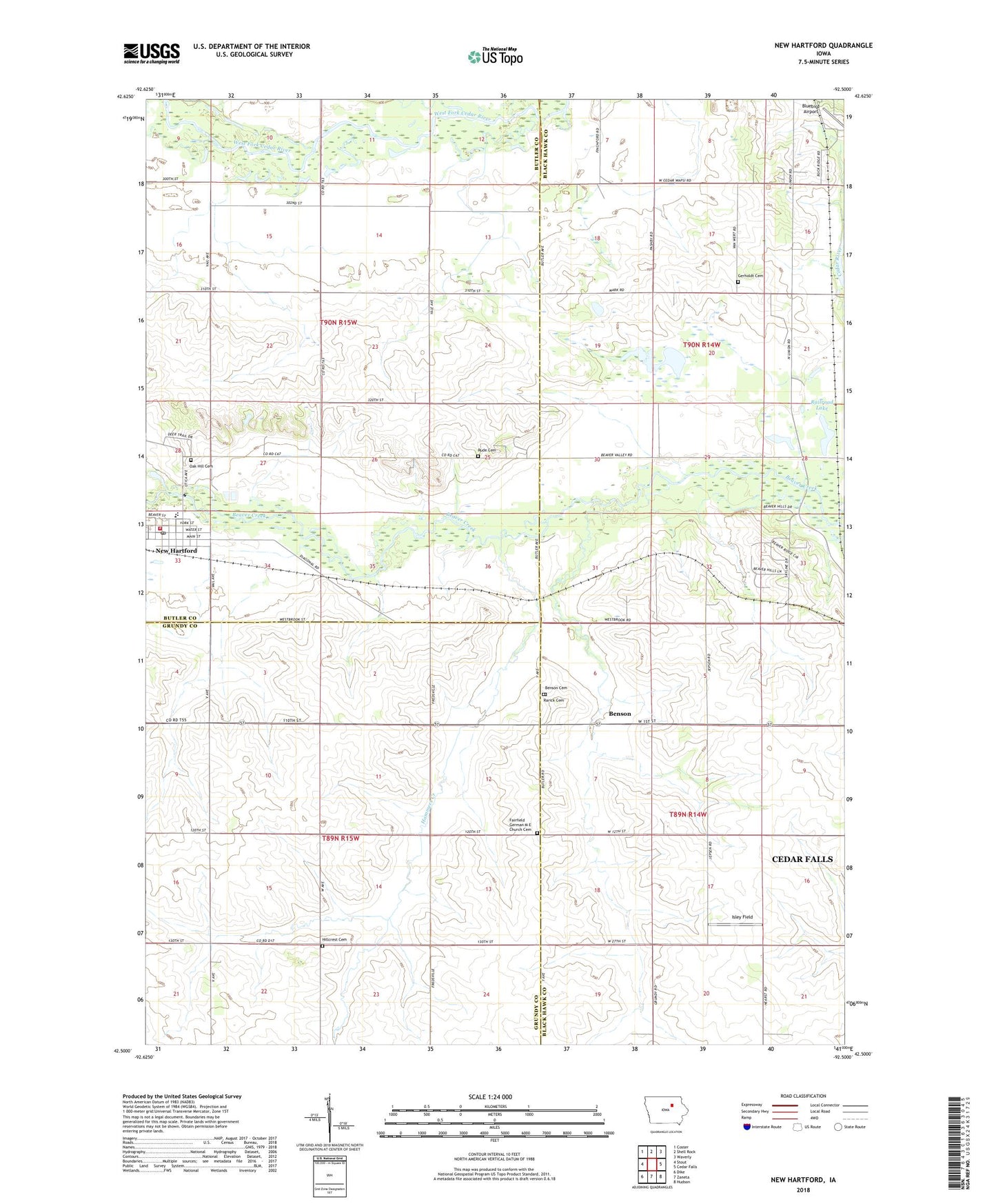
2022 topographic map quadrangle New Hartford in the state of Iowa. Scale: 1:24000. Based on the newly updated USGS 7.5' US Topo map series, this map is in the following counties: Black Hawk, Butler, Grundy. The map contains contour data, water features, and other items you are used to seeing on USGS maps, but also has updated roads and other features. This is the next generation of topographic maps. Printed on high-quality waterproof paper with UV fade-resistant inks.
Quads adjacent to this one:
West: Stout
Northwest: Coster
North: Shell Rock
Northeast: Waverly
East: Cedar Falls
Southeast: Hudson
South: Zaneta
Southwest: Dike
This map covers the same area as the classic USGS quad with code o42092e5.
Contains the following named places: Beaver Creek Access Point, Beaver Hill Country Club, Benson, Benson Cemetery, Benson Post Office, Black Hawk County Cemetery, Bluebird Airport, City of New Hartford, Dike - New Hartford Elementary School, Elizabeth Post Office, First Baptist Church, First United Methodist Church, Gerholdt Cemetery, German M E Church Cemetery, Hammers Creek, Isley Field, Messerly Quarry, New Hartford, New Hartford City Hall, New Hartford City Library, New Hartford Elementary / Junior High School, New Hartford Fire Department, New Hartford Police Department, New Hartford Post Office, Oak Hill Cemetery, Railroad Lake, Rarick Cemetery, Rude Cemetery, Township of Beaver, Township of Cedar Falls, Township of Fairfield, Township of Union