MyTopo
Stout Iowa US Topo Map
Couldn't load pickup availability
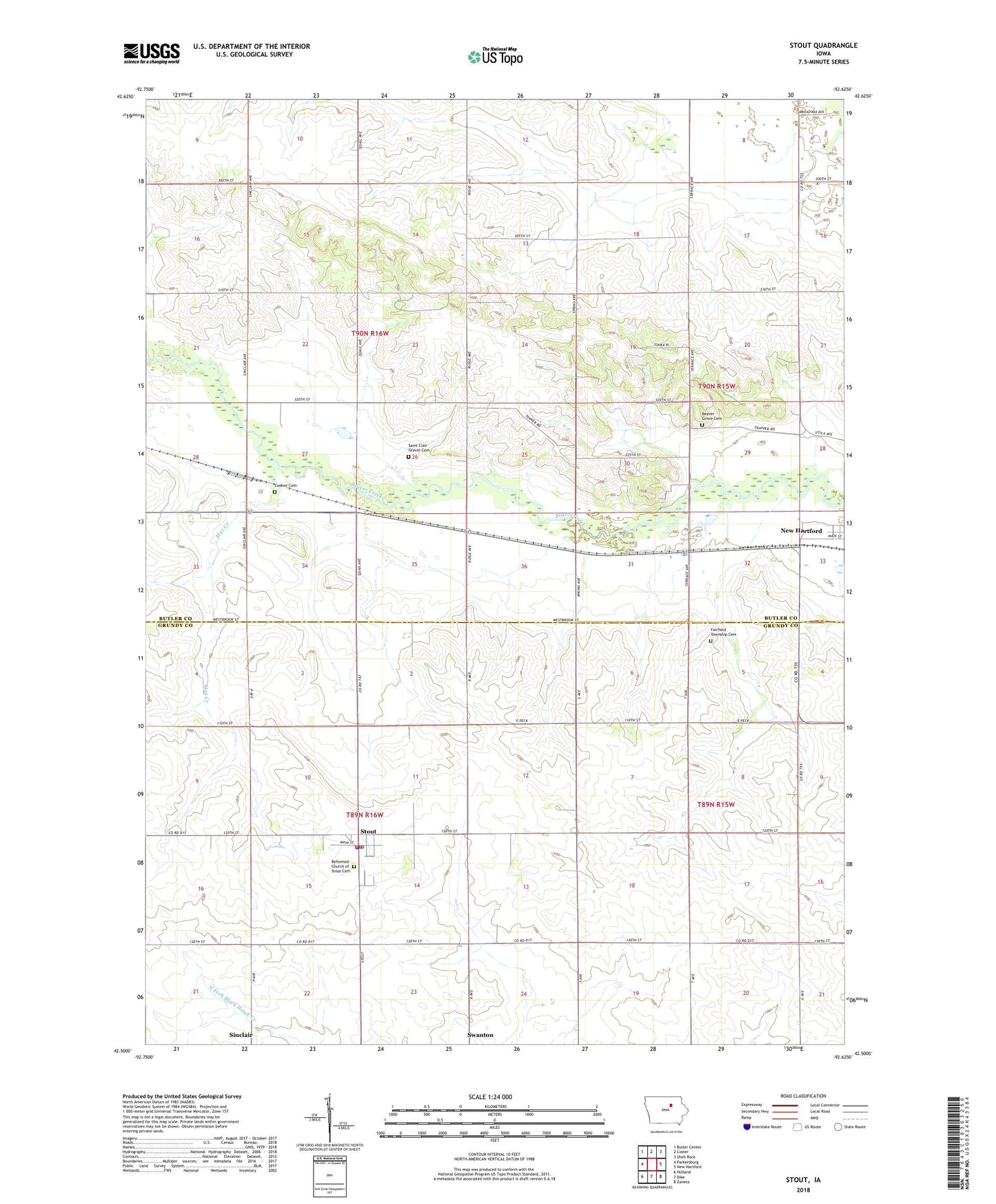
2022 topographic map quadrangle Stout in the state of Iowa. Scale: 1:24000. Based on the newly updated USGS 7.5' US Topo map series, this map is in the following counties: Butler, Grundy. The map contains contour data, water features, and other items you are used to seeing on USGS maps, but also has updated roads and other features. This is the next generation of topographic maps. Printed on high-quality waterproof paper with UV fade-resistant inks.
Quads adjacent to this one:
West: Parkersburg
Northwest: Butler Center
North: Coster
Northeast: Shell Rock
East: New Hartford
Southeast: Zaneta
South: Dike
Southwest: Holland
This map covers the same area as the classic USGS quad with code o42092e6.
Contains the following named places: Beaver Grove Cemetery, City of Stout, Codner Cemetery, Fairfield Township Cemetery, Helt Memorial Reserve, Lear, Lear Post Office, Max Creek, Moore's Access, Plymouth Brethren Gospel Hall, Reformed Church of Stout, Saint Clair Gravel Cemetery, Sinclair, Sinclair Elevator Incorporated Elevator, Sinclair Post Office, Stout, Stout Cemetery, Stout City Hall, Stout Fire Department, Stout Post Office, Taylor Hill, Taylor Hill Post Office, Township of Albion, Township of Beaver, Willoughby Post Office, ZIP Codes: 50660, 50673