MyTopo
Cherokee South Iowa US Topo Map
Couldn't load pickup availability
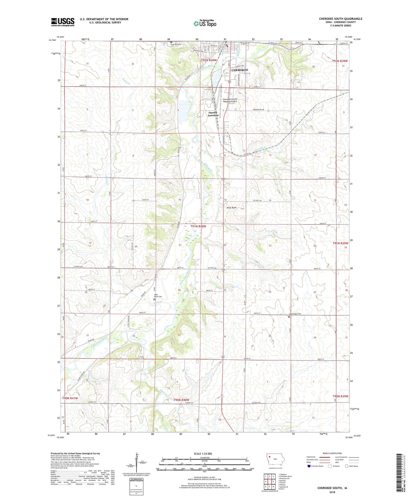
2022 topographic map quadrangle Cherokee South in the state of Iowa. Scale: 1:24000. Based on the newly updated USGS 7.5' US Topo map series, this map is in the following counties: Cherokee. The map contains contour data, water features, and other items you are used to seeing on USGS maps, but also has updated roads and other features. This is the next generation of topographic maps. Printed on high-quality waterproof paper with UV fade-resistant inks.
Quads adjacent to this one:
West: Quimby
Northwest: Cleghorn
North: Cherokee North
Northeast: Peterson SW
East: Aurelia
Southeast: Galva
South: Quimby SE
Southwest: Washta
This map covers the same area as the classic USGS quad with code o42095f5.
Contains the following named places: American Theatre, Baptist Church, Cherokee, Cherokee City Hall, Cherokee County, Cherokee County Fairground, Cherokee County Regional Airport, Cherokee Fire Department, Cherokee Public Library, Cherokee Wastewater Treatment Plant, City of Cherokee, Coonley Creek, Coonley Creek Farms, De Leon Post Office, DeLeon, First Farmers Co-op Company Elevator, Gengler Farms, Glassmaker Farm, Good Hope Cemetery, Harold Clark Habitat Area, Hilltop Angus Farm, Iowa Osteopathic Institute, Kennedy Chiropractic Office, Lincoln School, Loucks Farm, Mortenson Dairy Farm, Mount Oliver Church, Oak Hill Cemetery, Onawa Junction, Pearse Access, Perry Creek, Pilot Rock, Pilot Rock Lookout, Pilot Rock Lookout Historical Marker, Pilot Rock Post Office, Railroad Creek, Redtail Ridge Habitat Area, Reorganized Church of Jesus Christ of Latter Day Saints, Rhea Farms, S and T Farms, Saint Lukes Gordon Recovery Center, Saint Pauls United Methodist Church, Silver Creek, Silver Sioux Recreation Area, Spring Lake, Spring Lake Park, Township of Pilot, Wescott Park, West Point Cemetery, Will Farm, ZIP Code: 51012