MyTopo
Elkhart Iowa US Topo Map
Couldn't load pickup availability
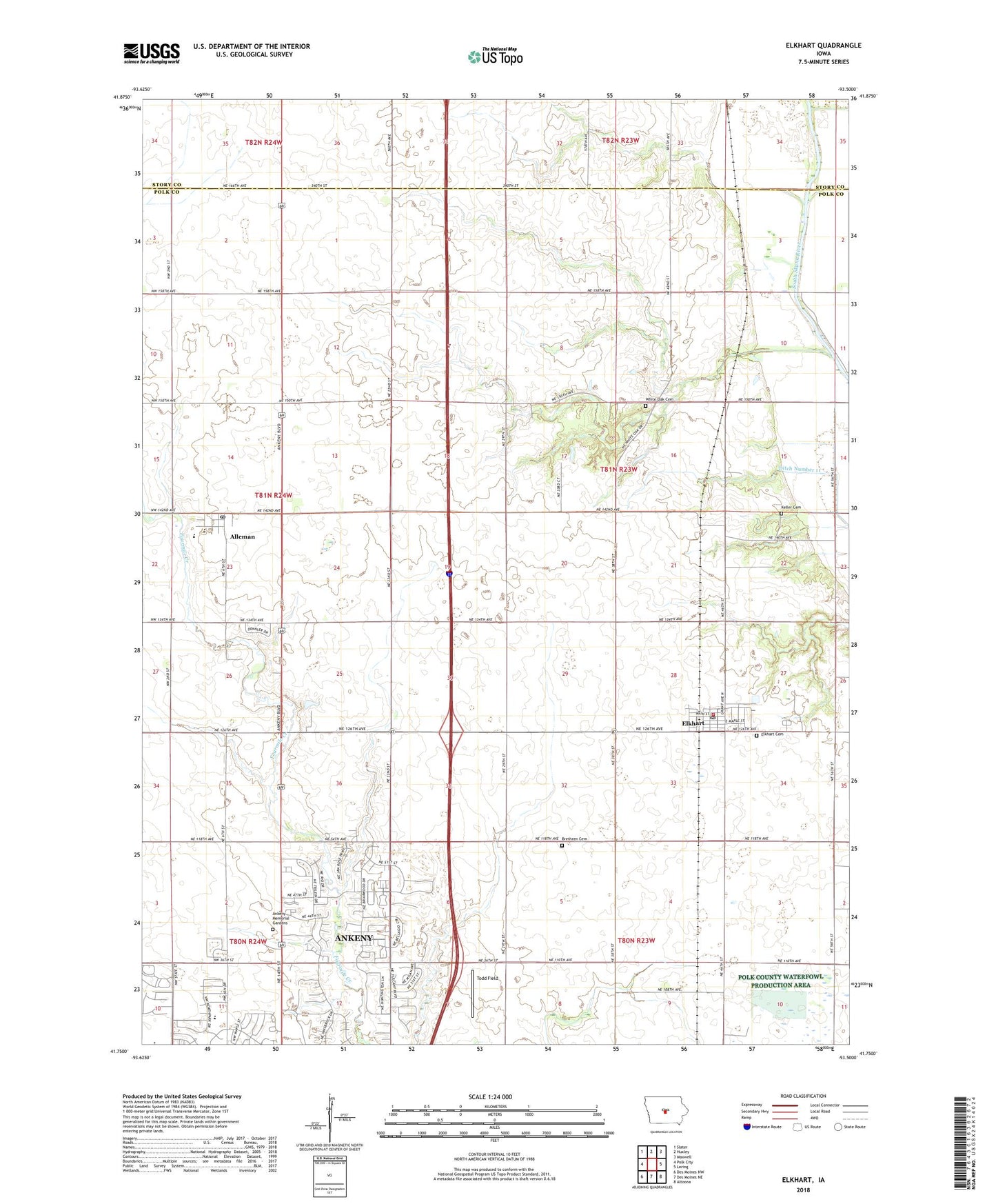
2022 topographic map quadrangle Elkhart in the state of Iowa. Scale: 1:24000. Based on the newly updated USGS 7.5' US Topo map series, this map is in the following counties: Polk, Story. The map contains contour data, water features, and other items you are used to seeing on USGS maps, but also has updated roads and other features. This is the next generation of topographic maps. Printed on high-quality waterproof paper with UV fade-resistant inks.
Quads adjacent to this one:
West: Polk City
Northwest: Slater
North: Huxley
Northeast: Maxwell
East: Loring
Southeast: Altoona
South: Des Moines NE
Southwest: Des Moines NW
This map covers the same area as the classic USGS quad with code o41093g5.
Contains the following named places: Alleman, Alleman Post Office, Ankeny Memorial Gardens Cemetery, Ankeny North Bound Rest Area, Ankeny South Bound Rest Area, Brethren Cemetery, Briarwood Golf Course, Christian Church, City of Alleman, City of Elkhart, Coon Creek, Elkhart, Elkhart Cemetery, Elkhart Center School, Elkhart City Hall, Elkhart Fire Department, Elkhart Post Office, Faith Christian Fellowship, Hawks School, Historic Des Moines State Historical Marker, KBTV-TV (Des Moines), KCCI-TV (Des Moines), KDIN-TV (Des Moines), KDSM-TV (Des Moines), Keller Cemetery, KLYF-FM (Des Moines), KRNQ-FM (Des Moines), Lincoln School, North Polk Central Elementary School, North Polk High School, Otter Creek Golf Course, Otter Creek Park, Pleasant Prairie School, Polk County Waterfowl Production Area, Saint Mary's Catholic Church, Salem United Church of Christ, School Number 7, Sexauer School, Todd Field, Township of Elkhart, Tyner Post Office, White Oak Cemetery, WHO-TV (Des Moines), WOI-FM (Ames), WOI-TV (Ames), ZIP Codes: 50007, 50073