MyTopo
Radcliffe Iowa US Topo Map
Couldn't load pickup availability
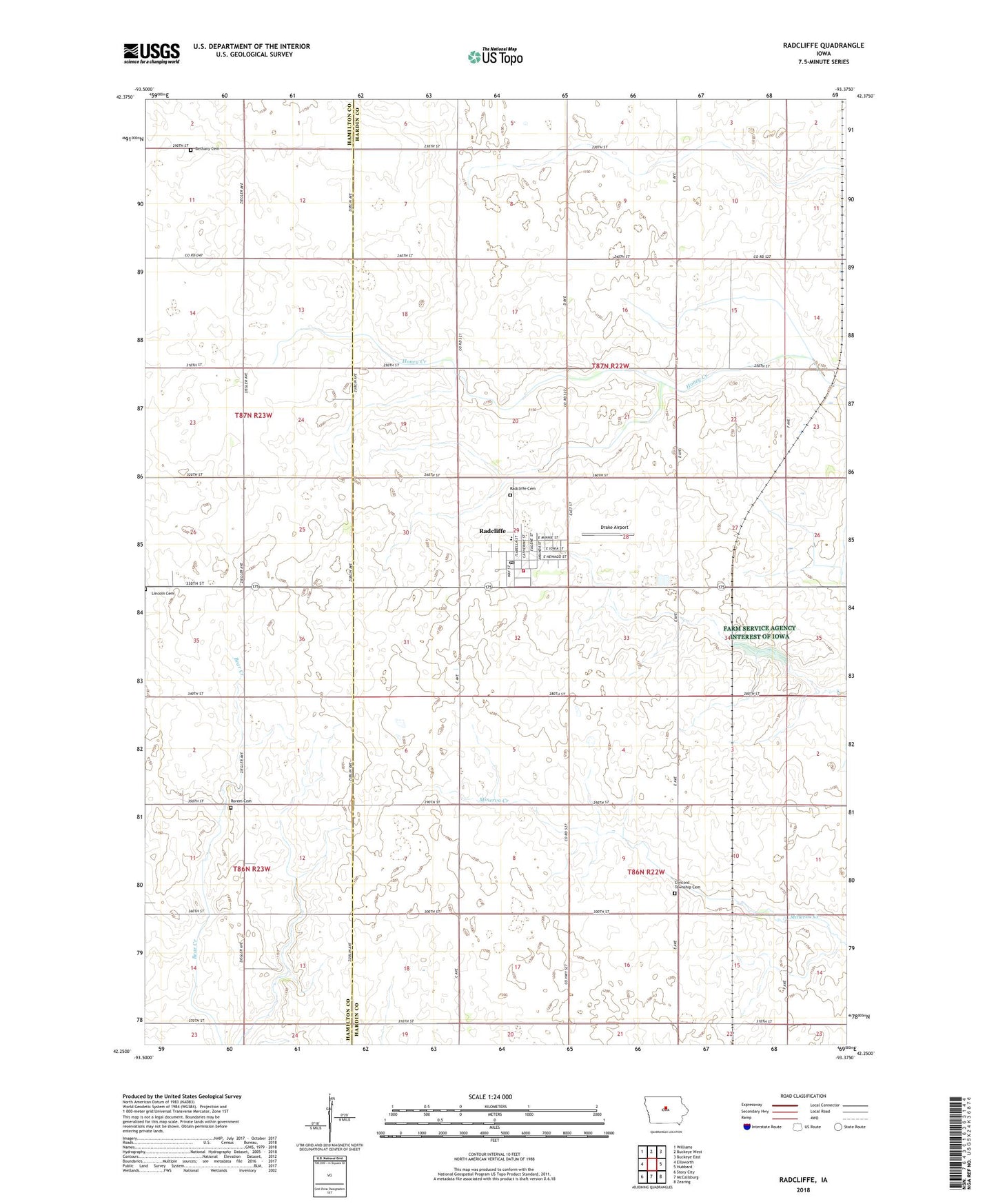
2022 topographic map quadrangle Radcliffe in the state of Iowa. Scale: 1:24000. Based on the newly updated USGS 7.5' US Topo map series, this map is in the following counties: Hardin, Hamilton. The map contains contour data, water features, and other items you are used to seeing on USGS maps, but also has updated roads and other features. This is the next generation of topographic maps. Printed on high-quality waterproof paper with UV fade-resistant inks.
Quads adjacent to this one:
West: Ellsworth
Northwest: Williams
North: Buckeye West
Northeast: Buckeye East
East: Hubbard
Southeast: Zearing
South: McCallsburg
Southwest: Story City
This map covers the same area as the classic USGS quad with code o42093c4.
Contains the following named places: Bethany Cemetery, City of Radcliffe, Concord Township Cemetery, Drake Airport, Faith Evangelical Church, Farmers Co-op Elevator, Friendly Fairways, Hubbard - Radcliffe Elementary School, Our Saviors Lutheran Church, Radcliffe, Radcliffe Cemetery, Radcliffe City Park, Radcliffe Fire Department and Ambulance Service, Radcliffe Library, Radcliffe Museum, Radcliffe Post Office, Radcliffe Town Hall, Rorem Cemetery, Saint John's United Methodist Church, Salem Church, Sherman, Township of Concord, Township of Sherman, ZIP Code: 50230